
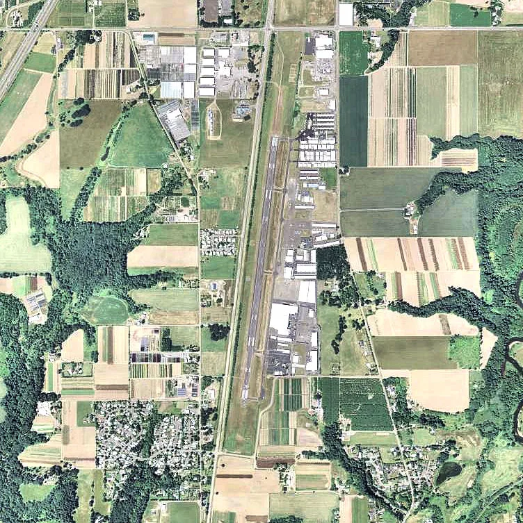
Aurora State Airport in Marion County, Oregon
Aurora State Airport in Marion County is an airfield (ICAO: KUAO). Aurora State Airport is also known as UAO. Ⓦ.
Image
Streets nearby
Airport Road Northeast200 ft
Stenbock Way0.8 mi
Blacktail Lane Northeast0.8 mi
French Prairie Rest Area - Northbound0.8 mi
Northeast Stoller Place0.8 mi
Piper Street Northeast0.9 mi
Mooney Avenue Northeast0.9 mi
Cessna Street Northeast0.9 mi
Northeast Arndt Road0.9 mi
Wilsonville-Hubbard Highway0.9 mi
Northeast Countryside Drive0.9 mi
Yellow Gate Lane Northeast1.1 mi
Hubbard Cutoff Road Northeast1.1 mi
Boones Ferry Road Northeast1.1 mi
French Prairie Rest Area - Southbound1.2 mi
South Arndt Road1.2 mi
Northeast Prairie View Court1.3 mi
Northeast Prairie View Drive1.4 mi
Keil Road Northeast1.4 mi
Northeast Mulligan Court1.4 mi
Wisteria Court Northeast1.5 mi
Smith Lane1.5 mi
Floral Avenue Northeast1.5 mi
Camellia Avenue Northeast1.6 mi
Carissa Avenue Northeast1.6 mi
Northeast Lawnview Circle1.6 mi
Kasel Court Northeast1.6 mi
Lloyds Lane1.6 mi
Floral Court Northeast1.6 mi
Erica Drive Northeast1.6 mi
Northeast Airport Road1.6 mi
Albers Way Northeast1.6 mi
Northeast Miley Road1.6 mi
Camellia Court Northeast1.6 mi
Murray Lane Northeast1.7 mi
Azalea Court Northeast1.7 mi
Buildings nearby
Columbia Helicopters300 ft
Cemeteries nearby
Keil Family Cemetery1.6 mi
Golf courses nearby
Langdon Farms Golf Course0.9 mi
Hangars nearby
Life Flight1.0 mi
Helicopter Transport Services1.2 mi
Industrial buildings nearby
Van's Aircraft1.2 mi
Places of worship nearby
Saint Francis of Assisi1.6 mi
Public restrooms nearby
Baldock Rest Area South1.2 mi
Railways nearby
UP Brooklyn Subdivision1.7 mi
Scrubs nearby
Wilsonville Pond1.0 mi
Sports centers nearby
Pat's Acres Karting Complex1.1 mi
Streams nearby
Kraus Creek1.0 mi
Other nearby
Baldock Solar Station0.8 mi
| Named after | Aurora |
|---|---|
| Elevation | 61 m |
| Operator | Oregon Department of Aviation |
| Located in | Oregon |
| Country | United States |
 Public transit map Marion County Legend
| Railway | |
| Bus | |
| Streetcar |
 Bicycle map Marion County Legend
| Bike path | |
| Bike lane on roadway | |
| Cycling allowed on bus lane | |
| Bicycle street | |
| Open to cyclists | |
| Open to cyclists, good path | |
| Cycling prohibited | |
| Cobblestone |
| Long-distance bike route | (depending on scale) | |
| Long-distance bike route |
 Pedestrian map Marion County Legend
| Path |
| Long-distance hiking trail | (depending on scale) | |
| Long-distance hiking trail | ||
| Pedestrians prohibited |