
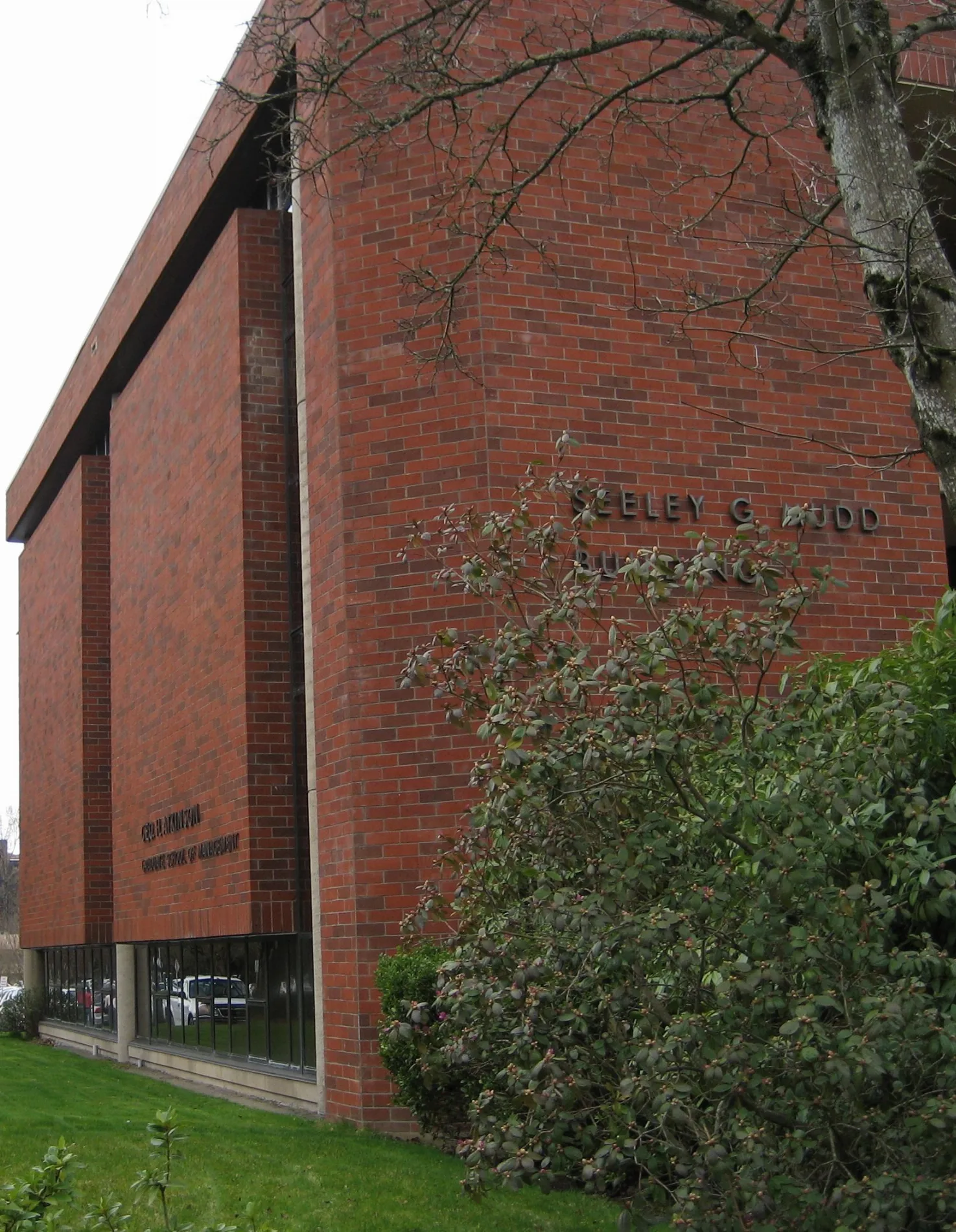
Seeley G. Mudd Building in Salem, Oregon
Seeley G. Mudd Building in Salem is a university (Willamette University). Seeley G. Mudd Building is located near Pringle Creek Path. Ⓦ.
- Amenity
- university
- Operator
- Willamette University
- Building Type
- university building
Artworks
Fountains
Universities
Music stores
Cafes
Parking entrances
Doctor's offices
Accessory shops
Clothing stores
Bus stops
Restaurants
Studios
Hair salons
Places of worship
Streets nearby
Winter Street SoutheastC Lot, Salem Gastro, A Lot, Winter @ Salem Hospital
250 ft
Mill Street SoutheastGentlemen's Choice, Illy's Closet, Pringle Park Plaza, Fellowship Church Downtown, PPP Hair Design, Blink, Salem
500 ft
Pringle Parkway SoutheastPringle Parkway @ Church
0.1 mi
Mill Race PathBarber's Underground, Lush Lash Bar, Little Cannoli Bakery, Chira's Restaurant
0.1 mi
Pringle Creek PathBlink, Little Village Learning Center
0.2 mi
Bellevue Street Southeast0.2 mi
Church Street Southeast0.2 mi
Ferry Street SoutheastStarbucks, DaVinci Ristorante, Northwest Bagels, La Margarita Co, Blink, Pentacle Theatre, Diamond Cuts, The Cosmic Exchange, Elsinore Framing & Gallery, Avalon Salon, Addictions, Bilingual Gateway School
0.2 mi
Birth Center Dropoff0.2 mi
High Street SoutheastWorld Of Wigs, Drum Bug Music, The Easy Otter, Glow Beauty Lounge, Travel Network, Fuji Rice Time, Inclusion Ink, Sisters Irish Bistro, Dot the Free Pantry
0.2 mi
Emergency0.3 mi
Mission Street SoutheastPink Eden Salon, Starbucks, Cochell Family Dentistry, Salem, Mission @ University, Salem Pulmonary Associates, PC & Sleep Center, Salem Health Specialty Clinic - Cardiology, Withnell Hyundai
0.3 mi
Amenities nearby
York House / Lee House300 ft
University Apartments400 ft
Shepard Hall450 ft
Doney Hall500 ft
Lausanne Hall550 ft
WISH House0.1 mi
Buildings nearby
Physical Plant West250 ft
Executive Building450 ft
Church Street Sewage Pumping Station0.2 mi
Vick Building0.2 mi
Park Place Medical0.3 mi
Cafes nearby
Goudy Commons550 ft
Canals nearby
Mill Race400 ft
Community centers nearby
Pringle Community Hall0.2 mi
Dormitories nearby
Haseldorf0.2 mi
Grasslands nearby
Brown Field450 ft
Hospitals nearby
S0.1 mi
C0.2 mi
A0.2 mi
Parkview Family Lodge0.2 mi
M0.3 mi
Museums nearby
Hallie Ford Art Museum0.2 mi
Office buildings nearby
MICAH Building0.2 mi
Parking lots nearby
Pringle Parkade0.2 mi
Patient Visitor Parking Garage0.3 mi
Parks nearby
Mill Race Beautification0.1 mi
SAIF Salem Campus Park0.2 mi
Pringle Park0.2 mi
Playgrounds nearby
Let's All Play Park0.3 mi
Schools nearby
Willamette Academy Annex0.1 mi
Stadiums nearby
McCulloch Stadium0.4 mi
Streams nearby
Pringle Creek0.2 mi
Trails nearby
Soap box derby0.4 mi
Universities nearby
Collins Legal Center450 ft
West Annex0.1 mi
Legal Arts Building0.2 mi
Other nearby
Salem Hospital Heliport0.2 mi
| Year built | 1974 |
|---|---|
| Located in | Oregon |
| Country | United States |
| Website | http://www.willamette.edu/agsm/ |
Public transit map Salem Legend
| Railway | |
| Bus | |
| Streetcar |
Bicycle map Salem Legend
| Bike path | |
| Bike lane on roadway | |
| Cycling allowed on bus lane | |
| Bicycle street | |
| Open to cyclists | |
| Open to cyclists, good path | |
| Cycling prohibited | |
| Cobblestone |
| Long-distance bike route | (depending on scale) | |
| Long-distance bike route |
Pedestrian map Salem Legend
| Path |
| Long-distance hiking trail | (depending on scale) | |
| Long-distance hiking trail | ||
| Pedestrians prohibited |