
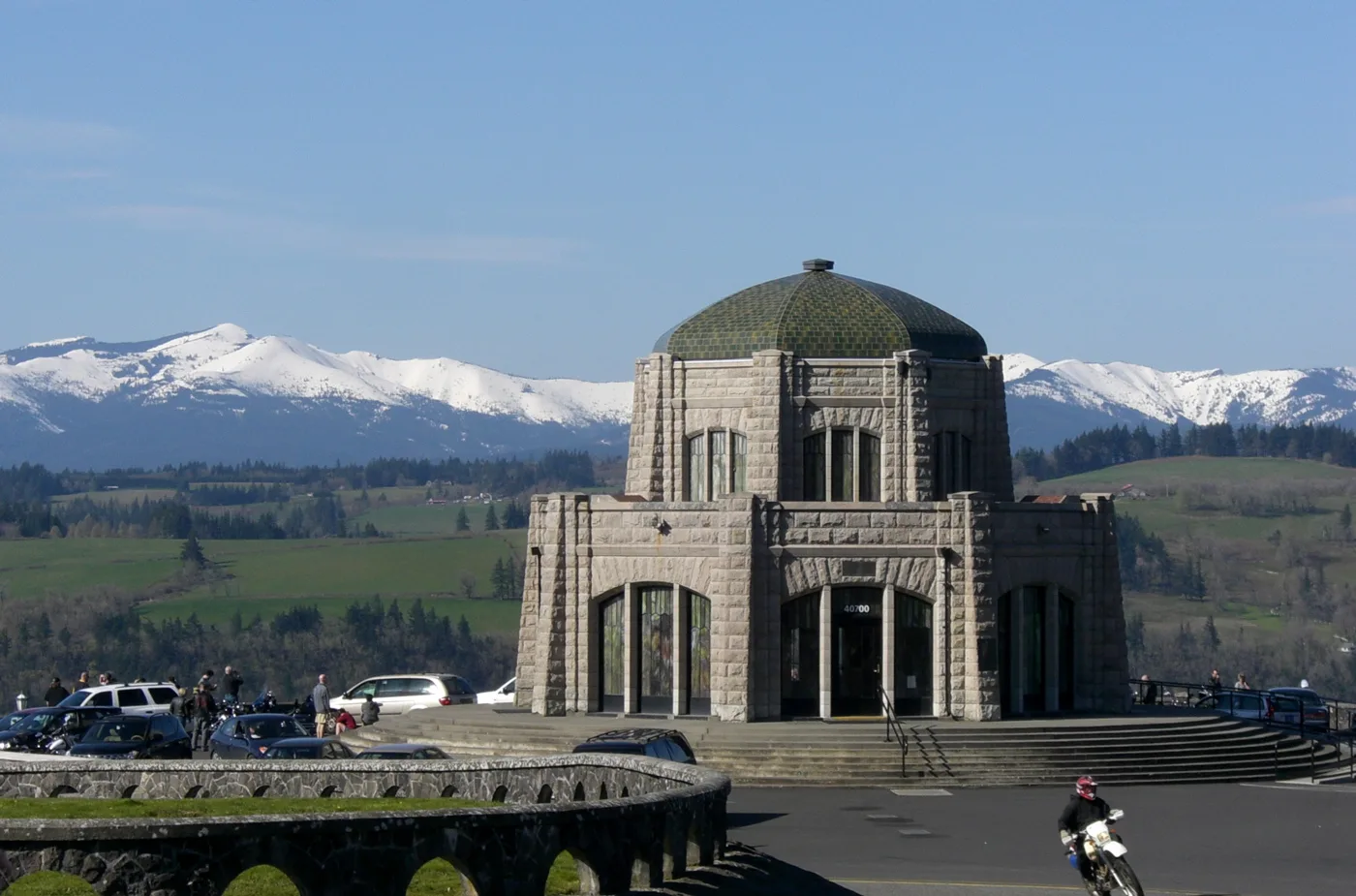
Crown Point Vista House in Multnomah County, Oregon
Crown Point Vista House in Multnomah County is a historic object, East Historic Columbia River Highway 40700 (97019). Crown Point Vista House is built in the Art Nouveau architecture style. Ⓦ.
- House Number
- 40700
- Postal Code
- 97019
- Street
- East Historic Columbia River Highway
- Building Type
- building
Image
Streets nearby
Northeast Columbia AvenueThe View Point Inn
0.3 mi
Northeast Thor Boulevard0.5 mi
East Larch Mountain Road0.6 mi
Columbia River HighwayWarrendale, Oneonta, Oregon Travel Information, Multnomah Falls, Multnomah Falls (Westbound)
0.6 mi
Northeast Salzman Road0.7 mi
Water Line Road Trail0.8 mi
Northeast Aldermeadows Drive0.8 mi
Rooster Rock RoadPortland Women's Forum State Scenic Viewpoint, Chanticleer Point
0.9 mi
Northeast Park Street1.1 mi
Northeast 3rd Street1.1 mi
Menucha Retreat Center Road1.1 mi
Northeast 2nd StreetLatourell
1.1 mi
Latourell Falls Trail1.1 mi
Bluff Trail1.1 mi
High Water Trail1.1 mi
Sand Island Trail1.1 mi
Northeast Falls Street1.2 mi
East Historic Columbia River HighwayWahkeena Picnic Site, Springdale, Bridal Veil, Corbett, Multnomah Falls Restaurant, Visitor Center, Multnomah Falls Gifts, Crown point, Vista House Espresso, Ainsworth Day Use Area
1.2 mi
Northeast Latourell Road1.2 mi
East Knieriem Road1.2 mi
Lagoon Trail1.3 mi
Northeast Crestview Lane1.4 mi
Southeast Jody Road1.4 mi
Moore Falls Road1.4 mi
East Haines Road1.5 mi
Southeast Lewis and Clark HighwayMount Pleasant
1.6 mi
Bare rocks nearby
Onion Rock1.2 mi
Buildings nearby
Building C, Creevey Complex0.9 mi
Building B, Creevey Complex0.9 mi
Building D, Creevey Complex0.9 mi
Building A or Creevey Commons, Creevey Complex1.0 mi
Ballard Hall1.0 mi
Menucha Retreat & Conference Center, Wright Hall1.0 mi
Office1.1 mi
Boyd Hall Habitat Hideaway1.1 mi
Maintenance Shop1.1 mi
Fairways nearby
Cape Horn Channel1.0 mi
Rooster Rock Channel1.1 mi
Gardens nearby
Rose Garden Labyrinth1.0 mi
Grasslands nearby
Lindsay Field1.0 mi
Houses nearby
Beam House1.0 mi
Lindsay House1.1 mi
Railways nearby
UP Portland Subdivision0.3 mi
BNSF Fallbridge Subdivision1.6 mi
Ranger stations nearby
Rooster Rock Ranger Station0.7 mi
Rocks nearby
Rooster Rock0.4 mi
Streams nearby
Latourell Creek0.5 mi
Rainbow Creek1.2 mi
Waters nearby
Mirror Lake0.4 mi
| Year built | 1916 |
|---|---|
| Architectural style | Art Nouveau architecture |
| Heritage designation | National Register of Historic Places listed place, National Register of Historic Places contributing property |
| Protected area | Columbia River Gorge National Scenic Area, Crown Point State Scenic Corridor |
| Located in | Multnomah County |
| Country | United States |
| Location | Corbett |
 Public transit map Multnomah County Legend
| Railway | |
| Bus | |
| Streetcar |
 Bicycle map Multnomah County Legend
| Bike path | |
| Bike lane on roadway | |
| Cycling allowed on bus lane | |
| Bicycle street | |
| Open to cyclists | |
| Open to cyclists, good path | |
| Cycling prohibited | |
| Cobblestone |
| Long-distance bike route | (depending on scale) | |
| Long-distance bike route |
 Pedestrian map Multnomah County Legend
| Path |
| Long-distance hiking trail | (depending on scale) | |
| Long-distance hiking trail | ||
| Pedestrians prohibited |