
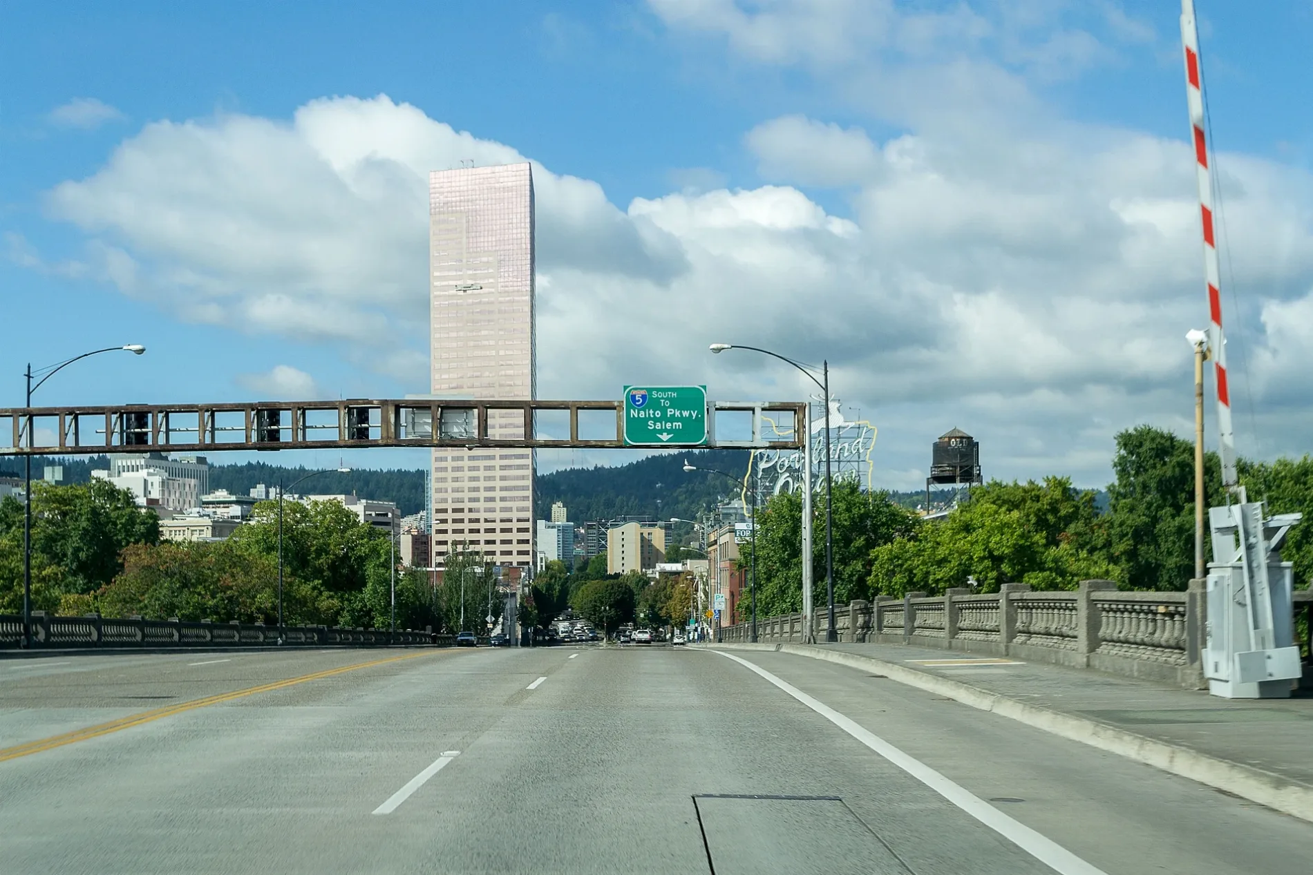
West Burnside Street in Arlington Heights, Portland, Oregon
West Burnside Street in Arlington Heights in Portland is a four-lane, asphalted main road. The street has sidewalks. It runs in an east-west direction starting from Northwest 23rd Avenue and crosses Northwest 23rd Place, Northwest 24th Place, Northwest Uptown Terrace, Northwest Maywood Drive, Northwest 11th Avenue, Southwest 11th Avenue, Northwest 12th Avenue, Southwest 12th Avenue, Northwest 13th Avenue, Southwest 13th Avenue and Northwest 14th Avenue. It connects Downtown, Northwest District, Pearl District, Old Town, Hillside and Goose Hollow. The nearest stops are West Burnside & Northwest Maywood Drive and West Burnside & Northwest Uptown Terrace. The bus lines 18 and 20 serve this stop. Ⓦ.
- Bicycle
- yes
- Road Type
- main road
- Lanes
- 4
- Speed Limit
- 35 mph
- Route
- east-west
Image
Bus stops
- bus lines 18, 20
Streets nearby
Southwest Parkside Lane250 ft
Southwest Marconi Avenue250 ft
Southwest Kingston AvenueSouthwest Kingston & Tichner, Southwest Kingston & Japanese Garden
400 ft
Southwest Wright Avenue450 ft
Northwest Macleay BoulevardNorthwest Macleay & West Burnside, Hillside, Northwest Macleay & Hermosa, Northwest Macleay & Lomita Terrace
0.1 mi
Northwest Mildred Street0.1 mi
Northwest Lomita Terrace0.1 mi
Southwest Rutland Terrace0.1 mi
Northwest Beuhla Vista TerraceNorthwest Macleay & Beuhla Vista
0.1 mi
Northwest Calumet Terrace0.1 mi
Northwest Rainier Terrace0.1 mi
Southwest Washington Way0.1 mi
Southwest Parkside Drive0.2 mi
Northwest Roanoke Street0.2 mi
Southwest Tichner Drive0.2 mi
Stearns Road Trail0.2 mi
Northwest Maywood DriveWest Burnside & Northwest Maywood Drive
0.2 mi
Southwest Sacajawea BoulevardSouthwest Sacajawea & Sherwood (closed)
0.2 mi
Northwest Monte Vista Terrace0.2 mi
Northwest Albemarle Terrace0.2 mi
Northwest Marlborough Avenue0.2 mi
Northwest Uptown TerraceHilltop Condominium
0.2 mi
Northwest Imperial Terrace0.2 mi
Southwest Rose Garden WaySouthwest Rose Garden Way & Wright, Southwest Rose Garden Boulevard & Sherwood
0.2 mi
West Burnside RoadWest Burnside & Northwest Macleay, West Burnside & Northwest Hermosa, West Burnside & Northwest Barnes, West Burnside & Southwest 48th Drive, West Burnside & Southwest Fischer Lane, 4600 Block West Burnside
0.2 mi
Southwest Sterns Drive0.2 mi
Northwest 24th PlaceCarbon Salon
0.2 mi
Northwest Santanita Terrace0.2 mi
Southwest Lewis And Clark CircleFree Shuttle Stop
0.2 mi
MAC Trail0.2 mi
Northwest Westover Square0.2 mi
Northwest Melinda Avenue0.2 mi
Southwest Champlain Drive0.3 mi
Northwest Westover Terrace0.3 mi
Northwest Ariel Terrace0.3 mi
Northwest Westover Circle0.3 mi
Southwest Murray Street0.3 mi
Northwest Culpepper Terrace0.3 mi
Northwest Hermosa Boulevard0.3 mi
Northwest Alpine Terrace0.3 mi
Oregon TerracePortland Japanese Garden Gift Shop, Japanese Arts Learning Center
0.4 mi
Japanese Garden Trail0.4 mi
Community centers nearby
Hillside Community Center0.3 mi
Dams nearby
City of Portland Number 3 Dam0.3 mi
Parks nearby
Hillside Park0.3 mi
Residential areas nearby
Westover Terraces0.2 mi
Hilltop Condominiums0.2 mi
The Westover0.2 mi
Westover Square0.3 mi
Ticket offices nearby
Calvin and Mayho Tanabe Welcome Center0.3 mi
| Located in | Portland |
|---|---|
| Country | United States |
Public transit map Arlington Heights Legend
| Railway | |
| Bus | |
| Streetcar |
Bicycle map Arlington Heights Legend
| Bike path | |
| Bike lane on roadway | |
| Cycling allowed on bus lane | |
| Bicycle street | |
| Open to cyclists | |
| Open to cyclists, good path | |
| Cycling prohibited | |
| Cobblestone |
| Long-distance bike route | (depending on scale) | |
| Long-distance bike route |
Pedestrian map Arlington Heights Legend
| Path |
| Long-distance hiking trail | (depending on scale) | |
| Long-distance hiking trail | ||
| Pedestrians prohibited |