
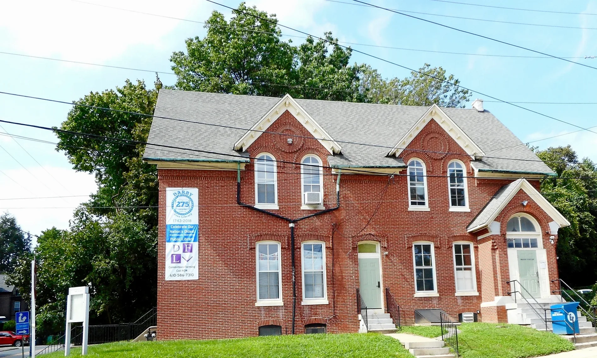
Darby Free Library in Darby, Pennsylvania
Darby Free Library in Darby is a library (opening hours: Mo,We,Fr 09:00-17:00; Tu,Th 10:00-17:00; Sa 10:00-17:00 "summer 10:00-14:00", Elevation 12 m), Main Street 1001 (19023) 🌐. Ⓦ.
- House Number
- 1001
- Postal Code
- 19023
- Street
- Main Street
- Amenity
- library
- Building Type
- building
- Website
- https://darbylibrary.org
Image
Police stations
Fast food restaurants
Supermarkets
Streetcar stops
Places of worship
Stations
Auto repair shops
Schools
Variety stores
Streets nearby
South Macdade BoulevardMeineke
450 ft
South 11th Street450 ft
Chestnut Street500 ft
Main StreetDarby Transportation Center, Main Street & Summit Street, Main Street & 6th Street, Main Street & 5th Street, Main Street & 4th Street, Main Street & 3rd Street, Main Street & 2nd Street, Main Street & Powell Road, Main Street & Mill Street, Main Street & Front Street, Mt Zion Church
0.1 mi
North 10th Street10th Street & Main Street, 10th Street & Summit Street, 10th Street & Ridge Avenue, 10th Street & Wycombe Avenue, 10th Street & Mulberry Street
0.1 mi
North 9th Street9th Street & Summit Street, 9th Street & Ridge Avenue, 9th Street & Cedar Avenue, 246 North 9th Street
0.1 mi
Ridge AvenueDarby, Darby Police Department
0.1 mi
School Street0.1 mi
Woodbine Street0.1 mi
Kenwood Road0.2 mi
Mulberry Street0.2 mi
Powell RoadMain Street & Powell Road
0.2 mi
Forrester Avenue0.2 mi
Chester Pike0.2 mi
Springfield Road0.2 mi
South 12th Street0.2 mi
Center Avenue0.2 mi
Florence Road0.2 mi
Glen Avon Road0.2 mi
Maple Terrace0.2 mi
North Macdade Boulevard0.2 mi
Tyler Avenue0.2 mi
Creek Road0.2 mi
Quarry Street0.2 mi
Summit Street0.2 mi
New Walnut Street0.2 mi
Berkley Road0.2 mi
South 13th Street0.2 mi
Summit Avenue0.2 mi
Macdade BoulevardMacDade Boulevard, Collingdale, Collingdale Library
0.3 mi
Weymouth Road0.3 mi
Southridge Road0.3 mi
East Lynbrook Road0.3 mi
South 14th Street0.3 mi
Crestview Road0.3 mi
Buildings nearby
Delaware County Assistance Office0.2 mi
Fast food restaurants nearby
McDonald's450 ft
Dunkin'0.2 mi
Fire stations nearby
Darby Fire Company #10.2 mi
Houses nearby
Historic Schoolmasters House200 ft
Oldest surviving twin house - Bunting family0.2 mi
Parks nearby
Powell Park0.2 mi
Pharmacies nearby
Walgreens0.3 mi
Places of worship nearby
Darby Friends Meeting300 ft
Blessed Virgin Mary Church0.1 mi
Ever Abundant Life Church0.2 mi
Produce markets nearby
Produce Junction500 ft
Sports centers nearby
Edward Bacon Recreation Center550 ft
Town halls nearby
Darby Borough Municipal Complex550 ft
| Located in | Darby |
|---|---|
| Country | United States |
 Public transit map Darby Legend
| Railway | |
| Bus | |
| Streetcar |
 Bicycle map Darby Legend
| Bike path | |
| Bike lane on roadway | |
| Cycling allowed on bus lane | |
| Bicycle street | |
| Open to cyclists | |
| Open to cyclists, good path | |
| Cycling prohibited | |
| Cobblestone |
| Long-distance bike route | (depending on scale) | |
| Long-distance bike route |
 Pedestrian map Darby Legend
| Path |
| Long-distance hiking trail | (depending on scale) | |
| Long-distance hiking trail | ||
| Pedestrians prohibited |