
Pawtucket Times Building in Pawtucket, Rhode Island
Pawtucket Times Building in Pawtucket is a building. Pawtucket Times Building is located near Manchester Street. Ⓦ.
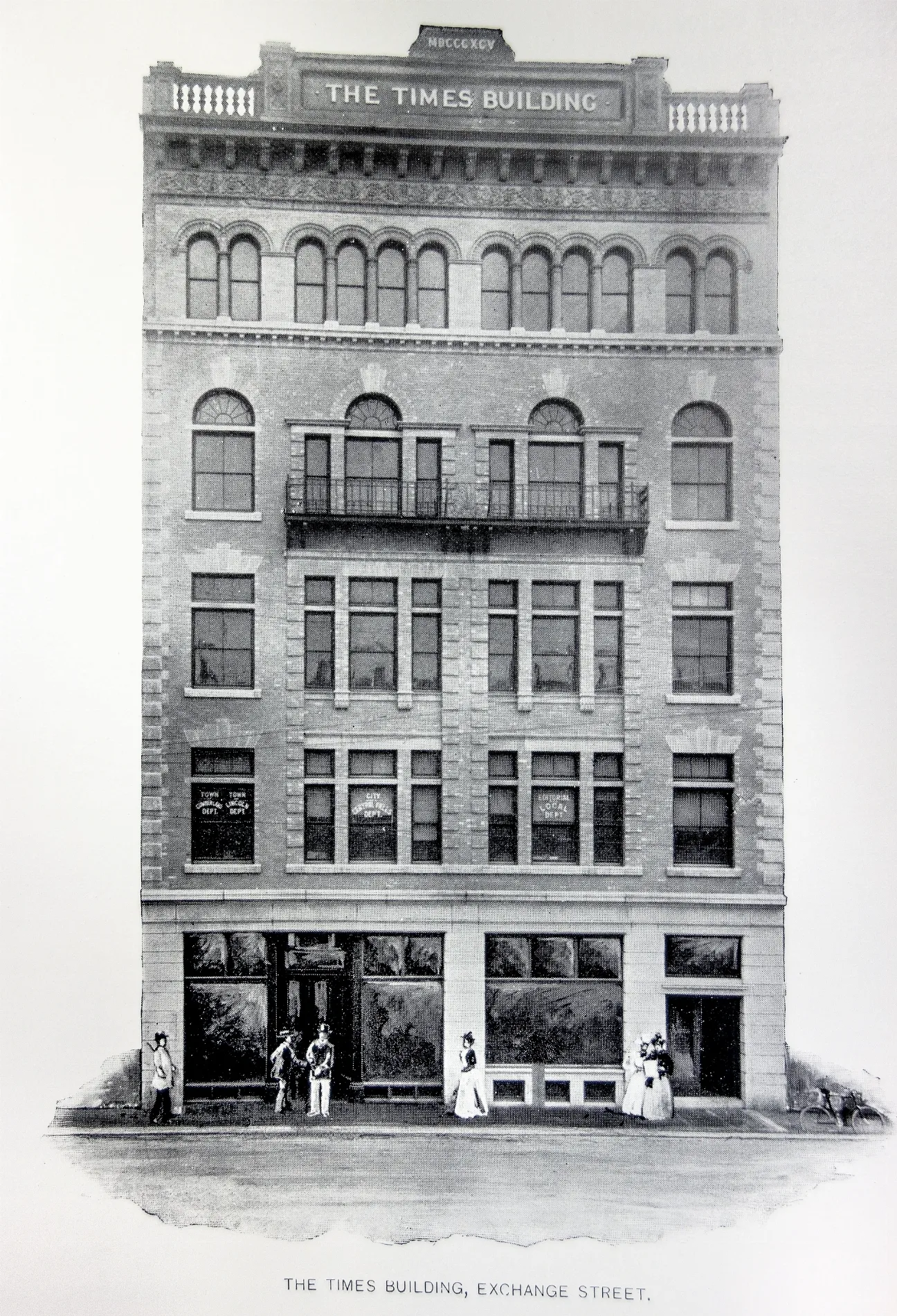
- Building Type
- building
Bus stops
Pharmacies
Schools
Fire stations
Libraries
Convenience stores
Post offices
Police stations
Places of worship
Streets nearby
North Union Street200 ft
Exchange StreetExchange after Broad, Valley Community and Day School, Exchange after Roosevelt, Roosevelt Avenue, Exchange at Tolman High School, Exchange before Exchange Ct
250 ft
Maple Street400 ft
Summer Street500 ft
Humes Street0.1 mi
Grant Street0.1 mi
Mason StreetWalgreens
0.1 mi
Main StreetThe Main Oasis, Saint Georges Roman Catholic Church, Saint Marys Antiochian Church, Collyer Park, Woodlawn, Hope Artiste Village, Grenville Street, Sayles Avenue, Whitman Street, Pearl Street
0.1 mi
Roosevelt AvenueSlater Mill Historic Site Library, Slater Mill (Roosevelt & Main), Opposite Slater Mill (Roosevelt & Main), Pawtucket Transit Center, Visitor Center (Roosevelt & Main), Pawtucket, Pawtucket Post Office, Pawtucket Fire Station 2, Pawtucket Police Department
0.1 mi
Goff AvenueGoff Avenue
0.1 mi
Andrew D. Ferland Way0.1 mi
Leather Avenue0.1 mi
Dexter StreetDexter before Bayley, Dexter opposite Andrew Ferland, Dexter after Goff, United Church of Christ, Dexter & Barton (before Court), Dexter & Barton (after Barton), Dexter opposite Congress, Dexter after Congress
0.2 mi
Manchester Street0.2 mi
Saint Mary's Way0.2 mi
Park PlacePark Place Congregational United Church of Christ, Park before Church
0.2 mi
Broad StreetBroad before Barton, Broad after Barton
0.2 mi
Bayley StreetArmando
0.2 mi
Miller Street0.2 mi
Montgomery Street0.2 mi
Commerce Street0.2 mi
Blackstone AvenueHeritage Park Early Learning Center
0.2 mi
Olive Street0.2 mi
Jackson Street0.3 mi
Nickerson Street0.3 mi
Darrow Street0.3 mi
Barton StreetPawtucket/Central Falls
0.3 mi
Dexter Court0.3 mi
High Street0.3 mi
Clay StreetPlay Plus Preschool
0.4 mi
Cherry Street0.4 mi
Hawes Street0.4 mi
Jenks Street0.4 mi
Cross StreetCentral Falls Congregational Church
0.4 mi
Elm Street0.5 mi
Central StreetCentral Street School
0.5 mi
Buildings nearby
Pawtucket Elks Lodge150 ft
Wilkinson Mill0.2 mi
Commercial buildings nearby
YMCA350 ft
Libraries nearby
Deborah Cook Sayles Public Library300 ft
Pawtucket Public Library400 ft
Adams Memorial Library0.5 mi
Parks nearby
Wilkinson Park0.2 mi
Places of worship nearby
Saint Mary Antiochian Orthodox Church0.2 mi
Chinese Christian Church of Rhode Island0.3 mi
Railways nearby
Main Line0.2 mi
Rivers nearby
Blackstone River0.2 mi
Stations nearby
RIPTA Pawtucket Transit Center0.2 mi
Town halls nearby
Pawtucket City Hall0.2 mi
| Heritage designation | National Register of Historic Places listed place |
|---|---|
| Located in | Rhode Island |
| Country | United States |
 Public transit map Pawtucket Legend
| Railway | |
| Bus | |
| Streetcar |
 Bicycle map Pawtucket Legend
| Bike path | |
| Bike lane on roadway | |
| Cycling allowed on bus lane | |
| Bicycle street | |
| Open to cyclists | |
| Open to cyclists, good path | |
| Cycling prohibited | |
| Cobblestone |
| Long-distance bike route | (depending on scale) | |
| Long-distance bike route |
 Pedestrian map Pawtucket Legend
| Path |
| Long-distance hiking trail | (depending on scale) | |
| Long-distance hiking trail | ||
| Pedestrians prohibited |