
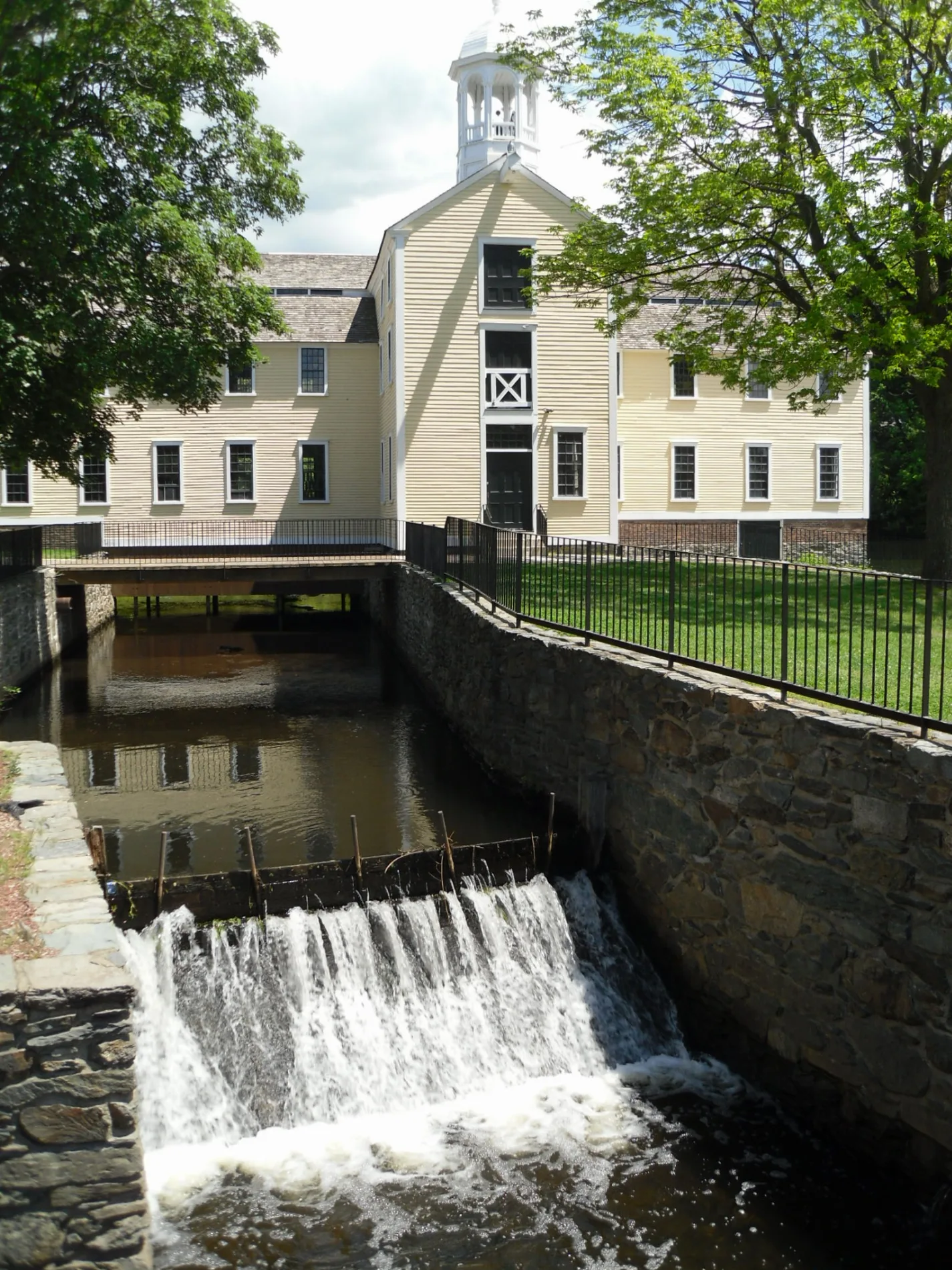
Slater Mill in Pawtucket, Rhode Island
Slater Mill in Pawtucket is an attraction, Roosevelt Avenue. Slater Mill is also known as Slater Mill Historic Site. Ⓦ.
- Street
- Roosevelt Avenue
- Alternate Name
- Slater Mill Historic Site
- Building Type
- building
- Tourism
- attraction
Image
Libraries
Police stations
Post offices
Convenience stores
Bus stops
Places of worship
Fire stations
Schools
Streets nearby
Roosevelt AvenueSlater Mill Historic Site Library, Slater Mill (Roosevelt & Main), Opposite Slater Mill (Roosevelt & Main), Pawtucket Transit Center, Visitor Center (Roosevelt & Main), Pawtucket, Pawtucket Post Office, Pawtucket Fire Station 2, Pawtucket Police Department
250 ft
Leather Avenue400 ft
Main StreetSaint Georges Roman Catholic Church, Saint Marys Antiochian Church, Collyer Park, Woodlawn, Hope Artiste Village, Grenville Street, Sayles Avenue, Whitman Street, Pearl Street, The Main Oasis
450 ft
Walcott StreetPawtucket Congregational Church, United Church of Christ, Greek Orthodox Church of the Assumption, Walcott after Walnut, Walcott before Arlington, Walcott before Underwood, Walcott after French, Pawtucket Soup Kitchen
500 ft
High Street500 ft
Summer Street0.1 mi
Kids Way0.2 mi
Exchange Court0.2 mi
North Union Street0.2 mi
Exchange StreetExchange after Broad, Valley Community and Day School, Exchange after Roosevelt, Roosevelt Avenue, Exchange at Tolman High School, Exchange before Exchange Ct
0.2 mi
Jenks Way0.2 mi
Underwood StreetSaint Anthonys Greek Orthodox Church, Underwood after Walcott
0.2 mi
Vernon Street0.2 mi
Longley Court0.3 mi
Grove Street0.3 mi
South Street0.3 mi
Summit StreetSummit before Walcott, Summit after Walcott, Summit before Johnson, Summit before Division
0.3 mi
Fruit Street0.3 mi
New Court0.3 mi
Arlington Street0.3 mi
School StreetSunoco, School opposite Pond, School opposite Pearson, School opposite Englewood, School at Riverview Terrace
0.3 mi
BroadwayBroadway after May, Broadway before Exchange, Broadway before George Bennett, Broadway opposite Margaret, Broadway opposite Lilac, Broadway after East, Broadway before East, Broadway after Allen, Broadway & Central (after Laurel), Broadway & Central (opposite Laurel), Broadway before Woodbine, Broadway after Woodbine, Broadway before Blackstone
0.3 mi
Potter Street0.3 mi
Homestead Street0.3 mi
Water StreetSchool St after Main
0.3 mi
May Street0.3 mi
Prospect StreetProspect before Linwood, Prospect opposite Chestnut, 500 Prospect, Prospect before Rhode Island, 560 Prospect, Prospect after Meadow, Prospect before Fruit
0.3 mi
Spring Street0.3 mi
Howard Avenue0.3 mi
US 10.3 mi
Maynard Street0.4 mi
Bowers Street0.4 mi
Cottage StreetFirst Baptist Church, Underwood before Grove, Honey Dew, Cottage before County, Cottage before Newport, Cottage after Benefit, Cottage before Benefit
0.4 mi
Armistice BoulevardArmistice opposite Alexander McGregor, Armistice after Orient, Armistice & Newport, Armistice after Daggett, Slater Park (Armistice Blvd), Armistice before N Bend, Armistice after N Bend, Armistice & George Bennett, Armistice opposite Schofield, Armistice after Schofield, Dunkin', Armistice after George Bennett, Armistice & York (after Alden), Armistice before Bloomfield, Armistice & York (after Rosemont), Armistice before Littlefield, Armistice before Slater Park, Armistice before Greenslitt, Armistice before Felsmere, Armistice opposite Parkside, Armistice after Littlefield, Armistice before Perrin, Armistice after Rosemont
0.4 mi
Tyler Street0.4 mi
Walnut Street0.4 mi
French Street0.4 mi
Division Street0.4 mi
Buildings nearby
Wilkinson Mill100 ft
Pawtucket Armory Arts Center0.2 mi
Libraries nearby
Pawtucket Public Library0.1 mi
Deborah Cook Sayles Public Library0.1 mi
Parks nearby
Slater Mill Site100 ft
Rivers nearby
Blackstone River200 ft
School buildings nearby
William E. Tolman High School0.2 mi
Stations nearby
RIPTA Pawtucket Transit Center350 ft
Town halls nearby
Pawtucket City Hall0.1 mi
Weirs nearby
Pawtucket Upper Dam250 ft
Pawtucket Lower Dam350 ft
| Protected area | Blackstone River Valley National Historical Park |
|---|---|
| Located in | Rhode Island |
| Country | United States |
| Website | https://www.nps.gov/places/slater-mill.htm |
 Public transit map Pawtucket Legend
| Railway | |
| Bus | |
| Streetcar |
 Bicycle map Pawtucket Legend
| Bike path | |
| Bike lane on roadway | |
| Cycling allowed on bus lane | |
| Bicycle street | |
| Open to cyclists | |
| Open to cyclists, good path | |
| Cycling prohibited | |
| Cobblestone |
| Long-distance bike route | (depending on scale) | |
| Long-distance bike route |
 Pedestrian map Pawtucket Legend
| Path |
| Long-distance hiking trail | (depending on scale) | |
| Long-distance hiking trail | ||
| Pedestrians prohibited |