
East Side Tunnel in Providence, Rhode Island
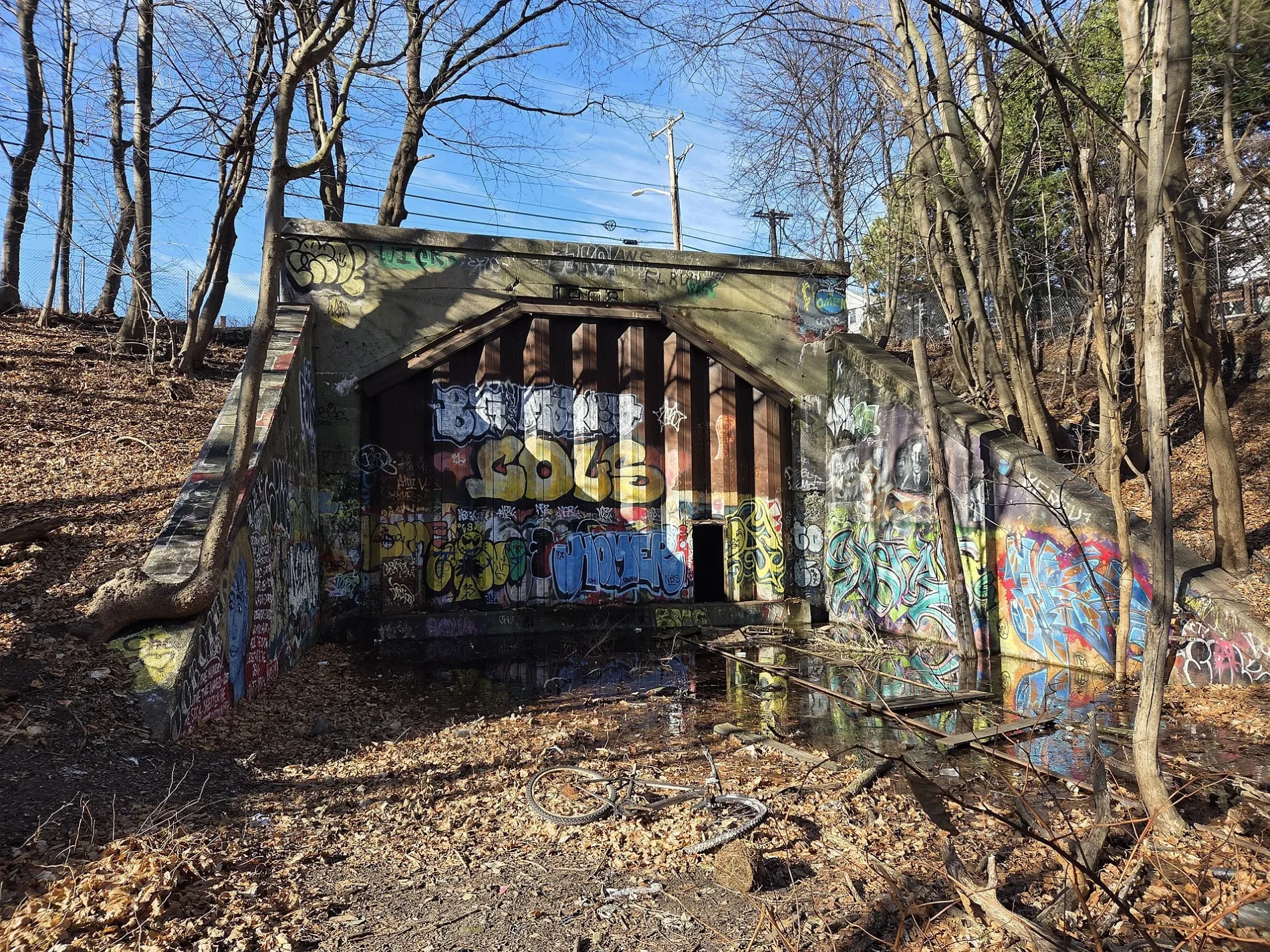
East Side Tunnel in Providence is a disused railway. Ⓦ.
Image
Cafes
Clothing stores
Artworks
Galleries
Restaurants
Bars
Carpet stores
Viewpoints
Bus stops
Museums
- The Nature Lab at Rhode Island School of Design (Web) at Waterman Street 13 (02903) – approx. 450 ft.
Hair salons
Fountains
Bookstores
Streets nearby
Meeting StreetDen Den Café Asiana, The XO Bar, Woods Gerry Gallery, Andreas, Spiritus Fermenti, Meeting Street Cafe, Berk's;Shanghai, Thayer before Meeting, West House Compost Bins, Fellowship of House Church, FedEx Office, B.GOOD, Warby Parker
200 ft
Thomas StreetHazel Origin Coffee
250 ft
Benefit StreetRhode Island Supreme Court, Richmond Fountain
350 ft
Waterman StreetCarr Haus Cafe, Tunnel before S Main, Waterman at Henderson Bridge On-Ramp, Waterman after Governor, Waterman & Butler (after Butler), Waterman and Hope, ChargePoint, Waterman before Hope, Mare Rooftop Restaurant, Waterman after Wayland, Verizon, Massage Envy, Wayland Fresh, Washington Trust, Wong's Kitchen, Kung Fu Tea, Wayland Square Bus Stop, Waterman after Gano, Haffenreffer Museum of Anthropology, Blue Room, Campus Market, Under the Laurentide, Stuart Theatre, Leeds Theatre, Pokeworks
400 ft
South Court Street450 ft
North Main StreetHarry's Bar & Burger, Mill's Tavern, Muse Paint Bar, Speedway, Third Street, Saint Johns Rectory, Roger Williams National Memorial, RISD store, S Main before Waterman, Ninth Street, N Main after Ann Mary, Rhode Runner, Charlesgate, Petco, Starbucks, University Heights, T-Mobile, North Burial Ground, Rochambeau Avenue, Shell, Tantric Night Club
450 ft
East Side Bus TunnelThe Nature Lab at Rhode Island School of Design, Cafe Pearl, Ben & Jerry's, Tunnel and Thayer, Tunnel & Thayer (after Thayer), Tunnel and South Main, Tunnel after S Main
500 ft
Hammett LaneLoominous Rugs, Lola Fashion Boutique
500 ft
North Court Street500 ft
Blair LaneBitty & Beau's
0.1 mi
Steeple StreetNew Rivers American Bistro, Palo Tapas Bar
0.1 mi
Throop AlleyMess Salon
0.1 mi
Chase PlazaRhode Island School of Design
0.1 mi
Washington Place0.1 mi
Abandoned railways nearby
East Providence Branch250 ft
Apartment buildings nearby
Colonial Apartments100 ft
Buildings nearby
Dexter House100 ft
173 Benefit Street150 ft
State Arsenal150 ft
Dunnell House300 ft
What Cheer Garage & Studios400 ft
Old State House450 ft
Waterman Street Building500 ft
Wayland Building500 ft
Jonathan Treadwill House0.1 mi
Illustration Studies Building0.1 mi
Edge College Hill Apartments0.1 mi
Commercial buildings nearby
Market House0.2 mi
Fire stations nearby
Providence Fire Department450 ft
Gardens nearby
Radeke Garden0.1 mi
Grasslands nearby
RISD Beach400 ft
Old State House Grounds0.1 mi
Guest houses nearby
The Old Court Bed & Breakfast500 ft
Houses nearby
Dwight House200 ft
Thomas A. Jenckes House200 ft
Congdon House350 ft
University Club0.1 mi
Museums nearby
Farago Wing0.1 mi
Pendleton House0.1 mi
Office buildings nearby
Auditorium Building0.1 mi
One Citizens Plaza0.1 mi
Parks nearby
Market Square0.2 mi
Places of worship nearby
First Baptist Church in America400 ft
University buildings nearby
Carr House450 ft
Chace Center0.1 mi
Metcalf Building0.1 mi
Cheapside Building0.1 mi
Bank Building0.1 mi
Hope Block0.1 mi
| Located in | Rhode Island |
|---|---|
| Country | United States |
 Public transit map Providence Legend
| Railway | |
| Bus | |
| Streetcar |
 Bicycle map Providence Legend
| Bike path | |
| Bike lane on roadway | |
| Cycling allowed on bus lane | |
| Bicycle street | |
| Open to cyclists | |
| Open to cyclists, good path | |
| Cycling prohibited | |
| Cobblestone |
| Long-distance bike route | (depending on scale) | |
| Long-distance bike route |
 Pedestrian map Providence Legend
| Path |
| Long-distance hiking trail | (depending on scale) | |
| Long-distance hiking trail | ||
| Pedestrians prohibited |