This City map of South Carolina shows streets, paths and places across the United States state. South Carolina covers about 82,931 square kilometres and had 5,118,425 residents in 2020, compared with 4,625,364 in 2010. The state was founded in 1788 and reaches a recorded elevation of 105 metres. Its 46 counties and numerous towns extend from the Atlantic coast and the Lowcountry to the Piedmont and the Blue Ridge foothills.Mapped long-distance cycling routes in South Carolina include the East Coast Greenway and the Coastal Route. The regional map includes places such as Charleston, Columbia, Greenville, Myrtle Beach and the 53 listed subregions below.
Irmo is a town-level place in South Carolina with OSM administrative level 8. It lies in the central part of the state near Lake Murray and the Saluda River. The town is associated with the suburban area west of Columbia and lies near Lexington and Richland counties. The map identifies Irmo through its local streets, paths and places.
Fairfax is a village in South Carolina with a recorded population of 1,505. Its mapped area is 8,580,694 square metres, and its elevation is 42 metres. Fairfax is located in the state's southern Lowcountry near Allendale County and the Savannah River region. The town-level locality has OSM administrative level 8.
DoD Photo by Staff Sgt. Alexander Nieves, Public domain – Wikimedia Commons
Andrews is a town in Georgetown County, South Carolina, with a recorded population of 2,575. The locality covers 5,710,705 square metres and has an elevation of 8 metres. Andrews lies in the Lowcountry between Georgetown and the inland communities of Williamsburg County. Its local map includes streets and paths within OSM administrative level 8.
Blythewood is a town in central South Carolina with OSM administrative level 8. It is located north of Columbia in Richland County and near the boundary with Fairfield County. The town belongs to the rapidly developing corridor along Interstate 77. Its map represents the local streets, paths and named places of Blythewood.
Ware Shoals is a town in South Carolina with OSM administrative level 8. It lies near the Saluda River in the state's western Piedmont, close to Greenwood, Laurens and Abbeville counties. The river and the nearby Piedmont road network are central geographic references for the locality. The map records Ware Shoals as a town-level place.
Fountain Inn is a city in Greenville and Laurens counties with a recorded population of 10,416. Its mapped area is 18,231,380 square metres, and its elevation is 264 metres. The city lies in the Upstate along the corridor between Greenville and Laurens. Fountain Inn has OSM administrative level 8 and a dense network of urban streets.
Monetta is a town in South Carolina with OSM administrative level 8. It lies in the central-western part of the state near the boundaries of Aiken, Saluda and Lexington counties. The town is situated in the inland agricultural landscape between the Saluda River and the Savannah River basin. Its map identifies local roads, paths and places.
Pickens County is a South Carolina county with a recorded population of 131,404 and an area of 1,326,000,000 square metres. It was established in 1826 and occupies the northwestern Upstate at the foot of the Blue Ridge Mountains. The county includes the city of Pickens and parts of the foothill landscape near Table Rock State Park. Its waterways include the Twelve Mile River and the headwaters of the Saluda system.
Greenville County has a recorded population of 491,863, making it one of South Carolina's largest counties. It surrounds Greenville in the northwestern Upstate and extends toward the Blue Ridge foothills. Paris Mountain and parts of the Reedy River watershed are located in the county. Interstate 85 and Interstate 385 connect Greenville County with Charlotte, Columbia and Atlanta.
Spartanburg County has a recorded population of 327,997 and covers 2,122,000,000 square metres. The county was established in 1785 and is centred on the city of Spartanburg in the Upstate. The Pacolet River and Tyger River drain parts of its Piedmont terrain. Interstate 85, Interstate 26 and Interstate 585 provide major transport corridors through the county.
Laurens County has a recorded population of 66,623 and lies in the western Piedmont of South Carolina. Laurens is the county seat, while Clinton and Fountain Inn are important local communities. The county is crossed by the Enoree River and the Reedy River watershed. Its position between Greenville, Columbia and the Savannah River basin gives it a central Upstate location.
Anderson County has a recorded population of 203,718 and covers 1,962,000,000 square metres. Established in 1826, it occupies the western South Carolina Piedmont around the city of Anderson. Lake Hartwell forms a major water feature along the county's western boundary on the Savannah River. Interstate 85 links Anderson County with Greenville and Atlanta.
Oconee County has a recorded population of 78,607 and an area of 1,745,000,000 square metres. Established in 1868, it occupies South Carolina's northwestern corner along the Georgia and North Carolina borders. Lake Jocassee, Lake Keowee and the Chattooga River are prominent geographic features. The county includes the Blue Ridge foothills and access to Devils Fork State Park.
Allendale County has a recorded population of 8,039 and covers 1,069,000,000 square metres. Established in 1919, it lies in South Carolina's southern Lowcountry near the Savannah River and the Georgia border. Allendale is the county seat and the principal named town in the county. The landscape belongs to the inland coastal plain between Hampton and Barnwell counties.
Bamberg County has a recorded population of 13,311 and an area of 1,024,000,000 square metres. Established in 1897, it lies in the lower central part of South Carolina near the Edisto River system. Bamberg is the county seat, while Denmark is another incorporated town. The county connects the Lowcountry with inland communities around Orangeburg and Allendale.
Beaufort County has a recorded population of 187,117 and covers 2,390,000,000 square metres. Established in 1764, it occupies the Atlantic coastal Lowcountry and includes Beaufort, Hilton Head Island and the Port Royal area. Broad tidal waterways such as the Broad River and the Beaufort River define much of the county's coast. The county contains sea islands, salt marshes and sections of the Intracoastal Waterway.
Berkeley County has a recorded population of 229,861 and an area of 3,181,000,000 square metres. Established in 1882, it extends north of Charleston from the coastal plain toward Lake Moultrie and Lake Marion. Moncks Corner is the county seat, and Goose Creek is a major urban centre. The Cooper River, the Santee River system and Interstate 26 cross the county.
Charleston County has a recorded population of 408,235 and covers 3,517,000,000 square metres. Established in 1769, it includes the historic city of Charleston, Mount Pleasant, North Charleston and large Atlantic barrier and sea islands. Charleston Harbor lies between the Ashley and Cooper rivers and opens toward the Atlantic Ocean. The county contains major landmarks including the Ravenel Bridge and the historic Charleston peninsula.
Colleton County has a recorded population of 38,604 and an area of 2,935,000,000 square metres. Established in 1800, it occupies the central South Carolina Lowcountry between the Combahee and Edisto river systems. Walterboro is the county seat, and Edisto Beach lies on the Atlantic coast. The Edisto River, one of the longest free-flowing blackwater rivers in North America, borders and crosses parts of the county.
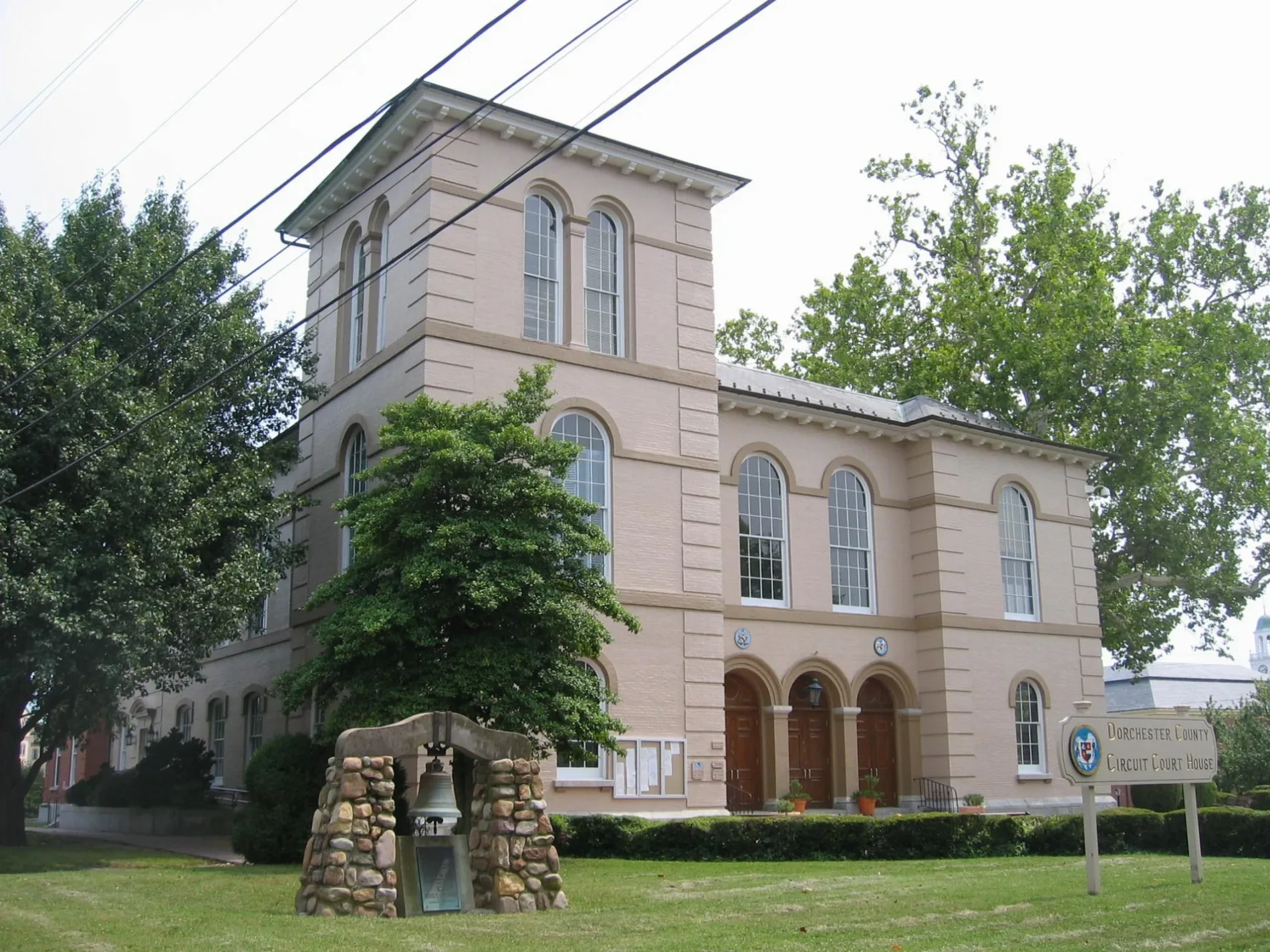
Dorchester County has a recorded population of 161,540 and covers 1,494,000,000 square metres. Established in 1897, it lies northwest of Charleston and includes Summerville, St. George and parts of North Charleston. The Ashley River forms a major geographic feature on the county's eastern side. Interstate 26 connects Dorchester County with Charleston and Columbia.
Hampton County has a recorded population of 18,561 and an area of 1,457,000,000 square metres. Established in 1878, it lies in the southern Lowcountry between Beaufort, Jasper and Allendale counties. Hampton is the county seat, and the county's waterways include tributaries of the Combahee River. U.S. Route 278 provides an east-west connection across the county.
Jasper County has a recorded population of 28,791 and covers 1,512,000,000 square metres. Established in 1912, it occupies the southwestern Lowcountry along the Savannah River and the Georgia border. Ridgeland is the county seat, and Hardeeville lies near the coastal transport corridor. The New River, the Savannah River and extensive coastal wetlands define the county's drainage network.
Curt Teich & Co., Chicago (publisher), Public domain – Wikimedia Commons
Orangeburg County has a recorded population of 84,223 and an area of 2,922,000,000 square metres. Established in 1769, it lies in the central part of South Carolina and includes the city of Orangeburg. Lake Marion borders the county to the east, while the North Fork Edisto River and South Fork Edisto River cross the region. Interstate 26 and U.S. Route 301 connect Orangeburg with Columbia and Charleston.
Abbeville County has a recorded population of 24,295 and covers 1,324,000,000 square metres. Established in 1785, it lies in the western Piedmont near the Georgia border and the Savannah River. Abbeville is the county seat, and Calhoun Falls is located near Lake Russell. The county includes parts of the watersheds of the Savannah River and the Rocky River.
The original uploader was Festiva76 at English Wikipedia ., Public domain – Wikimedia Commons
Aiken County has a recorded population of 168,808 and an area of 2,798,000,000 square metres. Established in 1871, it occupies western South Carolina along the Savannah River opposite Augusta, Georgia. Aiken is the county seat, while North Augusta lies beside the river and the Georgia border. The county includes the Savannah River Site and extensive Sandhills landscapes.
Barnwell County has a recorded population of 20,589 and covers 1,443,000,000 square metres. Established in 1800, it lies in the western Lowcountry between Aiken and Allendale counties. Barnwell is the county seat, and the Savannah River forms the county's western boundary. The region is part of the inland coastal plain and lies near the Savannah River Site.
Calhoun County has a recorded population of 14,119 and an area of 1,016,000,000 square metres. Established in 1908, it lies in central South Carolina between Orangeburg and Lexington counties. St. Matthews is the county seat, and Lake Marion lies southeast of the county. The Congaree and North Fork Edisto drainage systems shape the local landscape.
Cherokee County has a recorded population of 56,216 and covers 1,029,000,000 square metres. Established in 1897, it lies in the northern Upstate around Gaffney and borders North Carolina. The Broad River and its tributaries cross the county's Piedmont terrain. Interstate 85 passes through Gaffney and connects Cherokee County with Charlotte and Greenville.
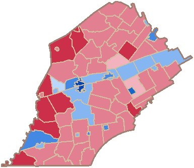
Chester County has a recorded population of 32,294 and an area of 1,518,000,000 square metres. Established in 1785, it lies in the north-central Piedmont between York and Fairfield counties. Chester is the county seat, and the Broad River runs along the county's western side. U.S. Route 321 and South Carolina Highway 9 serve the county's principal communities.
Jeremy Francis Gilmer, Chief Engineer, Dept. of Northern Virginia, CSA Army, Public domain – Wikimedia Commons
Chesterfield County has a recorded population of 43,273 and covers 2,087,000,000 square metres. Established in 1798, it occupies the northeastern Sandhills and Pee Dee region near the North Carolina border. Chesterfield is the county seat, while Cheraw lies near the Great Pee Dee River. The Pee Dee and Lynches river systems drain the county.
Clarendon County has a recorded population of 31,144 and an area of 1,802,000,000 square metres. Established in 1855, it lies in central South Carolina around Manning and Summerton. Lake Marion covers a large area along the county's eastern side and is formed by the Santee River. Interstate 95 crosses Clarendon County from north to south.
Darlington County has a recorded population of 62,905 and covers 1,468,000,000 square metres. Established in 1785, it lies in the northeastern Pee Dee region and includes Darlington, Hartsville and Society Hill. The Black Creek and Lynches River are important waterways in the county. Darlington Raceway, a major NASCAR circuit, is located near the city of Darlington.
Dillon County has a recorded population of 28,292 and an area of 1,053,000,000 square metres. Established in 1910, it lies in northeastern South Carolina along the North Carolina border. Dillon is the county seat, and Lake View is another incorporated community. The Little Pee Dee River and the Great Pee Dee watershed drain the county.
Edgefield County has a recorded population of 25,657 and covers 1,312,000,000 square metres. Established in 1785, it has a recorded elevation of 130 metres and lies in the western Piedmont near Georgia. Edgefield is the county seat, while the Savannah River forms the western county boundary farther south. The area includes tributaries of the Saluda and Savannah river systems.
Fairfield County has a recorded population of 20,948 and an area of 1,839,000,000 square metres. Established in 1785, it lies in central South Carolina between the Piedmont and the Midlands. Winnsboro is the county seat, and the Broad River forms part of the western boundary. Lake Wateree lies east of the county near the Catawba-Wateree river system.
Florence County is an administrative county in northeastern South Carolina with OSM administrative level 6. It lies in the Pee Dee region around the city of Florence, a major junction for Interstate 95 and Interstate 20. The Great Pee Dee River and Lynches River are principal waterways in the surrounding region. Florence connects the inland Midlands with Myrtle Beach and the Atlantic coast.
Georgetown County has a recorded population of 63,404 and covers 2,681,000,000 square metres. Established in 1769, it extends along the Atlantic coast between Charleston County and Horry County. Georgetown lies at the mouth of the Sampit River, while Pawleys Island and Murrells Inlet are coastal communities. The county contains tidal marshes, barrier islands and sections of the Intracoastal Waterway.
Asheville Post Card Co., Asheville, North Carolina (publisher), Public domain – Wikimedia Commons
Greenwood County has a recorded population of 69,351 and an area of 1,199,000,000 square metres. Established in 1897, it lies in the western Piedmont around the city of Greenwood. Lake Greenwood occupies the Saluda River system and is a major mapped water feature. The county borders Abbeville, Laurens, Newberry and McCormick counties.
Horry County has a recorded population of 309,199 and occupies the northeastern coastal corner of South Carolina. It includes Myrtle Beach, North Myrtle Beach, Conway and the Grand Strand, a developed Atlantic coastline. The Waccamaw River and the Intracoastal Waterway cross the county. U.S. Route 17 and Interstate 95 provide major north-south connections.
Kershaw County has a recorded population of 65,403 and covers 1,916,602,000 square metres. Established in 1791, it lies northeast of Columbia and includes Camden, the county seat. The Wateree River and Lake Wateree form major geographic features in the eastern part of the county. Camden is known for the historic Camden Revolutionary War Site.
Lancaster County has a recorded population of 96,016 and an area of 1,438,000,000 square metres. Established in 1798, it lies in the north-central Piedmont along the North Carolina border. Lancaster is the county seat, while Indian Land is part of the fast-growing Charlotte metropolitan area. The Catawba River and the Catawba-Wateree reservoir system define the county's western edge.
Lee County has a recorded population of 16,531 and covers 1,065,000,000 square metres. Established in 1902, it lies in the central Pee Dee region between Sumter and Darlington counties. Bishopville is the county seat and the main incorporated town. Black River tributaries and the nearby Wateree River shape the county's drainage.
Lexington County has a recorded population of 293,991 and an area of 1,963,000,000 square metres. Established in 1804, it lies west of Columbia and includes Lexington, West Columbia and the Lake Murray shoreline. The Saluda River forms the county's principal water system, with Lake Murray extending northwest of the capital region. Interstate 20, Interstate 26 and Interstate 77 cross Lexington County.
Marion County has a recorded population of 29,183 and covers 1,280,000,000 square metres. Established in 1800, it lies in the northeastern Pee Dee region near the North Carolina border. Marion is the county seat, and Mullins is a major local town. The Little Pee Dee River and its tributaries drain the county toward the Winyah Bay region.
Marlboro County has a recorded population of 26,667 and an area of 1,257,000,000 square metres. Established in 1798, it lies in northeastern South Carolina along the Great Pee Dee River and the North Carolina border. Bennettsville is the county seat, while McColl and Clio are local communities. The county's river plain connects the Sandhills with the broader Pee Dee basin.
McCormick County has a recorded population of 9,526 and covers 1,020,000,000 square metres. Established in 1914, it occupies the western Piedmont along Lake Thurmond and the Savannah River near Georgia. McCormick is the county seat, and the lake is formed by the J. Strom Thurmond Dam. The county borders Abbeville, Edgefield and Greenwood counties.
Newberry County has a recorded population of 37,719 and an area of 1,676,000,000 square metres. Established in 1785, it lies in central South Carolina between the Midlands and the western Piedmont. Newberry is the county seat, and the Saluda River and Lake Murray lie to the west and southwest. Interstate 26 crosses the county between Columbia and Spartanburg.
Richland County has a recorded population of 407,051 and includes Columbia, the capital of South Carolina. The county lies in the Midlands at the confluence of the Broad and Saluda rivers, which form the Congaree River. Fort Jackson, one of the largest United States Army training installations, occupies a substantial area east of Columbia. The Congaree National Park lies southeast of the city along the Congaree River.
Saluda County has a recorded population of 18,862 and covers 1,196,000,000 square metres. Established in 1896, it lies in the western Midlands near Lake Murray and the Saluda River. Saluda is the county seat, and the county borders Lexington, Newberry, Greenwood, Edgefield and McCormick counties. The rolling Piedmont terrain rises toward the western interior of South Carolina.
Sumter County has a recorded population of 107,480 and lies in central South Carolina. Sumter is the county seat and a regional centre between Columbia, Florence and Charleston. Shaw Air Force Base is located east of the city of Sumter. The county's waterways belong to the Wateree and Black River systems, with Lake Marion to the southeast.
Union County has a recorded population of 27,244 and covers 1,336,000,000 square metres. Established in 1798, it lies in the northern Piedmont between Spartanburg and Chester counties. Union is the county seat, while the Tyger River and Pacolet River drain the surrounding uplands. The county's eastern landscape approaches the Broad River basin.
Williamsburg County has a recorded population of 31,026 and was established in 1804. It lies in the eastern Lowcountry between Georgetown, Berkeley, Florence and Clarendon counties. Kingstree is the county seat and stands near the Black River. The county's coastal plain drains toward the Santee and Pee Dee river systems.
York County has a recorded population of 282,090 and covers a large area in the north-central part of South Carolina. Established in 1798, it includes York, Rock Hill and Fort Mill along the North Carolina border. The Catawba River and Lake Wylie form major western water features. Interstate 77 links York County with Charlotte, Columbia and the wider Piedmont.
Data sources: OpenStreetMap (ODbL), Wikidata (CC0) · Image: Wikimedia Commons
South Carolina – Facts
Population
5118425
Area
82931 km²
Subregions
53
Named after
Province of Carolina, south
Year built
1788
Elevation
105 m
Located in
United States
Country
United States
Body of water
Atlantic Ocean
Nickname
The Palmetto State
Native name
South Carolina
Official name
State of South Carolina
Described by
Brockhaus and Efron Encyclopedic Dictionary, Yuzhakov Big Encyclopedia, Jewish Encyclopedia of Brockhaus and Efron, Small Brockhaus and Efron Encyclopedic Dictionary, The Nuttall Encyclopædia, Desktop Encyclopedic Dictionary, 1922 Encyclopædia Britannica, Encyclopædia Britannica 11th edition, The American Cyclopædia, Collier's New Encyclopedia, 1921, The New Student's Reference Work, New International Encyclopedia, Meyers Konversations-Lexikon, 4th edition (1885–1890)
Part of
contiguous United States, South Atlantic states, The Carolinas










 Public transit map South Carolina Legend
  Bicycle map South Carolina Legend
  Pedestrian map South Carolina Legend