
Hays County
Hays County is a county in Texas with an area of about 1,761 square kilometres. Its recorded population is 241,067. The county was established in 1848. San Marcos is the county seat and extends into Caldwell and Guadalupe counties.
 CartogiraffeMap · Streets · Places
This page is the City map of Texas, a map with streets, paths, and places across the state of the United States. Texas covers about 696,241 square kilometres and lies at an elevation of approximately 520 metres above sea level. The state had 29,145,505 residents, compared with 25,145,561 in 2010, and was founded in 1845. The map includes counties, cities, roads, settlements, and recorded long-distance cycling routes such as On-Street Route 80, On-Street Route 51, and On-Street Route 14.

Hays County is a county in Texas with an area of about 1,761 square kilometres. Its recorded population is 241,067. The county was established in 1848. San Marcos is the county seat and extends into Caldwell and Guadalupe counties.

Comal County covers about 1,488 square kilometres in central Texas. Its recorded population is 161,501. The county was established in 1846. New Braunfels is the county seat and lies on the Guadalupe and Comal rivers.

Blanco County is a Texas county identified in the administrative map at level 6. It lies in the Texas Hill Country. The county seat is Blanco. The Blanco River runs through the county and gives the county its name.

Travis County covers about 2,650 square kilometres and has a recorded population of 1,290,188. It was established in 1840. Austin, the capital of Texas, is the county seat. The Colorado River flows through Austin and forms Lady Bird Lake in the city.

Caldwell County covers about 1,418 square kilometres and has a recorded population of 45,883. It was established in 1848. Lockhart is the county seat. San Marcos extends from Hays County into Caldwell County.

Guadalupe County covers about 1,850 square kilometres and has a recorded population of 172,706. It was established in 1846. Seguin is the county seat. New Braunfels extends into Guadalupe County from neighbouring Comal County.

Bexar County covers about 3,211 square kilometres and has a recorded population of 2,009,324. It was established in 1824. San Antonio is the county seat and the second-largest city in Texas. The San Antonio River and the historic Alamo are located in the metropolitan area.
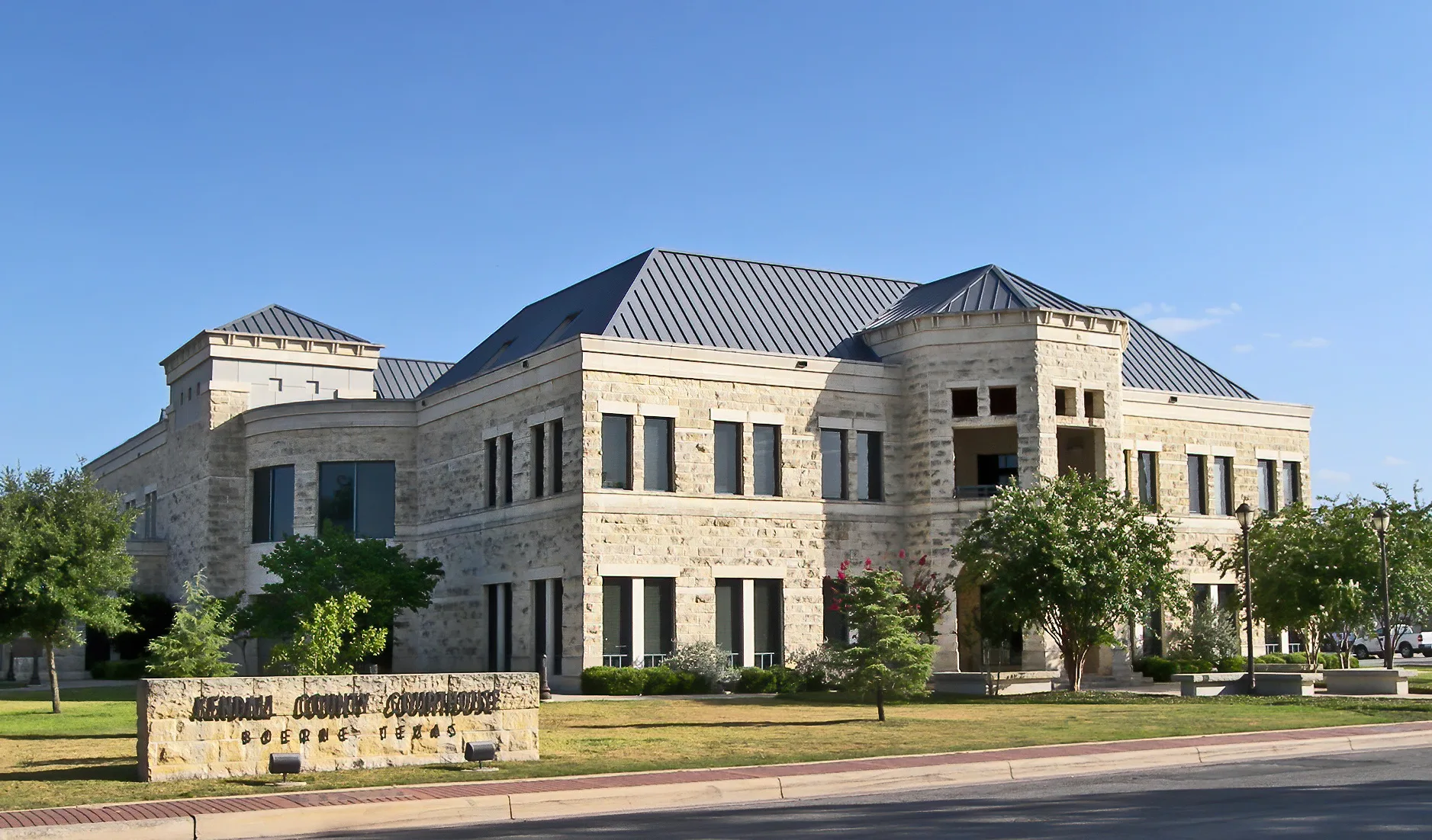
Kendall County covers about 1,717 square kilometres and has a recorded population of 44,279. It was established in 1862. Boerne is the county seat. The county lies in the Texas Hill Country west of San Antonio.

Hico is a Texas locality represented at administrative level 8. It lies in Hamilton County. The settlement is located in north-central Texas. Its map entry identifies the built-up place rather than a county government.

Longview is a city and county seat in Gregg County, Texas. Its recorded population is 81,638 and its area is about 144.5 square kilometres. The city was established in 1871. It lies in East Texas near the Sabine River.

San Marcos is the county seat of Hays County and extends into Caldwell and Guadalupe counties. Its recorded population is 67,553 and its area is about 88.7 square kilometres. The city stands at an elevation of approximately 188 metres. The San Marcos River rises in the city and flows toward the Guadalupe River.

Niederwald is a city in Caldwell and Hays counties. Its recorded population is 668 and its area is about 9.5 square kilometres. The city lies at an elevation of approximately 171 metres. It is located southeast of Austin along the corridor between Austin and San Marcos.

Bullard is a Texas locality represented at administrative level 8. It lies in Smith and Cherokee counties. The town is part of the East Texas region. Its location is south of Tyler.

New Braunfels is the seat of Comal County and extends into Guadalupe County. Its recorded population is 90,403 and its area is about 117.6 square kilometres. The city stands at an elevation of approximately 192 metres and was established in 1845. The Comal and Guadalupe rivers run through the city.

Fair Oaks Ranch is a city in Texas located in Bexar, Kendall, and Comal counties. Its recorded population is 9,833 and its area is about 25.9 square kilometres. The city stands at an elevation of approximately 387 metres. It lies in the Texas Hill Country northwest of San Antonio.

Bruceville-Eddy is a city in Texas with a recorded population of 1,413. Its area is about 8.3 square kilometres. The city stands at an elevation of approximately 211 metres. It lies in McLennan and Falls counties near Interstate 35.

Whitewright is a town in Grayson and Fannin counties. Its recorded population is 1,725 and its area is about 4.8 square kilometres. The town stands at an elevation of approximately 229 metres. It lies in North Texas near the Red River watershed.

McGregor is a Texas city represented at administrative level 8. It lies mainly in McLennan County near the boundary with Coryell County. The city is part of the Waco metropolitan area. It stands west of Waco in central Texas.

Mineral Wells is a city in Palo Pinto and Parker counties. Its recorded population is 14,820 and its area is about 54.9 square kilometres. The city stands at an elevation of approximately 269 metres and was established in 1900. It lies west of Fort Worth near Lake Mineral Wells State Park.

Royse City extends across Rockwall, Collin, and Hunt counties. Its recorded population is 13,508 and its area is about 42 square kilometres. The city stands at an elevation of approximately 169 metres and was established in 1885. It lies east of Dallas along Interstate 30.

Ovilla is a Texas city represented at administrative level 8. It lies in Ellis and Dallas counties. The city is part of the southern Dallas–Fort Worth area. Its location is southwest of Dallas near U.S. Route 67.
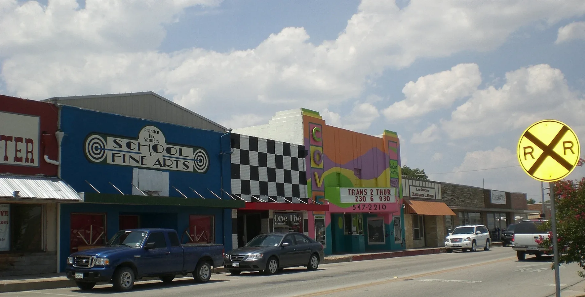
Copperas Cove is a city in central Texas with a recorded population of 36,670. Its area is about 46.7 square kilometres and its elevation is approximately 333 metres. The city was established in 1879. It lies in Coryell, Bell, and Lampasas counties near Fort Hood.

Missouri City extends across Fort Bend and Harris counties. Its recorded population is 74,259 and its area is about 78.2 square kilometres. The city stands at an elevation of approximately 24 metres. It lies southwest of Houston in the Houston metropolitan area.
League City is a city in Galveston County with a recorded population of 114,392. Its area is about 137 square kilometres and its elevation is approximately 6 metres. The city was established in 1961. It lies on the mainland shore of Galveston Bay between Houston and Galveston.

Windthorst is a Texas locality represented at administrative level 8. It lies in Archer County. The settlement is located in north-central Texas. Wichita Falls is the nearest major city.

Southlake extends across Tarrant and Denton counties. Its recorded population is 31,265 and its area is about 58.1 square kilometres. The city stands at an elevation of approximately 194 metres and was established in 1956. Dallas–Fort Worth International Airport lies southeast of the city.

Westlake is a Texas town represented at administrative level 8. It lies mainly in Tarrant County near the boundary with Denton County. The town is part of the Dallas–Fort Worth metropolitan area. It is located west of Grapevine and north of Fort Worth.

Horseshoe Bay is a city in Burnet and Llano counties. Its recorded population is 4,257 and its area is about 39.9 square kilometres. The city stands at an elevation of approximately 258 metres and was established in 2005. It is located on the shore of Lake Lyndon B. Johnson in the Texas Hill Country.

Amarillo is a city in the Texas Panhandle represented at administrative level 8. It lies in Potter and Randall counties. The city is located near the Canadian River and the southern High Plains. Palo Duro Canyon begins south of Amarillo in Randall County.

Newark is a Texas city represented at administrative level 8. It lies in Wise County northwest of Fort Worth. The city is part of the outer Dallas–Fort Worth region. Eagle Mountain Lake is located southeast of Newark.

Stamford is a Texas city represented at administrative level 8. It lies in Jones and Haskell counties. The city is located in north-central Texas. Stamford Lake lies to the northeast of the urban area.
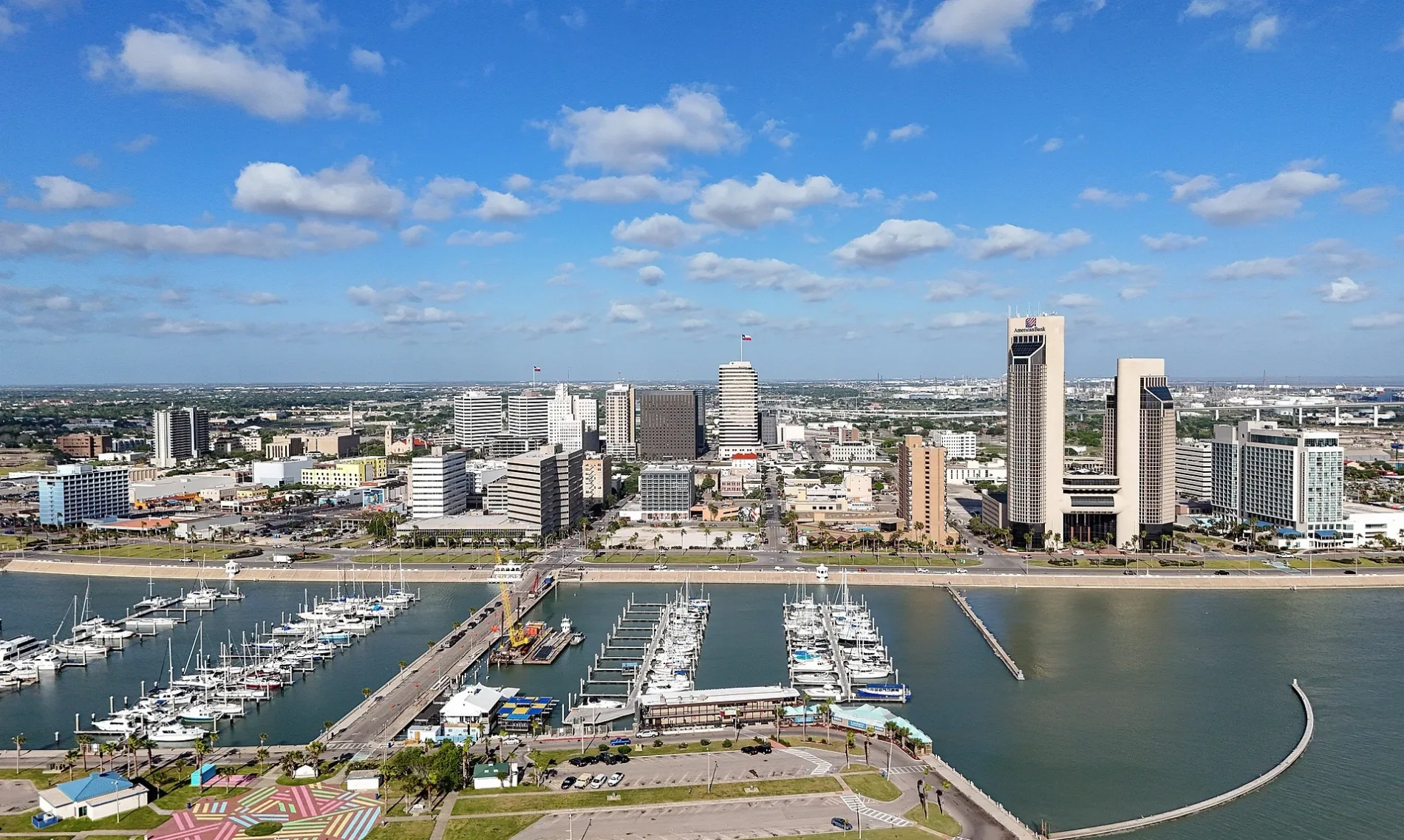
Corpus Christi is the county seat of Nueces County on the Texas Gulf Coast. Its recorded population is 317,863 and its area is about 1,304 square kilometres. The city stands at an elevation of approximately 8 metres and was established in 1839. It lies on Corpus Christi Bay near Padre Island and the Gulf of Mexico.

Montgomery County is a Texas county with a recorded population of 537,559. It lies north of Houston in the East Texas region. Conroe is the county seat. Lake Conroe and the San Jacinto River are prominent geographic features.

Harris County covers about 4,604 square kilometres and has a recorded population of 4,731,145. It was established in 1836. Houston is the county seat and the largest city in Texas. Buffalo Bayou, the Houston Ship Channel, and Galveston Bay connect the county to the Gulf Coast.

Liberty County covers about 3,046 square kilometres and has a recorded population of 91,628. It was established in 1836. Liberty is the county seat. The Trinity River forms part of the county’s western boundary before reaching Trinity Bay.

Chambers County covers about 2,258 square kilometres and has a recorded population of 46,571. It was established in 1858. Anahuac is the county seat. The county lies between Trinity Bay and Galveston Bay on the upper Texas Gulf Coast.

Friendswood is a city in Texas with a recorded population of 41,213. Its area is about 53.9 square kilometres and its elevation is approximately 9 metres. The city was established in 1960. It lies in Galveston and Harris counties south of Houston.

Fort Bend County covers about 2,282 square kilometres and has a recorded population of 822,779. It was established in 1837. Richmond is the county seat. The Brazos River crosses the county from northwest to southeast.

Galveston County covers about 2,261 square kilometres and has a recorded population of 350,682. It was established in 1838. The county seat is Galveston. Its territory includes Galveston Island, Bolivar Peninsula, and parts of Galveston Bay.

Brazoria County covers about 4,137 square kilometres and has a recorded population of 372,031. It was established in 1836. Angleton is the county seat. The Brazos River reaches the Gulf of Mexico through the county near Freeport.

Waller County is a Texas county with a recorded population of 48,656. It lies northwest of Houston. Hempstead is the county seat. The county is crossed by U.S. Highway 290 and lies near the Brazos River.

Lamar County covers about 2,415 square kilometres and has a recorded population of 50,088. It was established in 1841. Paris is the county seat. The county lies in northeast Texas near the Red River and the Oklahoma border.

Fannin County covers about 2,329 square kilometres and has a recorded population of 35,662. It was established in 1837. Bonham is the county seat. The county lies along the Red River in northeast Texas.

Grayson County covers about 2,536 square kilometres and has a recorded population of 135,543. It was established in 1846. Sherman is the county seat. The Red River forms the northern boundary with Oklahoma, and Lake Texoma lies to the northwest.

Medina County covers about 3,456 square kilometres and has a recorded population of 50,748. It was established in 1848. Hondo is the county seat. The Medina River and Medina Lake lie west of San Antonio.

Bandera County covers about 2,066 square kilometres and has a recorded population of 20,851. It was established in 1856. Bandera is the county seat. The county lies in the Texas Hill Country along the Medina River and is known as the Cowboy Capital of the World.

Wilson County covers about 2,095 square kilometres and has a recorded population of 49,753. It was established in 1860. Floresville is the county seat. The county lies southeast of San Antonio, and the San Antonio River crosses its western area.

Atascosa County is a Texas county with a recorded population of 48,435. Jourdanton is the county seat. The county lies south of San Antonio in the South Texas Plains. The Atascosa River runs through the county.

Frio County covers about 2,983 square kilometres and has a recorded population of 18,385. It was established in 1871. Pearsall is the county seat. The Frio River crosses the county before continuing toward the Nueces River basin.

Dallam County is a Texas county represented at administrative level 6. It lies in the northwestern Texas Panhandle. Dalhart is the county seat. The county borders New Mexico and Oklahoma.

Sherman County is a Texas county represented at administrative level 6. It lies in the northern Texas Panhandle. Stratford is the county seat. The county borders Oklahoma to the north.

Hansford County is a Texas county represented at administrative level 6. It lies in the northern Panhandle near the Oklahoma border. Spearman is the county seat. The Canadian River drainage shapes the surrounding High Plains landscape.

Ochiltree County covers about 2,378 square kilometres and has a recorded population of 10,015. It was established in 1889. Perryton is the county seat. The county lies in the northeastern Texas Panhandle near the Oklahoma border.

Lipscomb County covers about 2,414 square kilometres and has a recorded population of 3,059. It was established in 1887. Lipscomb is the county seat. The county lies in the northeastern Panhandle along the Oklahoma border.

Hartley County is a Texas county represented at administrative level 6. It lies in the western Texas Panhandle. Dalhart is the county seat. The county includes high plains terrain west of Amarillo.

Moore County covers about 2,356 square kilometres and has a recorded population of 21,358. It was established in 1876. Dumas is the county seat. The county lies in the northern Texas Panhandle near the Canadian River.

Hutchinson County covers about 2,318 square kilometres and has a recorded population of 20,617. It was established in 1901. Stinnett is the county seat. Borger and the Canadian River are located in the county.

Roberts County covers about 2,394 square kilometres and has a recorded population of 827. It was established in 1889. Miami is the county seat. The county lies in the eastern Texas Panhandle near the Canadian River.

Hemphill County is a Texas county represented at administrative level 6. It lies in the eastern Texas Panhandle. Canadian is the county seat. The Canadian River runs through the county.

Oldham County covers about 3,889 square kilometres and has a recorded population of 1,758. It was established in 1881. Vega is the county seat. The county lies west of Amarillo in the Texas Panhandle near the Canadian River.
Data sources: OpenStreetMap (ODbL), Wikidata (CC0) · Image: Wikimedia Commons
| Population | 29145505 |
|---|---|
| Area | 696241 km² |
| Subregions | 351 |
| Named after | friend |
| Year built | 1845 |
| Elevation | 520 m |
| Located in | United States |
| Country | United States |
| Body of water | Gulf of Mexico, Rio Grande |
| Nickname | The Lone Star State |
| Native name | Texas |
| Official name | State of Texas |
| Described by | Granat Encyclopedic Dictionary, Brockhaus and Efron Encyclopedic Dictionary, Small Brockhaus and Efron Encyclopedic Dictionary, Jewish Encyclopedia of Brockhaus and Efron, The Nuttall Encyclopædia, Encyclopædia Britannica 11th edition, 1922 Encyclopædia Britannica, The American Cyclopædia, The Catholic Encyclopedia, Collier's New Encyclopedia, 1921, The New Student's Reference Work, New International Encyclopedia, Meyer’s Universum, Siebzehnter Band, Meyer’s Universum, Achtzehnter Band |
| Part of | contiguous United States |
| Website | https://texas.gov |
Data source: Wikidata (CC0)
| Railway | |
| Bus | |
| Streetcar |
| Bike path | |
| Bike lane on roadway | |
| Cycling allowed on bus lane | |
| Bicycle street | |
| Open to cyclists | |
| Open to cyclists, good path | |
| Cycling prohibited | |
| Cobblestone |
| Long-distance bike route | (depending on scale) | |
| Long-distance bike route |
| Path |
| Long-distance hiking trail | (depending on scale) | |
| Long-distance hiking trail | ||
| Pedestrians prohibited |