
Benson Way in Sandy, Utah
Benson Way in Sandy is a residential street and it runs in a northeast-southwest direction starting from 9270 South and crosses 9230 South and ends at 110 East. Benson Way is also known as 70 East. The nearest bus stop is State Street @ 9345 South (about 350 m away).
- Road Type
- residential street
- Alternate Name
- 70 East
- Speed Limit
- 25 mph
- Route
- northeast-southwest
Image
Auto repair shops
Light rail stops
Fast food restaurants
Charging stations
Sporting goods stores
Bus stops
Artworks
Cafes
Stations
Banks
Restaurants
Streets nearby
9230 South150 ft
9270 South450 ft
Rimando WaySandy Acres
0.1 mi
State StreetState Street @ 9481 South, Schlotzsky's, State Street @ 9646 South, Crisp & Green, Mooyah, Zimbu, Wolfdog, HuHot Mongolian Grill, State St @ 8881 S, Men's Wearhouse, State Street / 10600 South (NB), The Original Pancake House, Makanmakan, Robeks, The Habit Burger Grill, The Smoked Taco, State St @ 8516 S, State St @ 8631 S, Best Home Appliance, State St @ 8718 S, State St @ 9044 S, State Street @ 9345 South, RUSH Diesel & Automotive, State Street @ 9438 South, Five Guys, Crescent, Mo'Bettahs, State St @ 8848 S, GOAT Haircuts, Vessel Kitchen, AT&T, Rita's Italian Ice, Glamour Gels, Di Napoli, State St @ 8385 S, State St @ 8999 S, State St @ 8721 S, 7-Eleven, Ascent Kitchen, State Street @ 9673 South, Chipotle, Rumbi's Island Grill, Firehouse Subs, Pei Wei, Santorini's, Libertango Steakhouse, Sport Clips, Nothing Bundt Cakes, Visionworks, Verizon, Wingstop, Which Wich?, Spavia Day Spa, State Street / 10200 South (SB), VEG Veterinary Emergency Group, Overtime Cards
0.1 mi
110 East0.1 mi
9200 South0.1 mi
Crawford Place0.1 mi
150 East0.2 mi
Porter Rockwell TrailSandy Expo, Historic Sandy, Sandy Civic Center, Sandy Civic Center Station (Bay B), Sandy Civic Center Station (Bay C), Sandy Civic Center Station (Bay D), Historic Sandy Station (Bay C), Crescent View
0.2 mi
9180 South0.2 mi
170 East0.2 mi
9400 South9400 South @ 1285 East, 9400 South @ 1365 East, 9400 South @ 1252 East, 9400 South @ 1356 East, Chevron, Smith's Fuel Center, 9400 South @ 2150 East, Hot Dog on a Stick, Ty Fish & Chips, Finwise Bank, Ski 'N See, 9400 South @ 801 East, 9400 South @ 745 East, 9400 South @ 800 East, Starbucks, McDonald's, Costa Vida, 9400 South @ 1846 East, 9400 South @ 1855 East, Platinum Dental Sandy, Massage Envy, Harper Nails Spa, Washington Square, Wendy's, 9400 S @ 2215 E, 9400 S @ 2306 E, 9400 South @ 2064 East, Walgreens, Canyon Brook Estates, 9400 South @ 1710 East, 9400 South @ 1165 East, 9400 South @ 1156 East, 9400 South @ 1108 East, Fabulous Freddy's, Mountain America Credit Union, 9400 S @ 880 E, 9400 South @ 881 East, Altabank, Plewe Orthodontics, 9400 South @ 1434 East, 9400 South @ 1820 East, 9400 South @ 1733 East, 9400 South @ 1555 East, Rancheritos, 9400 South @ 730 East, Papa Murphy's, The Bead Fairy, Synchronicities, Body Mind & Soul, Daybreak Records, KFC
0.2 mi
Tiny Wood Drive0.3 mi
9000 SouthBMW Motorcycles of Utah, 9000 S @ 732 W, 9000 S @ 487 E, 9000 S @ 603 E, 9000 S @ 492 E, 9000 S @ 138 W, So Grill Korean BBQ and Sushi, Athena VII, 9000 S @ 426 W, 9000 S @ 632 E, Starbucks, 7-Eleven, 9000 S @ 810 E, Historic Sandy Station (Bay C), Historic Sandy Station (Bay D), ChargePoint, Sandy Station Place, 9000 S @ 73 E, Endot, 9000 S @ 407 W, 9000 S @ 253 W, Subway, 9000 S @ 675 W, 9000 S @ 348 E, 9000 S @ 843 E, 9091 S @ 1098 E
0.3 mi
Corrie Circle0.3 mi
Lynn Circle0.4 mi
Monroe Plaza Way0.4 mi
Brent Circle0.4 mi
Monroe StreetMonroe Street @ 9563 South, Monroe Street @ 9562 South, Monroe St @ 8754 S, Monroe Street @ 9864 South, Monroe Blvd @ 8938 S, Monroe Street @ 9353 South, Monroe Street @ 9391 South, Monroe Street @ 9991 South, Monroe Street @ 9871 South
0.4 mi
Streatham Road0.4 mi
9240 South0.4 mi
9210 South0.4 mi
9560 South0.4 mi
Oxford Road0.5 mi
Turnpike Lane0.5 mi
Safety Lane0.5 mi
Durdham LaneWallace Heights
0.5 mi
Towne Ridge Parkway0.5 mi
Brandy Spring Lane0.6 mi
Attractions nearby
Classic Fun Center0.4 mi
Banks nearby
Bank of Utah0.2 mi
America First Credit Union0.2 mi
Buildings nearby
The Root Beer Store0.2 mi
Car dealerships nearby
Tom Nunleys Trucks0.2 mi
Computer stores nearby
PC Laptops0.3 mi
Construction sites nearby
Destruction of Crown Burger0.5 mi
Convenience stores nearby
Holiday Oil0.3 mi
Exhibition centers nearby
Mountain America Exposition Center0.4 mi
Fast food restaurants nearby
Arby's0.4 mi
Liquor stores nearby
State Liquor & Wine Store0.4 mi
Movie theaters nearby
Megaplex at Jordan Commons0.1 mi
Nightclubs nearby
Club 900.4 mi
Office buildings nearby
Workers Compensation Fund0.6 mi
Residential areas nearby
Sandee Village0.4 mi
Restaurants nearby
Sizzler0.3 mi
Retail areas nearby
Jordan Commons0.2 mi
Service buildings nearby
9400 South Substation0.2 mi
Stadiums nearby
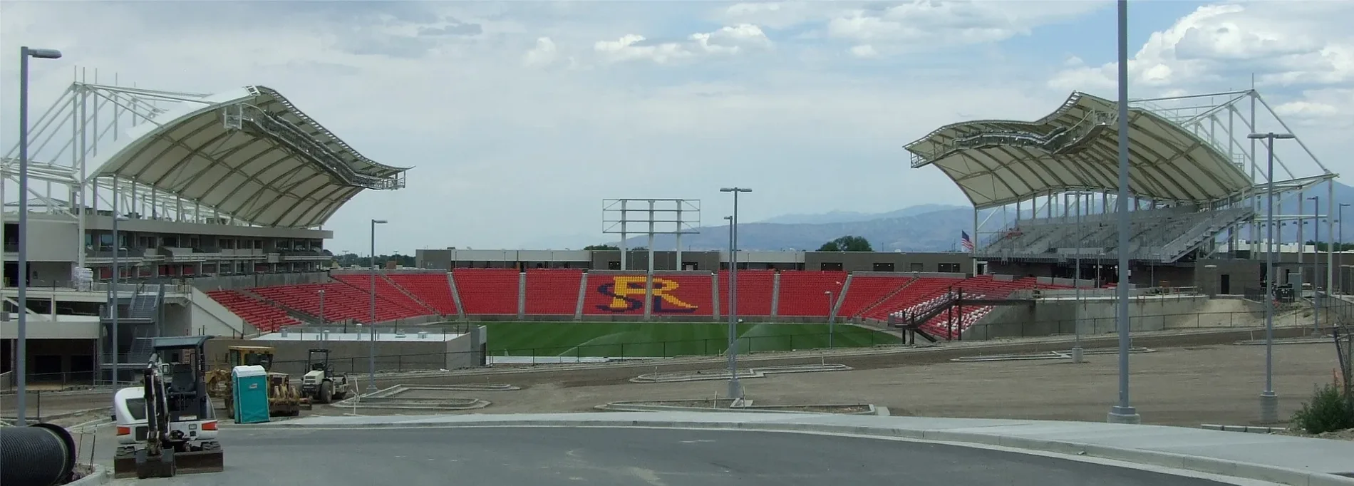
America First Field0.3 mi
Supermarkets nearby
Ocean Mart0.3 mi
Public transit map Sandy Legend
| Railway | |
| Bus | |
| Streetcar |
Bicycle map Sandy Legend
| Bike path | |
| Bike lane on roadway | |
| Cycling allowed on bus lane | |
| Bicycle street | |
| Open to cyclists | |
| Open to cyclists, good path | |
| Cycling prohibited | |
| Cobblestone |
| Long-distance bike route | (depending on scale) | |
| Long-distance bike route |
Pedestrian map Sandy Legend
| Path |
| Long-distance hiking trail | (depending on scale) | |
| Long-distance hiking trail | ||
| Pedestrians prohibited |