Washington

This City map of Washington covers the state’s streets, paths and places in the northwestern United States. Washington was admitted to the Union in 1889 and covers approximately 184,827 square kilometres. The state had 7,705,281 residents in the supplied data, compared with 6,724,540 in 2010. Its landscapes extend from the Pacific coast and Puget Sound to the Cascade Range, the Columbia River and the inland plateaus.

City map Washington
Davidwikifrog, CC BY-SA 4.0 – Wikimedia Commons

Pacific

Pacific is a Washington village with 7,235 residents and an elevation of 24 metres. Its mapped area is approximately 6,284,890 square metres. The locality lies in the state’s western lowland region, within the broader urban environment south of Seattle and near the Green River.

Bothell

Bothell is a city in King and Snohomish Counties with 48,161 residents and an elevation of 23 metres. The city was founded in 1870 and covers approximately 35,406,228 square metres in the supplied data. Bothell stands along the Sammamish River northeast of Seattle, close to Lake Washington and the University of Washington Bothell campus.

Auburn

Auburn is a King County city with 87,256 residents and an elevation of 25 metres. Its recorded area is approximately 77,397,956 square metres, and the city dates from 1891. Auburn lies in the Green River Valley between Seattle and Tacoma, with the White River forming part of the surrounding regional landscape.

Milton

Milton is a Washington city with 8,697 residents and an elevation of 93 metres. The supplied area is approximately 6,942,354 square metres. The community is located between Tacoma and the Puyallup Valley, near the eastern shore of Puget Sound.

Coulee Dam

Coulee Dam is a town in north-central Washington. It is located on the Columbia River beside the Grand Coulee Dam, one of the largest concrete dams in the United States. The dam’s reservoir, Franklin D. Roosevelt Lake, extends through the Columbia Basin.

City map Asotin County
David Dugan, CC BY-SA 3.0 – Wikimedia Commons

Asotin County

Asotin County had 22,285 residents in the supplied data and covers approximately 1,659 square kilometres. It was established in 1883 in southeastern Washington. The county seat, Asotin, lies on the Snake River opposite Lewiston, Idaho, while the Blue Mountains rise to the south.

City map Garfield County
Calvin Beale, Public domain – Wikimedia Commons

Garfield County

Garfield County is a Washington county in the southeastern Palouse region. Its county seat is Pomeroy, located west of the Snake River and near the foothills of the Blue Mountains. The county’s agricultural landscape is connected to nearby Whitman and Columbia Counties.

City map Whitman County
Jon Roanhaus, CC BY-SA 3.0 – Wikimedia Commons

Whitman County

Whitman County had 47,973 residents and covers approximately 5,641 square kilometres. It was established in 1871, with Colfax as the county seat. The county occupies a large part of the Palouse, a rolling agricultural region east of the Snake River and south of Spokane.

City map Columbia County
Williamborg, CC BY-SA 3.0 – Wikimedia Commons

Columbia County

Columbia County had 3,952 residents and an area of approximately 2,262 square kilometres. It was established in 1875, and Dayton is its county seat. The county lies along the Touchet River in southeastern Washington, close to the Blue Mountains and Walla Walla County.

City map Franklin County
Allen4names, CC BY-SA 3.0 – Wikimedia Commons

Franklin County

Franklin County had 96,749 residents and covers approximately 3,277 square kilometres. It was established in 1883, and Pasco is the county seat. Pasco stands at the confluence of the Snake and Columbia Rivers, forming part of the Tri-Cities with Kennewick and Richland.

City map Walla Walla County
Kabelleger / David Gubler ( http://www.bahnbilder.ch ), CC BY-SA 3.0 – Wikimedia Commons

Walla Walla County

Walla Walla County had 62,584 residents and covers approximately 3,364 square kilometres. It was established in 1854, and Walla Walla is the county seat. The county occupies the southeastern Palouse and the Walla Walla Valley, with the Walla Walla River flowing toward the Columbia River.

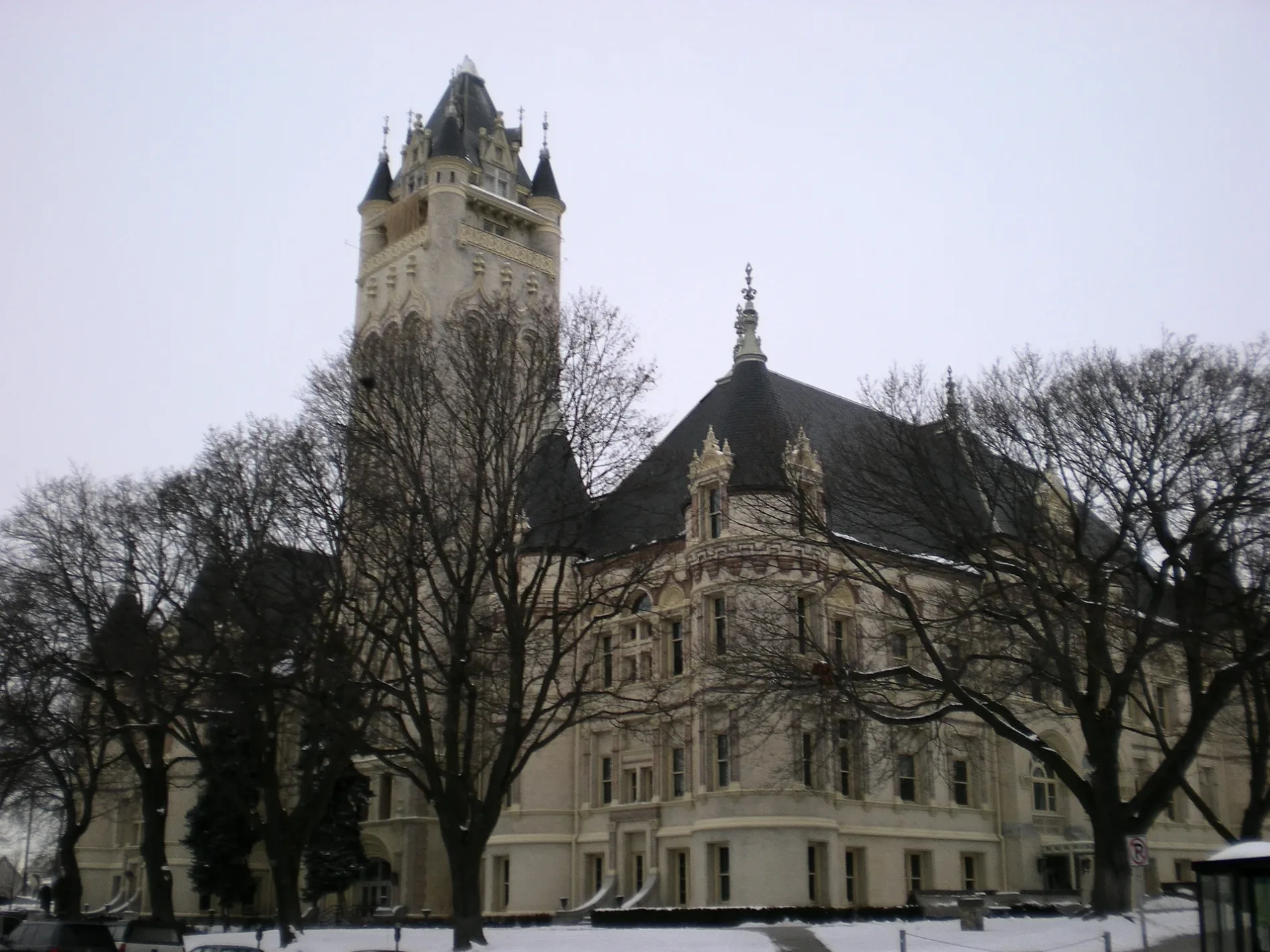
City map Spokane County
Murderbike, Public domain – Wikimedia Commons

Spokane County

Spokane County had 539,339 residents and covers approximately 4,612 square kilometres. It was established in 1858, and Spokane is the county seat and the largest city in eastern Washington. The Spokane River runs through the city before joining the Columbia River at Lake Roosevelt.

City map Pend Oreille County
Kirk Bailey, CC BY-SA 3.0 – Wikimedia Commons

Pend Oreille County

Pend Oreille County lies in northeastern Washington along the Pend Oreille River. Newport is the county seat, and the river flows north from Lake Pend Oreille toward the Columbia River. The county includes forested terrain near the Selkirk Mountains and the Idaho border.

City map Stevens County
Myotus, CC BY-SA 4.0 – Wikimedia Commons

Stevens County

Stevens County had 43,791 residents in the supplied data. Colville is the county seat, and the county extends across northeastern Washington between the Columbia River and the Selkirk Mountains. Lake Roosevelt borders part of the county along the Columbia River.

City map Benton County
Nyttend, Public domain – Wikimedia Commons

Benton County

Benton County had 206,873 residents and covers approximately 4,558 square kilometres. It was established in 1905, and Prosser is the county seat. The county includes Richland and Kennewick on the Columbia River, as well as dry agricultural and vineyard areas of the Columbia Basin.

City map Klickitat County
A. Balet, CC BY 3.0 – Wikimedia Commons

Klickitat County

Klickitat County had 21,026 residents in the supplied data. Goldendale is the county seat, and the county stretches along the north bank of the Columbia River opposite Oregon. The eastern Columbia River Gorge and the southern slopes of Mount Adams are major geographic features.

City map Ferry County
Rocky Raybell from Keller, Ferry County, Washington, USA, CC BY 2.0 – Wikimedia Commons

Ferry County

Ferry County had 7,178 residents and covers approximately 5,847 square kilometres. It was established in 1899, with Republic as its county seat. The county lies between the Columbia River and the Kettle River in the mountainous northeastern interior of Washington.

City map Lincoln County
Publichall, CC BY-SA 3.0 – Wikimedia Commons

Lincoln County

Lincoln County had 10,876 residents and covers approximately 6,060 square kilometres. It was established in 1883, and Davenport is the county seat. The county is situated on the Columbia Plateau west of Spokane, with the Columbia River forming much of its northern boundary.

City map Okanogan County
Joe Mabel, CC BY-SA 3.0 – Wikimedia Commons

Okanogan County

Okanogan County had 42,104 residents and covers approximately 13,766 square kilometres, making it the largest Washington county by area in the supplied data. It was established in 1888, and Okanogan is the county seat. The county includes the Okanogan River valley, the eastern Cascades and parts of the North Cascades region.

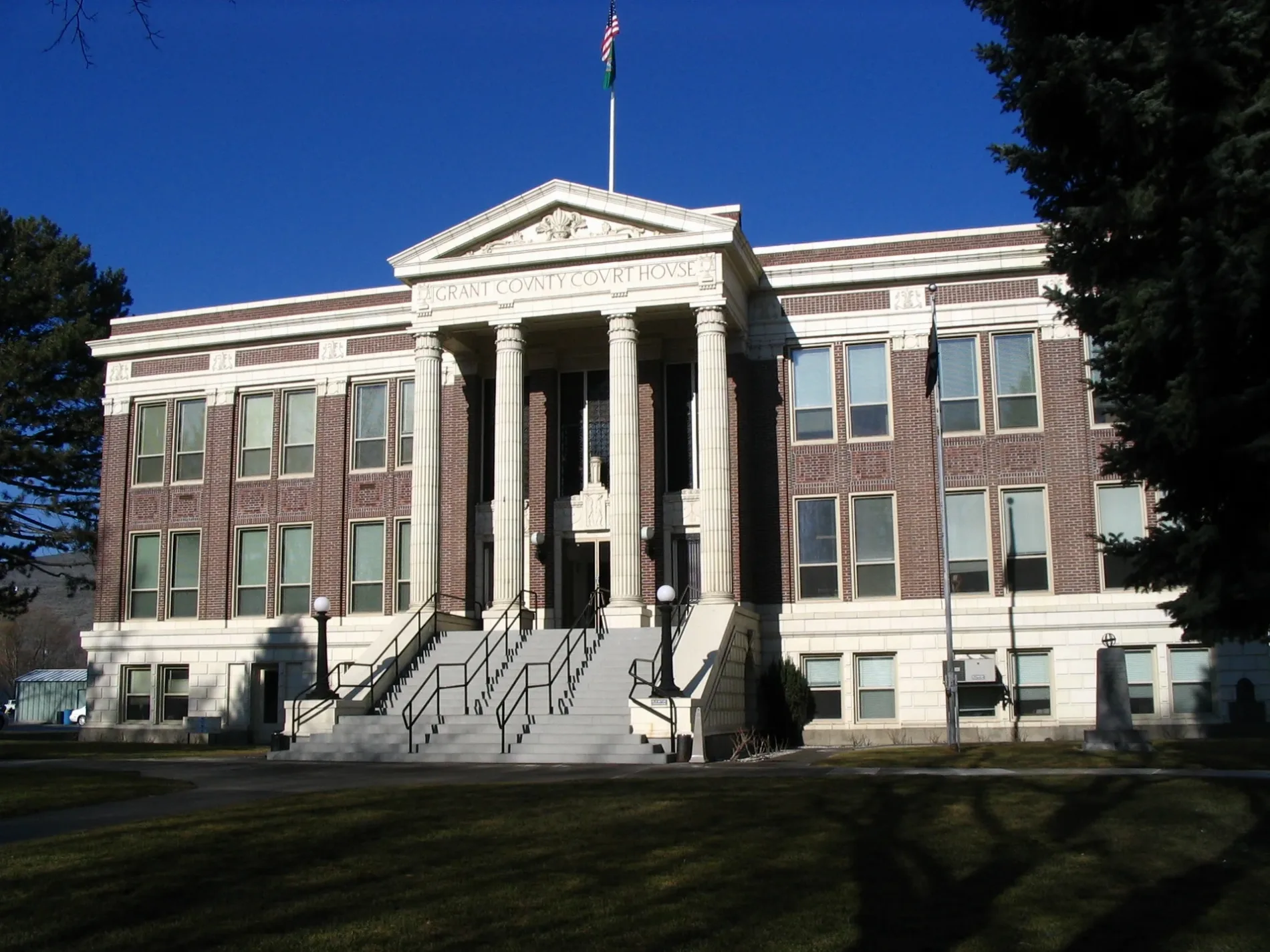
City map Grant County
Publichall, CC BY-SA 3.0 – Wikimedia Commons

Grant County

Grant County had 99,123 residents and covers approximately 7,229 square kilometres. It was established in 1909, and Ephrata is the county seat. The county occupies the Columbia Basin, where the Columbia River, irrigation canals and the Grand Coulee define major geographic features.

City map Adams County
Joe Mabel, CC BY-SA 3.0 – Wikimedia Commons

Adams County

Adams County had 20,613 residents and covers approximately 4,998 square kilometres. It was established in 1883, and Ritzville is the county seat. The county lies in the dry wheat-growing Palouse and Columbia Plateau east of the Columbia River.

City map Yakima County
Steven Pavlov, CC BY-SA 3.0 – Wikimedia Commons

Yakima County

Yakima County had 256,728 residents and covers approximately 11,168 square kilometres. It was established in 1865, and Yakima is the county seat. The county includes the fertile Yakima Valley, the Yakima River and high mountain areas around Mount Adams and the Cascade Range.

City map Skamania County
Capella Space, CC BY 4.0 – Wikimedia Commons

Skamania County

Skamania County had 12,036 residents and covers approximately 4,361 square kilometres. It was established in 1854, and Stevenson is the county seat. The county follows the north side of the Columbia River Gorge and includes Mount St. Helens and extensive parts of the Gifford Pinchot National Forest.

City map Clark County
Umbra Lab, Inc., CC BY 4.0 – Wikimedia Commons

Clark County

Clark County had 503,311 residents and covers approximately 1,700 square kilometres. It was established in 1845, and Vancouver is the county seat on the north bank of the Columbia River opposite Portland, Oregon. The county extends from the river lowlands toward the foothills of the Cascade Range.

City map Cowlitz County
Unknown author Unknown author, Public domain – Wikimedia Commons

Cowlitz County

Cowlitz County had 110,730 residents and covers approximately 3,021 square kilometres. It was established in 1854, and Kelso is the county seat. The Cowlitz River joins the Columbia River near Longview, while Mount St. Helens rises east of the county.

City map Lewis County
Dougtone, CC BY-SA 2.0 – Wikimedia Commons

Lewis County

Lewis County had 82,149 residents and covers approximately 6,310 square kilometres. It was established in 1845, and Chehalis is the county seat. The county includes the upper Chehalis River basin, the Nisqually River headwaters and the eastern slopes of Mount Rainier.

City map Kittitas County
Washington Our Home, CC BY-SA 4.0 – Wikimedia Commons

Kittitas County

Kittitas County had 44,337 residents and covers approximately 6,043 square kilometres. It was established in 1883, and Ellensburg is the county seat. The county stretches from the Kittitas Valley and Yakima River to the crest of the Cascade Range, including Snoqualmie Pass.

City map King County
Umbra Lab, Inc., CC BY 4.0 – Wikimedia Commons

King County

King County had 2,269,675 residents and covers approximately 5,974 square kilometres. It was established in 1852, and Seattle is the county seat and the largest city in Washington. The county includes Lake Washington, Puget Sound, the Snoqualmie Valley and the alpine crest of the Cascades.

City map Pierce County
Umbra Lab, Inc., CC BY 4.0 – Wikimedia Commons

Pierce County

Pierce County had 921,130 residents and covers approximately 4,679 square kilometres. It was established in 1852, and Tacoma is the county seat on Puget Sound. Mount Rainier, at 4,392 metres, dominates the county’s eastern skyline and lies within Mount Rainier National Park.

City map Wahkiakum County
U.S. Navy, Public domain – Wikimedia Commons

Wahkiakum County

Wahkiakum County had 4,422 residents and covers approximately 743 square kilometres. It was established in 1854, and Cathlamet is the county seat. The county lies along the lower Columbia River, with islands, tidal channels and the river boundary with Oregon.

City map Pacific County
Frank La Roche (1853-1936), Public domain – Wikimedia Commons

Pacific County

Pacific County had 20,848 residents in the supplied data. South Bend is the county seat, and the county occupies the Pacific coast and the northern shore of Willapa Bay. Long Beach Peninsula separates the open Pacific Ocean from Willapa Bay, one of Washington’s major coastal estuaries.

City map Grays Harbor County
Joe Mabel, CC BY-SA 3.0 – Wikimedia Commons

Grays Harbor County

Grays Harbor County had 71,122 residents in the supplied data. The county seat is Montesano, while Aberdeen and Hoquiam lie near the mouth of the Chehalis River. Its landscape includes Grays Harbor, the Pacific coast and large forested areas on the western Olympic Peninsula.

City map Thurston County
OceanLoop, CC BY-SA 4.0 – Wikimedia Commons

Thurston County

Thurston County had 299,496 residents, and Olympia is its county seat and the capital of Washington. The county lies at the southern end of Puget Sound, with Budd Inlet and Capitol Lake beside Olympia. The Deschutes River flows through the capital area toward Puget Sound.

City map Chelan County
Capella Space, CC BY 4.0 – Wikimedia Commons

Chelan County

Chelan County had 79,074 residents and covers approximately 7,754 square kilometres. It was established in 1899, and Wenatchee is the county seat. The county contains Lake Chelan, the Columbia River and steep Cascade landscapes, including access to the North Cascades.

City map Douglas County
Williamborg ( talk ) 02:04, 16 June 2008 (UTC), Public domain – Wikimedia Commons

Douglas County

Douglas County had 40,534 residents in the supplied data. Waterville is the county seat, and the county extends across the Columbia Plateau north of the Columbia River. The Columbia forms a major boundary and supports the cities of East Wenatchee and Wenatchee on opposite sides of the river.

City map Mason County
Nyttend, Public domain – Wikimedia Commons

Mason County

Mason County had 65,726 residents and covers approximately 2,722 square kilometres. It was established in 1854, and Shelton is the county seat. The county includes the southern Olympic Peninsula, Hood Canal and the forested drainage of the Skokomish River.

City map Kitsap County
Unknown author Unknown author or not provided, Public domain – Wikimedia Commons

Kitsap County

Kitsap County had 275,611 residents and covers approximately 1,466 square kilometres. It was established in 1857, and Port Orchard is the county seat. The county occupies the Kitsap Peninsula between Puget Sound and Hood Canal, with Bremerton as a major naval city.

City map Jefferson County
HABS, Public domain – Wikimedia Commons

Jefferson County

Jefferson County had 32,977 residents and covers approximately 5,655 square kilometres. It was established in 1852, and Port Townsend is the county seat. The county includes the northeastern Olympic Peninsula, the Strait of Juan de Fuca, Hood Canal and portions of Olympic National Park.

City map Whatcom County
Umbra Lab, Inc., CC BY 4.0 – Wikimedia Commons

Whatcom County

Whatcom County had 226,847 residents and covers approximately 6,485 square kilometres. It was established in 1854, and Bellingham is the county seat on Bellingham Bay. The county reaches from the Salish Sea to Mount Baker and includes the Nooksack River valley along the Canadian border.

City map Skagit County
Umbra Lab, Inc., CC BY 4.0 – Wikimedia Commons

Skagit County

Skagit County had 129,523 residents and covers approximately 4,974 square kilometres. It was established in 1883, and Mount Vernon is the county seat. The Skagit River flows through the fertile Skagit Valley before reaching Skagit Bay, while the North Cascades rise to the east.

City map Snohomish County
Lee Pickett, Public domain – Wikimedia Commons

Snohomish County

Snohomish County had 827,957 residents and covers approximately 5,689 square kilometres. It was established in 1861, and Everett is the county seat on Possession Sound. The county includes the Snohomish and Stillaguamish River valleys, Lake Stevens and the western Cascade foothills.

City map Clallam County
Adbar, CC BY-SA 3.0 – Wikimedia Commons

Clallam County

Clallam County had 77,155 residents and covers approximately 6,917 square kilometres. It was established in 1854, and Port Angeles is the county seat on the Strait of Juan de Fuca. The county includes the northern Olympic Peninsula and large areas of Olympic National Park, including Hurricane Ridge.

City map San Juan County
Umbra Lab, Inc., CC BY 4.0 – Wikimedia Commons

San Juan County

San Juan County had 17,788 residents and covers approximately 1,609 square kilometres. It was established in 1873, and Friday Harbor is the county seat on San Juan Island. The county consists of islands in the Salish Sea between Washington and Vancouver Island, Canada.

City map Island County
Jengod, CC BY-SA 4.0 – Wikimedia Commons

Island County

Island County had 80,593 residents in the supplied data. It includes Whidbey Island and Camano Island in Puget Sound, with Coupeville as the county seat. Whidbey Island extends between the Strait of Juan de Fuca and Puget Sound, while Deception Pass separates it from Fidalgo Island.

Data sources: OpenStreetMap (ODbL), Wikidata (CC0) · Image: Wikimedia Commons

Washington – Facts

Population 7705281
Area 184827 km²
Subregions 39
Named after George Washington
Year built 1889
Elevation 520 m
Located in United States
Country United States
Body of water Pacific Ocean, Columbia River, Strait of Georgia, Haro Strait, Strait of Juan de Fuca
Nickname The Evergreen State
Native name Washington
Official name State of Washington
Described by Armenian Soviet Encyclopedia, Brockhaus and Efron Encyclopedic Dictionary, Jewish Encyclopedia of Brockhaus and Efron, Small Brockhaus and Efron Encyclopedic Dictionary, Otto's encyclopedia, The Nuttall Encyclopædia, 1922 Encyclopædia Britannica, Encyclopædia Britannica 11th edition, Collier's New Encyclopedia, 1921, New International Encyclopedia, Granat Encyclopedic Dictionary
Location Pacific Northwest, Pacific States Region
Part of contiguous United States
Website https://wa.gov/

Data source: Wikidata (CC0)