
West Virginia

West Virginia
This City map of West Virginia shows streets, paths and places across the state in the United States. West Virginia covers about 62,755 square kilometres and had 1,793,716 residents in 2020, down from 1,852,994 in 2010. The state was founded in 1863 and extends through the Appalachian Mountains, with Charleston on the Kanawha River as its capital. The map includes 60 administrative subregions, from counties such as Kanawha and Berkeley to cities such as Weirton and Nitro.
Montgomery

Montgomery is an administrative level 8 locality in West Virginia. The town lies along the Kanawha River in the central part of the state, within the Appalachian Plateau region.
Montgomery is associated with Fayette County and the New River Valley area. Its location connects the river corridor with nearby communities such as Smithers and Glenville.
To the mapWeirton

Weirton is a West Virginia city with 19,163 residents and an elevation of 230 metres in the supplied map data. Its built-up area extends along the Ohio River in the Northern Panhandle, directly beside Ohio and Pennsylvania.
The city was incorporated in 1947 and covers about 49,912,356 square metres. Weirton belongs to the industrial Ohio Valley, with Pittsburgh located to the east across the Pennsylvania border.
To the mapPaden City

Paden City is an administrative level 8 locality in West Virginia. It stands in the northern part of the state along the Ohio River, close to the boundary between Wetzel and Tyler counties.
The town is part of the Ohio Valley settlement corridor. Nearby communities include New Martinsville and Sistersville, both located along the river in northern West Virginia.
To the mapAlderson

Alderson is an administrative level 8 locality in West Virginia. The town lies on the Greenbrier River at the boundary of Greenbrier and Monroe counties in the southeastern part of the state.
Alderson is connected with the Greenbrier Valley and is located near the Appalachian ridges of southern West Virginia. The Greenbrier River flows northward through the town before joining the New River.
To the mapNitro

Nitro is a city in Putnam County, West Virginia, with 6,624 residents and an elevation of 181 metres. It lies along the Kanawha River between Charleston and the Ohio River in the western central part of the state.
The city covers about 15,073,694 square metres. Nitro was developed during World War I as an explosives-production site, and its position on the Kanawha corridor remains closely linked to the valley’s industrial history.
To the mapMineral County

Mineral County had 26,938 residents and covers about 852 square kilometres. It was created in 1866 from territory formerly belonging to Hampshire County.
The county lies in northeastern West Virginia along the Potomac River and includes Keyser, its county seat. The Allegheny Front and New Creek Mountain define major parts of the county’s Appalachian landscape.
To the mapBerkeley County

Berkeley County had 122,076 residents and an area of about 833 square kilometres. Established in 1772, it is situated in the Eastern Panhandle of West Virginia.
Martinsburg is the county seat and the largest city in Berkeley County. The county occupies the Shenandoah Valley between North Mountain and the Potomac River, with Interstate 81 crossing its main urban corridor.
To the mapJefferson County

Jefferson County had 57,701 residents and covers about 548 square kilometres. It was established in 1801 at the eastern tip of West Virginia, where the Shenandoah and Potomac valleys meet.
Charles Town is the county seat, while Harpers Ferry lies at the confluence of the Potomac and Shenandoah rivers. Harpers Ferry National Historical Park preserves sites associated with John Brown’s 1859 raid.
To the mapHampshire County

Hampshire County had 23,093 residents and an area of about 1,670 square kilometres. Founded in 1754, it is West Virginia’s oldest county and lies in the state’s Eastern Panhandle region.
Romney is the county seat and stands in the South Branch Potomac River valley. The county includes long ridges of the Allegheny Mountains and borders Maryland to the northeast.
To the mapMorgan County

Morgan County had 17,524 residents in the supplied data. The county occupies the northern Eastern Panhandle along Sleepy Creek and the Potomac River.
Berkeley Springs is the county seat and is known for its historic mineral springs. Cacapon Mountain and Sleepy Creek Mountain form prominent ridges west of the Potomac Valley.
To the mapGrant County

Grant County is an administrative level 6 county in eastern West Virginia. Petersburg is the county seat, located in the South Branch Potomac River valley.
The county includes portions of the Allegheny Mountains and borders Maryland to the east. Major nearby landscapes include North Fork Mountain and the South Branch of the Potomac.
To the mapPreston County

Preston County had 34,216 residents, covers about 1,687 square kilometres and has a recorded elevation of 526 metres. It was established in 1818 in the northern Allegheny region.
Kingwood is the county seat, and the Cheat River runs through the county toward the Cheat Canyon. Coopers Rock State Forest lies near the western edge above the Cheat River gorge.
To the mapBrooke County

Brooke County had 22,559 residents and covers about 239 square kilometres. Established in 1796, it occupies a narrow section of West Virginia’s Northern Panhandle.
Wellsburg is the county seat, while the Ohio River forms the county’s western boundary. The county lies between Hancock County to the north and Ohio County to the south, with Pennsylvania immediately east.
To the mapHancock County

Hancock County had 29,095 residents and an area of about 229 square kilometres. Created in 1848, it is the northernmost county in West Virginia.
New Cumberland is the county seat, and the Ohio River borders the county on the west. The Northern Panhandle continues south through Brooke County, while Pennsylvania surrounds the county on its northern and eastern sides.
To the mapMarshall County

Marshall County had 30,591 residents and covers about 809 square kilometres. It was established in 1835 in the Northern Panhandle along the Ohio River.
Moundsville is the county seat and is known for the West Virginia Penitentiary, a major nineteenth-century Gothic Revival complex. The Ohio River separates Marshall County from Ohio on its western side.
To the mapOhio County

Ohio County had 42,425 residents and covers about 282 square kilometres. Established in 1776, it occupies the central section of West Virginia’s Northern Panhandle.
Wheeling is the county seat and lies on the Ohio River, where Interstate 70 crosses the state. Wheeling served as a Unionist political centre during the creation of West Virginia in 1863.
To the mapHarrison County

Harrison County had 65,921 residents and covers about 1,079 square kilometres. It was established in 1784 in north-central West Virginia.
Clarksburg is the county seat and lies along the West Fork River. The county includes the city of Bridgeport and forms part of the Interstate 79 corridor between Morgantown and Charleston.
To the mapMarion County

Marion County had 56,205 residents and an area of about 807 square kilometres. Founded in 1842, it occupies a central position in northern West Virginia.
Fairmont is the county seat at the meeting of the Monongahela and West Fork rivers. The city’s river valleys connect Marion County with Monongalia County to the north and Harrison County to the south.
To the mapMonongalia County

Monongalia County had 105,822 residents and covers about 948 square kilometres. Established in 1776, it is one of the most populous counties in northern West Virginia.
Morgantown is the county seat and home to West Virginia University. The Monongahela River passes through the county, which borders Pennsylvania to the north and east.
To the mapTaylor County

Taylor County had 16,705 residents, covers about 455 square kilometres and has a recorded elevation of 332 metres. It was established in 1844 in north-central West Virginia.
Grafton is the county seat and lies at the confluence of the Tygart Valley River and the Three Fork Creek. The Baltimore and Ohio Railroad historically made Grafton an important rail junction.
To the mapTucker County

Tucker County had 6,762 residents, covers about 1,091 square kilometres and has a recorded elevation of 974 metres. Founded in 1856, it occupies a high section of the Allegheny Mountains.
Parsons is the county seat, while the Cheat River and Blackwater River drain the county. Blackwater Falls State Park protects the Blackwater River and its 19-metre waterfall near Davis.
To the mapWetzel County

Wetzel County had 15,816 residents in the supplied data. It lies in northern West Virginia along the Ohio River, between Marshall County and Tyler County.
New Martinsville is the county seat and occupies a broad bend of the Ohio River. The county’s eastern interior is marked by the rolling ridges of the Appalachian Plateau.
To the mapTyler County

Tyler County is an administrative level 6 county in northern West Virginia. Middlebourne is the county seat, located east of the Ohio River.
The Ohio River forms the county’s western boundary and separates Tyler County from Ohio. Sistersville is a notable river town in the northern part of the county, near the border with Wetzel County.
To the mapBraxton County

Braxton County had 12,447 residents and covers about 1,337 square kilometres. It was established in 1836 in central West Virginia.
Sutton is the county seat and lies near the Elk River and Sutton Lake. The county is crossed by Interstate 79, which links the central Appalachian communities of Clarksburg and Charleston.
To the mapCabell County

Cabell County had 94,350 residents and covers about 746 square kilometres. Founded in 1809, it occupies the western edge of West Virginia along the Ohio River.
Huntington is the county seat and the largest city in western West Virginia. The Ohio River, Guyandotte River and Interstate 64 define major transport and settlement corridors in the county.
To the mapCalhoun County
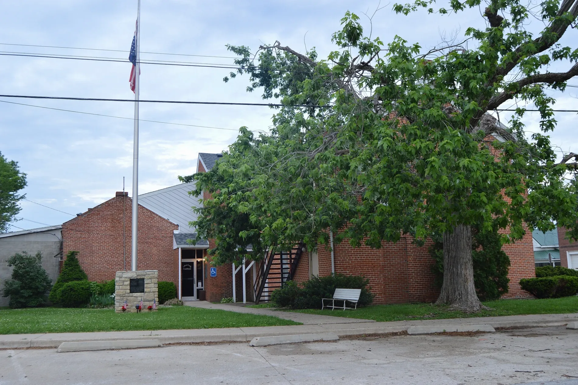
Calhoun County had 6,229 residents and covers about 727 square kilometres. It was established in 1856 in the northwestern central part of West Virginia.
Grantsville is the county seat, situated near the Little Kanawha River. The county’s wooded Appalachian Plateau includes the watershed of the West Fork Little Kanawha River.
To the mapClay County

Clay County is an administrative level 6 county in central West Virginia. Clay is the county seat and lies on the Elk River.
The county is positioned between the Kanawha and Little Kanawha watersheds. The Elk River valley connects Clay County with Braxton County to the northeast and Kanawha County to the southwest.
To the mapDoddridge County

Doddridge County is an administrative level 6 county in north-central West Virginia. West Union is the county seat and stands near the Middle Island Creek watershed.
The county lies between Harrison, Tyler, Ritchie and Lewis counties. Its landscape belongs to the Appalachian Plateau, with narrow valleys and wooded ridges around Middle Island Creek.
To the mapFayette County
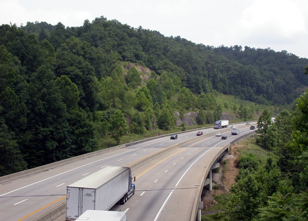
Fayette County had 40,488 residents and covers about 1,731 square kilometres. Established in 1831, it lies in southern West Virginia between the New River and the Kanawha Valley.
Fayetteville is the county seat, and New River Gorge National Park and Preserve occupies much of the county’s eastern side. The New River Gorge Bridge near Fayetteville is one of West Virginia’s best-known engineering landmarks.
To the mapGilmer County
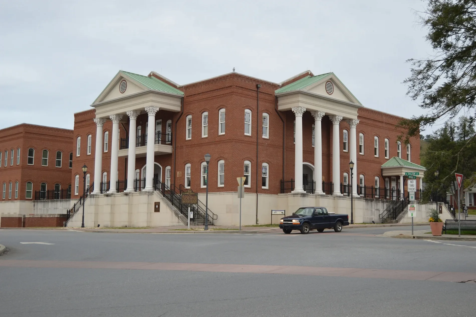
Gilmer County had 7,408 residents and covers about 881 square kilometres. It was founded in 1845 in central West Virginia.
Glenville is the county seat and lies along the Little Kanawha River. The river flows westward through the county toward Parkersburg and the Ohio River.
To the mapJackson County

Jackson County had 27,791 residents and covers about 1,206 square kilometres. Established in 1831, it lies in western West Virginia between the Ohio River and the Appalachian interior.
Ripley is the county seat, while Ravenswood stands on the Ohio River in the northern part of the county. The county also includes portions of the Little Kanawha and Sandy Creek watersheds.
To the mapKanawha County

Kanawha County had 180,745 residents and covers about 2,359 square kilometres. Created in 1788, it is West Virginia’s most populous county in the supplied data.
Charleston is the county seat and the state capital, located where the Elk River meets the Kanawha River. The county includes the Kanawha Valley industrial corridor and the cities of South Charleston and St. Albans.
To the mapLewis County

Lewis County had 17,033 residents and covers about 1,009 square kilometres. It was established in 1816 in north-central West Virginia.
Weston is the county seat and lies along the West Fork River. The Trans-Allegheny Lunatic Asylum, completed in the nineteenth century in Weston, is a prominent historic building in the county.
To the mapMason County

Mason County had 25,453 residents and covers about 1,152 square kilometres. Founded in 1804, it occupies the western tip of West Virginia along the Ohio River.
Point Pleasant is the county seat at the confluence of the Ohio and Kanawha rivers. The Battle of Point Pleasant took place there in 1774 during Dunmore’s War.
To the mapMingo County

Mingo County had 23,568 residents and covers about 1,097 square kilometres. It was created in 1895 in the southwestern coalfield region of West Virginia.
Williamson is the county seat on the Tug Fork, a tributary of the Big Sandy River. The county borders Kentucky and includes steep valleys associated with the southern Appalachian coalfields.
To the mapNicholas County

Nicholas County had 24,604 residents, covers about 1,695 square kilometres and has a recorded elevation of 606 metres. It was established in 1818 in central West Virginia.
Summersville is the county seat and lies near the Gauley River. Summersville Lake, West Virginia’s largest lake by surface area, occupies the Gauley River north of the town.
To the mapPleasants County

Pleasants County had 7,653 residents, covers about 349 square kilometres and has a recorded elevation of 316 metres. Founded in 1851, it is one of the smallest counties in northern West Virginia by area.
St. Marys is the county seat and stands along the Ohio River. The county is bordered by Tyler County to the north and Wood County to the south, within the Ohio Valley.
To the mapPutnam County

Putnam County had 57,440 residents and covers about 908 square kilometres. It was established in 1818 in the western central part of West Virginia.
Winfield is the county seat, while Hurricane and Teays Valley form a major settlement corridor along Interstate 64. The Kanawha River borders the county near its eastern end.
To the mapRandolph County

Randolph County had 27,932 residents, covers about 2,693 square kilometres and has a recorded elevation of 692 metres. Established in 1786, it is one of the largest counties in eastern West Virginia.
Elkins is the county seat in the Tygart Valley. The county contains sections of the Monongahela National Forest and lies near the headwaters of the Tygart Valley River and Cheat River.
To the mapRitchie County

Ritchie County had 8,444 residents, covers about 1,175 square kilometres and has a recorded elevation of 316 metres. It was established in 1843 in northwestern West Virginia.
Harrisville is the county seat, and the North Fork Hughes River drains much of the county. Ritchie County lies between the Little Kanawha River basin and the Middle Island Creek watershed.
To the mapRoane County
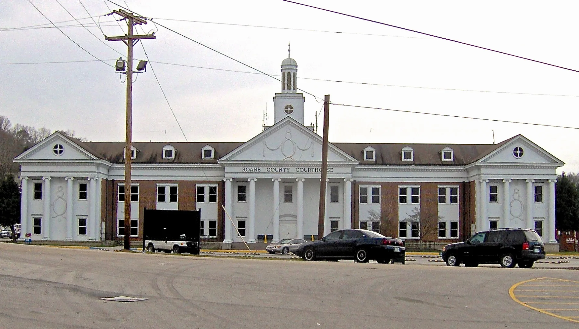
Roane County had 14,435 residents in the supplied data. Spencer is the county seat and lies in the central West Virginia hills.
The county is drained by the Little Kanawha River and its tributaries. Roane County borders Calhoun, Gilmer, Jackson, Kanawha, Clay and Wirt counties.
To the mapUpshur County

Upshur County had 23,816 residents and covers about 919 square kilometres. It was established in 1851 in north-central West Virginia.
Buckhannon is the county seat and lies along the Buckhannon River. The city is located near the West Virginia Wesleyan College campus and the headwaters of the Tygart Valley River system.
To the mapWayne County

Wayne County had 38,982 residents and was established in 1842 in western West Virginia. The county borders Ohio along the Ohio River and Kentucky along the Big Sandy River.
Wayne is the county seat, while Huntington occupies the northern end of the county’s urban region. The Twelvepole Creek valley extends through the interior toward the Ohio River.
To the mapWirt County

Wirt County is an administrative level 6 county in northwestern West Virginia. Elizabeth is the county seat and lies on the Little Kanawha River.
The county is bordered by Wood, Ritchie, Calhoun and Jackson counties. Its terrain consists of Appalachian Plateau ridges and valleys within the Little Kanawha drainage basin.
To the mapWood County

Wood County had 84,296 residents and was established in 1798 in the Ohio Valley. It covers the area around Parkersburg, the county seat and a major city in northwestern West Virginia.
Parkersburg stands where the Little Kanawha River meets the Ohio River. The county’s river location connects West Virginia with Marietta in Ohio and the central Little Kanawha Valley.
To the mapBoone County
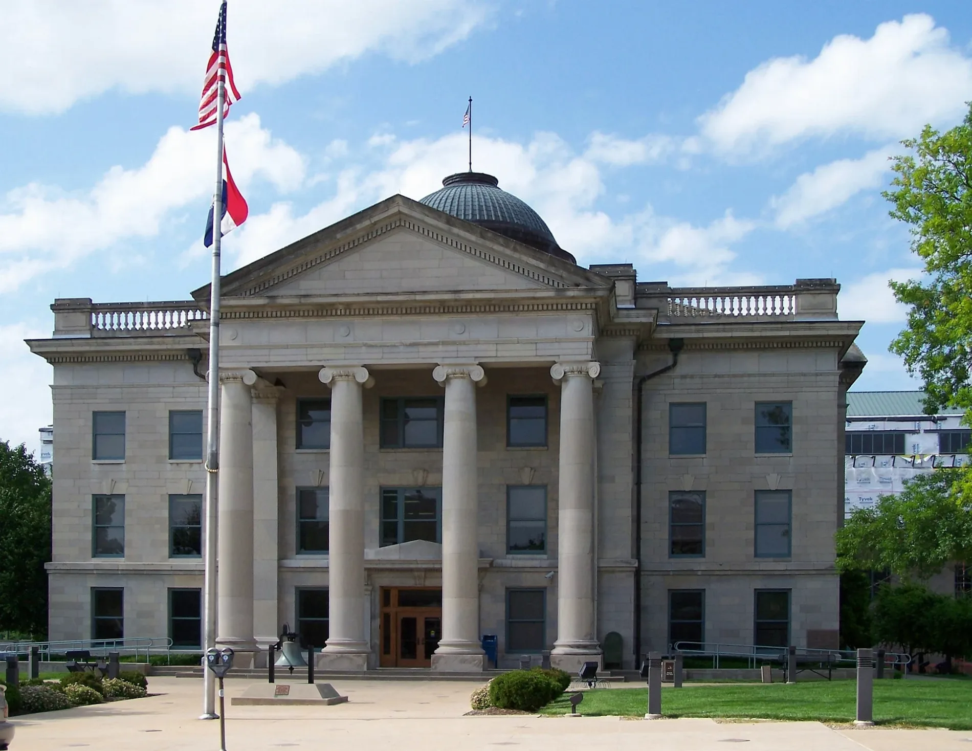
Boone County had 21,809 residents and covers about 1,303 square kilometres. Founded in 1847, it lies in the southern West Virginia coalfield region.
Madison is the county seat and is located along the Little Coal River. The county’s ridges and narrow valleys extend between Kanawha, Lincoln, Logan, Lincoln and Raleigh counties.
To the mapGreenbrier County

Greenbrier County had 35,516 residents in the supplied data. Lewisburg is the county seat, situated in the Greenbrier Valley of southeastern West Virginia.
The Greenbrier River flows through the county, while the Allegheny Mountains rise to the east. The Greenbrier resort complex and the Greenbrier River Trail are notable named features of the region.
To the mapHardy County

Hardy County had 14,299 residents and covers about 1,514 square kilometres. Established in 1785, it lies in the South Branch Potomac Valley of eastern West Virginia.
Moorefield is the county seat at the confluence of the South Branch Potomac River and South Fork South Branch Potomac River. The county is surrounded by Allegheny ridges, including South Branch Mountain.
To the mapLincoln County

Lincoln County had 20,463 residents and covers about 1,136 square kilometres. It was established in 1867 in western West Virginia, four years after the state was founded.
Hamlin is the county seat, and the Guyandotte River flows through the county. Lincoln County lies between the Ohio Valley and the coalfield counties of southern West Virginia.
To the mapLogan County

Logan County is an administrative level 6 county in southwestern West Virginia. Logan is the county seat and lies along the Guyandotte River.
The county is part of the southern Appalachian coalfield region and borders Kentucky. Buffalo Creek and Island Creek are among the named waterways shaping its narrow mountain valleys.
To the mapMcDowell County

McDowell County had 19,111 residents and covers about 1,385 square kilometres. Founded in 1858, it occupies the southernmost part of West Virginia along the Virginia and Kentucky borders.
Welch is the county seat, located at the confluence of Elkhorn Creek and the Tug Fork. The county’s history is closely connected with coal mining in the Appalachian Plateau and Ridge-and-Valley terrain.
To the mapMercer County

Mercer County had 61,164 residents in the supplied data. Princeton is the county seat, and Bluefield is a major city on the Virginia border.
The county lies in southern West Virginia between the New River and the Bluestone River. Pipestem Resort State Park and Bluestone State Park occupy prominent sections of the county’s Appalachian landscape.
To the mapMonroe County

Monroe County had 12,376 residents and covers about 1,227 square kilometres. Established in 1799, it occupies the southeastern corner of West Virginia beside Virginia.
Union is the county seat and lies in the Greenbrier Valley. The county includes limestone landscapes and the historic Sweet Springs area near the state line.
To the mapPendleton County

Pendleton County had 6,143 residents, covers about 1,808 square kilometres and has a recorded elevation of 667 metres. Founded in 1787, it lies in the eastern Allegheny Mountains.
Franklin is the county seat in the South Branch Potomac valley. Seneca Rocks, a prominent quartzite formation in the Monongahela National Forest, rises in the northern part of the county.
To the mapPocahontas County

Pocahontas County had 7,869 residents, covers about 2,439 square kilometres and has a recorded elevation of 815 metres. It was established in 1821 in the high Allegheny region.
Marlinton is the county seat on the Greenbrier River. The county contains extensive Monongahela National Forest lands and the headwaters of the Greenbrier and Gauley rivers.
To the mapRaleigh County

Raleigh County had 74,591 residents and covers about 1,578 square kilometres at a recorded elevation of 722 metres. Founded in 1850, it lies in southern West Virginia.
Beckley is the county seat and a regional centre in the Appalachian coalfields. The county includes access to the New River Gorge area and is crossed by Interstate 64 and Interstate 77.
To the mapSummers County

Summers County had 11,959 residents, covers about 952 square kilometres and has a recorded elevation of 558 metres. It was established in 1871 in southeastern West Virginia.
Hinton is the county seat at the confluence of the Greenbrier and New rivers. Bluestone Lake and Bluestone State Park occupy the northern part of the county near the New River.
To the mapWebster County

Webster County had 8,378 residents and was established in 1860 in central West Virginia. Webster Springs is the county seat and lies in the upper Elk River valley.
The county includes sections of the Monongahela National Forest and the Gauley River watershed. Holly River State Park protects forested mountain terrain in the eastern part of Webster County.
To the mapWyoming County

Wyoming County had 21,382 residents and covers the southern Appalachian coalfield region. Pineville is the county seat and stands along the Guyandotte River.
The county borders Kentucky and includes steep valleys associated with coal production. Mullens lies along the Guyandotte River in the eastern part of the county, near Raleigh and McDowell counties.
To the mapBarbour County

Barbour County had 15,465 residents and covers about 888 square kilometres. Established in 1843, it lies in north-central West Virginia within the Tygart Valley region.
Philippi is the county seat on the Tygart Valley River and was the site of the Battle of Philippi in 1861. The county’s ridges and valleys connect the central Appalachian Plateau with the Allegheny Mountains.
To the mapData sources: OpenStreetMap (ODbL), Wikidata (CC0) · Image: Wikimedia Commons
| Named after | Colony of Virginia, west |
|---|---|
| Year built | 1863 |
| Area | 62755 km² |
| Elevation | 455 m |
| Located in | United States |
| Country | United States |
| Population | 1793716 |
| Website | https://www.wv.gov/ |
| Nickname | Mountain State |
| Native name | West Virginia |
| Official name | State of West Virginia |
| Part of | South Atlantic states |

 Public transit map West Virginia Legend
 | Railway | |
| Bus | |
| Tram |
 Bicycle map West Virginia Legend
 | Bike path | |
| Bike lane on roadway | |
| Cycling allowed on bus lane | |
| Bicycle street | |
| Open to cyclists | |
| Open to cyclists, good path | |
| Cycling prohibited | |
| Cobblestone |
| Long-distance bike route | (depending on scale) | |
| Long-distance bike route |
 Pedestrian map West Virginia Legend
 | Path |
| Long-distance hiking trail | (depending on scale) | |
| Long-distance hiking trail | ||
| Pedestrians prohibited |