
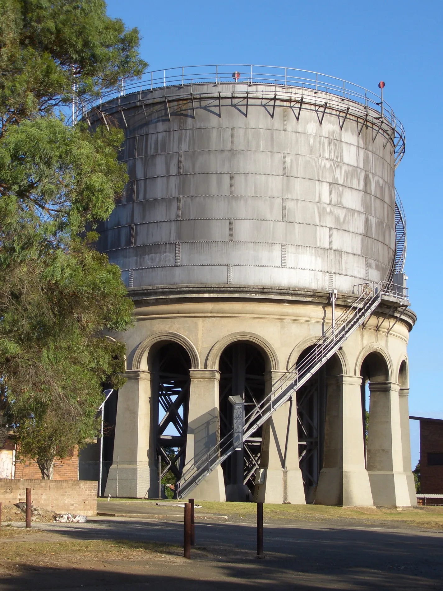
Ashfield Reservoir in Ashbury
Ashfield Reservoir in New South Wales is a water tower (Sydney Water). Ashfield Reservoir is near Fifth Street. Ⓦ.
- Building Type
- water tower
- Operator
- Sydney Water
Image
Bus stops
Roads nearby
Hillcrest AvenueAR Locksmith Sydney
200 m
Seaview Street200 m
Goodwin Avenue250 m
Allibone Street250 m
Fourth Street250 m
Trevenar StreetStreet library
250 m
Armstrong Street300 m
Crimson Street300 m
Woodlands Road300 m
Queen StreetQueen St opp Cardinal Freeman Village, Cardinal Freeman Village, Queen St, Queen St at Seaview St, Queen St at Clissold St, Queen St at Armstrong St, Queen St at Robert St, Queen Street Pateriss, Queen St opp Armstrong St, Gate 8, Gate 9, Queen St opp Robert St, Queen St after Hanks St, Queen St before Hanks St, Queen St after Liverpool Rd
350 m
Ashford Street350 m
Fifth Street350 m
Third StreetOcean Master Ashbury
400 m
Melville Street400 m
Crimson Lane400 m
Hanks Street450 m
Andrews Avenue500 m
Second Street500 m
Palace StreetPalace St at Allibone St, Palace St opp Allibone St, Palace St at Shepherd Lane, Palace St opp Shepherd Lane, Palace St at Holden St
500 m
Milton StreetMilton St before Palace St, Milton St after Palace St, Milton St at Trevenar St
500 m
Hardy Street550 m
Ettrick Street600 m
First Street600 m
Holden StreetCarina Florist
650 m
Kelvin Street650 m
Roslyn StreetRoslyn St at Ettrick St, Roslyn St opp Cheviot St, Roslyn St after Cheviot St, Roslyn St before Crieff St
750 m
Lasswade StreetAshbury
750 m
King StreetKing St opp Third St, King St at Trevenar St, King St at Third St, King St opp First St, King St at First St
750 m
Bakeries nearby
Tart Sisters400 m
Bicycle shops nearby
Cycling Projects700 m
Buildings nearby
A Block450 m
Cafés nearby
Excelsior Jones300 m
3 Tomatoes Cafe400 m
First St Pantry700 m
Car repair shops nearby
Ashfield Automotive300 m
Kindergartens nearby
Little Troopers Childcare600 m
Parks nearby
Peace Park250 m
James Foster Reserve800 m
Places of worship nearby
Ashbury Samoan Uniting Church450 m
School buildings nearby
C Block450 m
COLA500 m
G Block500 m
Weathershed550 m
B Block550 m
H Block550 m
Service buildings nearby
Valve House50 m
Ashfield Reservoir Pumping Station50 m
Sports pitches nearby
W H Wagener Oval600 m
Blick Oval650 m
| Inception | 1912 |
|---|---|
| Heritage designation | Heritage Act — State Heritage Register, Heritage Act - s.170 NSW State agency heritage register, Local Environmental Plan, Within a conservation area on an LEP |
| Located in | New South Wales |
| Street address | Holden Street, Ashbury, NSW 2193 |
| Country | Australia |
 Public transport map Ashbury Legend
| Railway | |
| Bus | |
| Tram |
 Cycling map Ashbury Legend
| Cycle path | |
| Cycle lane on road | |
| Cycling on bus lane | |
| Bicycle street | |
| Cyclists allowed | |
| Cyclists allowed, good surface | |
| No cycling | |
| Cobblestones |
| Long-distance cycle route | (depending on scale) | |
| Long-distance cycle route |
 Walking map Ashbury Legend
| Path |
| Long-distance hiking trail | (depending on scale) | |
| Long-distance hiking trail | ||
| No pedestrians |