
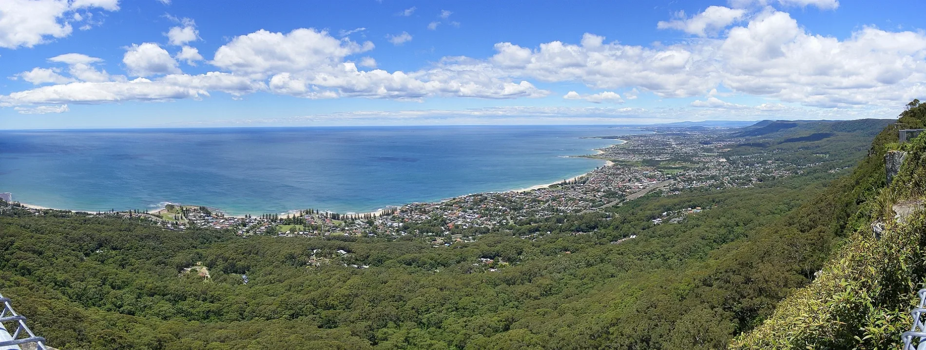
Illawarra Escarpment in Brogers Creek
Illawarra Escarpment in New South Wales is a mountain range. Ⓦ.
- Nature
- mountain range
Image
Viewpoint
Roads nearby
Drawing Room Rocks walking trackDrawing Room Rock Lookout
1000 m
Brogers Creek Road1,1 km
Woodhill Mountain RoadWoodhill
1,2 km
Foremans Road1,3 km
Old Pioneer Crest1,8 km
Cedargrove Lane1,9 km
Crago Rise1,9 km
Broughton Vale Road2,4 km
Bryan Close2,8 km
Hillandale Road2,8 km
Bluff View Lane2,8 km
Cooks Nose TrailCooks Nose Lookout, Cooks Nose, Cooks Nose (West)
3,2 km
Wattamolla Road3,2 km
Priddles Lane3,2 km
Tullouch Road3,6 km
Budderoo Fire TrailWallaya
3,8 km
Bong Bong Road3,9 km
Kangaroo Ridge Trail4,0 km
Boundary Road4,0 km
Bundewallah Reserve Walking Track4,1 km
Bundewallah Road4,4 km
Mount Hay Road4,5 km
Mount Hay Private RoadMt Hay Retreat
4,5 km
Griffiths Trail01, Barren Grounds Lodge Toilet, Barren Grounds Lookout, 02, 03, 04, Barren Grounds Day Use Area Toilet
4,8 km
Tindalls Lane4,9 km
Irvines Road4,9 km
Mount Vista Close5,0 km
Flying Fox Pass Trail5,0 km
Sabal Close5,4 km
Kangaroo Valley Road5,4 km
Weather Station Access Track5,4 km
Kentia Crescent5,6 km
Thomas Close5,6 km
Raffia Close5,6 km
The Gables5,8 km
North StreetNorth St after Prince Alfred St
5,8 km
Herbarium Walk01
5,9 km
Barren Grounds Road05, 02
5,9 km
Hersey Fire Trail6,0 km
Guest house nearby
Stone Cottage5,5 km
Nature reserves nearby
Rodway Nature Reserve2,2 km
Bundewallah Reserve3,8 km
Rivers nearby
Brogers Creek4,2 km
Streams nearby
Snake Gully2,9 km
Connollys Creek3,7 km
Chisholms Creek4,7 km
Bundewallah Creek4,7 km
Broughton Mill Creek5,2 km
Lamonds Creek5,6 km
| Elevation | 803 m |
|---|---|
| Located in | New South Wales |
| Country | Australia |
 Public transport map Brogers Creek Legend
| Railway | |
| Bus | |
| Tram |
 Cycling map Brogers Creek Legend
| Cycle path | |
| Cycle lane on road | |
| Cycling on bus lane | |
| Bicycle street | |
| Cyclists allowed | |
| Cyclists allowed, good surface | |
| No cycling | |
| Cobblestones |
| Long-distance cycle route | (depending on scale) | |
| Long-distance cycle route |
 Walking map Brogers Creek Legend
| Path |
| Long-distance hiking trail | (depending on scale) | |
| Long-distance hiking trail | ||
| No pedestrians |