
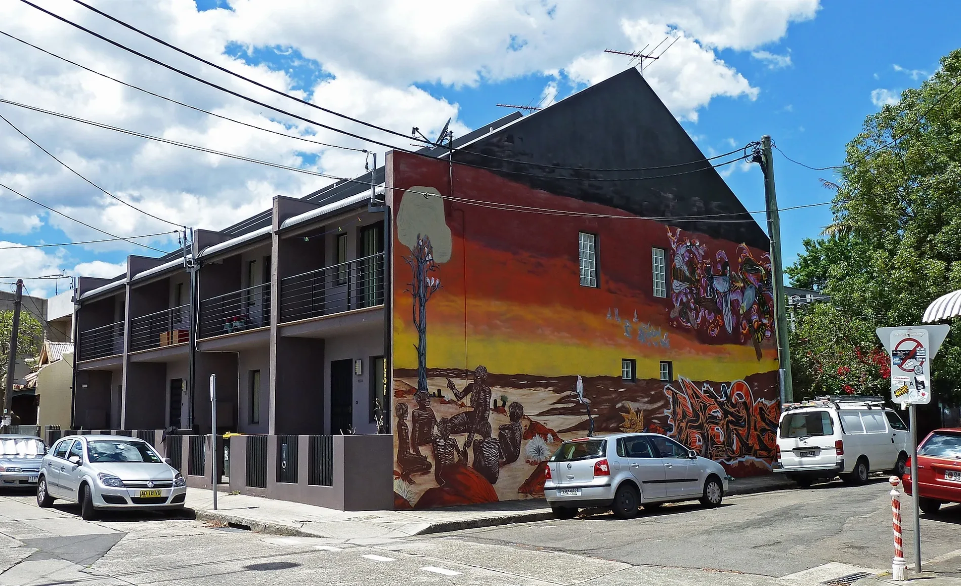
Lord Street in Newtown
Lord Street in New South Wales is a concreted, lit residential street (50 km/h). The road has a width of 6.9 m. It runs as a one-way street in an east-west direction and crosses John Street and ends at Edgeware Road, while the other end is a cul-de-sac. This road is part of the bicycle route "L10". Lord Street also exists in Roseville and St Peters.
- Road Type
- residential street
- Speed Limit
- 50
- Route
- east-west
Image
Cafés
Beauty salons
Hairdressers
Clothing shops
Restaurants
Car repair shops
Pet shops
Off-licences
Bus stops
Bakeries
Convenience stores
Roads nearby
John Street100 m
Council Street150 m
Caroline Lane200 m
M8 Motorway TunnelLunastudio, Ken Neale Overflow, Arabella, Sydney Super8mm, Art of Tiles, The Inner West Cat Hospital, Thats So Mi, Provocator, The Abbey on King, The Front Room, St Peters, Comfortel, Gigi Pizzeria, New 2 U Store, Lentil as Anything, King St at Holt St, Vina Vegan, Crust, Vandal Taqueria
200 m
Wells StreetTandoori Express, Patisserie Petunia
250 m
Bedwin Road250 m
Dickson Lane300 m
Smidmore StreetMarrickville Auto Repairs, Marrickville Metro, Smidmore St
300 m
Railway ParadeSydenham, Platform 2, Sydenham Station, Railway Pde, Stand C, Sydenham Station, Railway Pde, Stand D, Sydenham Station, Railway Pde, Stand B
300 m
Pearl Lane300 m
Hutchinson Street300 m
Unwins Bridge RoadTown and Country Hotel, Butterfly Blooms
350 m
Edinburgh RoadAustralia Post Parcel Locker, Edinburgh Rd at Murray St, Panetta Mercado, Panetta Mercado Cafe, Aeropets, Edinburgh Rd opp Smidmore St, Edinburgh Rd before Smidmore St, Ben Buckler Boards, Rose & Co.ffee
350 m
May LaneEzyMart
350 m
Brown StreetSt Peters
350 m
Applebee StreetRadism Events, Tortuga Studios
350 m
St Peter's PlazaSt Peters, domo 39, Dulcet Bake House
400 m
Lackey Street400 m
May StreetYiamas Greek Taverna, Fuel Bakery
400 m
Goodsell Street400 m
King Street CyclewayCheapest Load of Rubbish
400 m
Florence Street400 m
Barwon Park RoadBP, The Bearded Barista, Onu Cake
450 m
Campbell Street450 m
Short Street450 m
Church Street550 m
Princes Highway - Campbell Road Crossing550 m
Apartment buildings nearby
Art House350 m
Parkside Apartments500 m
Buildings nearby
May Street Artist Studios300 m
Applebee Industrial Units350 m
Gardens nearby
Brown Street Community Garden400 m
Hardware shops nearby
Euro Abrasives550 m
Hotels nearby
Town and Country Hotel350 m
Parks nearby
Seating Area and Garden200 m
Camdenville Park250 m
Pearl St Reserve300 m
Simpson Park300 m
May Street Reserve350 m
Platforms nearby
St Peters Platform 1 & 2350 m
St Peters Platform 3 & 4350 m
Playgrounds nearby
Darley St Playground150 m
Collyer Playground250 m
Residential areas nearby
The Stacks500 m
Residential buildings nearby
655 King400 m
Service buildings nearby
Air Quality Station550 m
Sports pitches nearby
Camdenville Park bike park200 m
Subway lines nearby
Eastern Bypass300 m
Wetlands nearby
Peter Bulger Wetlands300 m
 Public transport map Newtown Legend
| Railway | |
| Bus | |
| Tram |
 Cycling map Newtown Legend
| Cycle path | |
| Cycle lane on road | |
| Cycling on bus lane | |
| Bicycle street | |
| Cyclists allowed | |
| Cyclists allowed, good surface | |
| No cycling | |
| Cobblestones |
| Long-distance cycle route | (depending on scale) | |
| Long-distance cycle route |
 Walking map Newtown Legend
| Path |
| Long-distance hiking trail | (depending on scale) | |
| Long-distance hiking trail | ||
| No pedestrians |