
Edward Street in Laidley
Edward Street in Lockyer Valley Regional is a two-lane minor road. There is no cycle path. It runs in an east-west direction starting from Cooper Street and crosses John Street, Head Street, Patrick Street, Mary Street, Coates Street, Robinson Road and Goodwin Street and ends at Douglas McInnes Drive. Edward Street also exists in Western Downs Regional, Murweh Shire, Blackall Tambo Regional, South Burnett Regional and Gympie Regional.
- Road Type
- residential street
- Route
- east-west
Image
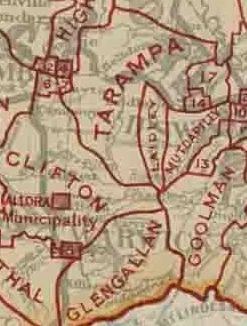
Sanitary dump stations
Museum
Bank
Supermarkets
Stations
- bus lines 539
Bus stops
- bus lines 539
Kindergarten
Library
Pubs
Campsite
Cafés
Off-licences
Pharmacy
Hardware shops
Platforms
- bus lines 539
Roads nearby
John StreetLaidley Caravan Dump Point
50 m
McGregor Street250 m
Head Street250 m
Cooper Street300 m
Patrick StreetLaidley, Laidley Library, Laidley Pharmacy, Community Grounds, Bendigo Bank, Kelli's Diner, Goodwin & Storr Mitre 10, Liquor Legends Laidley, Exchange Cellars, Exchange Hotel - Laidley
450 m
Hayes Street450 m
Mary StreetMary St at Mary Street Community Centre
550 m
Shirley Pitt Pedestrian Bridge550 m
South Street550 m
Ambrose Street650 m
Patrick Lane700 m
Parkview Place750 m
Tareeda Boulevard750 m
Fernleigh Court800 m
North Street850 m
Vaux Street850 m
Whites Road850 m
William StreetWilliam St at Laidley, William St at Laidley District Hospital, C&K Preschool, Das Neumann Haus
900 m
Acacia Court900 m
Orton Street950 m
Coates Street950 m
Spicer Street950 m
Blue Gum Court950 m
Cribb Street950 m
Alfred Street1000 m
Pike StreetLaidley
1000 m
Victoria Street1000 m
Joel Street1,0 km
Alexander Street1,0 km
Railway Street1,0 km
Thomas Street1,0 km
Storr Street1,1 km
Wickham Street1,1 km
Winston Street1,1 km
Robinson Road1,1 km
Napier Street1,2 km
Jordan Street1,2 km
Cassia Court1,2 km
Buildings nearby
Laidley Ambulance Station850 m
Commercial buildings nearby
C&K PreSchool700 m
Community centres nearby
Laidley Community Centre400 m
Fire stations nearby
Laidley Fire and Rescue Station800 m
Houses nearby
Michael O'Keefe Place650 m
Parks nearby
G.G Ferrari Park500 m
Police stations nearby
Laidley Police Station800 m
Railway lines nearby
Main Line1,1 km
Recreation grounds nearby
Laidley Sports and Recreation Reserve700 m
Swimming pools nearby
Laidley Pool400 m
Other nearby
Laidley Hospital Helipad900 m
 Public transport map Laidley Legend
| Railway | |
| Bus | |
| Tram |
 Cycling map Laidley Legend
| Cycle path | |
| Cycle lane on road | |
| Cycling on bus lane | |
| Bicycle street | |
| Cyclists allowed | |
| Cyclists allowed, good surface | |
| No cycling | |
| Cobblestones |
| Long-distance cycle route | (depending on scale) | |
| Long-distance cycle route |
 Walking map Laidley Legend
| Path |
| Long-distance hiking trail | (depending on scale) | |
| Long-distance hiking trail | ||
| No pedestrians |