
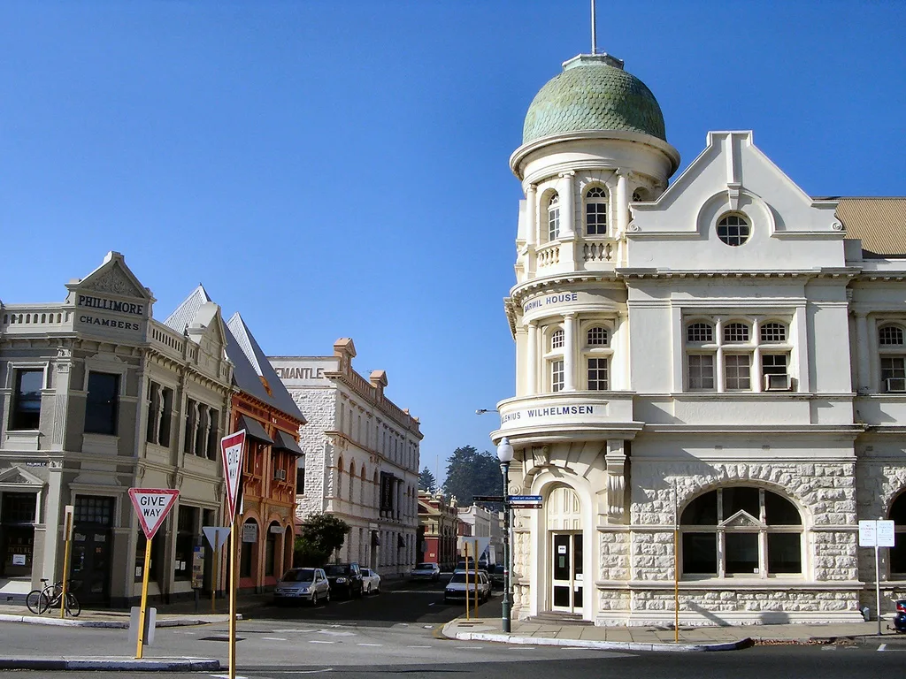
West End in Fremantle
West End in City of Fremantle ist ein historisches Objekt. West End is also known as West End Heritage Area. West End is near Mrs Trivett Place. Ⓦ.
- Alternative Name
- West End Heritage Area
Image
Cafés
Bus stops
Guest house
Studios
Artwork
Restaurants
Scuba diving shops
Tourist information offices
Community centre
Museum
Roads nearby
Fremantle Railway Shared PathKidogo Arthouse, Arthur Head Reserve, Commissariat Buildings, Old Kerosene Store, Kelp, Bathers Beach, Fremantle, Fremantle Station, Stand 5, Fremantle Station, Stand 4, Twin Fin
50 m
Captains LaneRound House, Artist Houses, Walyalup Aboriginal Cultural Centre
100 m
Fleet StreetBathers Beach
100 m
Mrs Trivett PlaceBathers Beach
100 m
Little High Street100 m
High StreetFremantle Tram Tours, Chalkys, Christian Brothers College, CBC Fremantle, High St After Stirling St, High St After Parry St, Vin Populi, Hotel Fremantle, New Edition Bookshop, Denim/Store, Hush, Bill Campbell Books, Sundancer Bar, 5 Star Tattoo, Lapa, Breglia Piccolo's Lunch Bar, Orient, Jungle Bird, Art Marx Gallery, The Record Finder, Breaks, Bousfields Menswear, Bitches Brew, The Chart and Map Shop, Bodkin's Bootery, Rialto Apartments, Casa Rialto, Unique Hair and Beauty, Navy Club, Japingka Gallery, Somes Newsageny, High on 55, David Giles Art Gallery, Brazilian Butterfly, Port Jarrah Furniture, Finishing Touch Gallery, Otis & Mave, Lavita, Xavier Herbert, Crosta, St Pat's Op Shop, Kardinya Kitchens, Ode to Sirens, Honkey Tonk, Common Ground Collective, Fremantle Pharmacy, Remedy, Sip Paint Create, The Artisan Store Fremantle, Three Stories, Kim Scott, Vintage On High, High St Gelato, High St After Swanbourne St, High St After Ord St, High St After Chalmers St, Boost, Shepherd's Newsagency, Sunglass Shack, Surf Dive 'n Ski, Creations, Oz Australia, Telstra, Specsavers, Coal River Farm, Elsa, High St After Queen St, Aunty Lucy's Cakery, Manuka Woodfire, The Hair & Barber Room, Kings Square, Australian Red Cross Shop, Vinnies, Siam Kitchen, Authentic Indian Cuisine, D'Angelo Cafe, Victoria Hall, H&C Urban Winery, The Salty Beetroot, Cellarbrations, Coccolicco, Apple Dental Centre, Fremantle Library, John Curtin, Town Hall, Fremantle Visitor Centre
100 m
Phillimore StreetThe Prestige Italian Cafè, Fremantle Station, Stand 1, Fremantle Station, Stand 6, Fremantle Station, Fremantle Fire Station, Old Fire Station, Fremantle Station, Stand 9, Fremantle Station, Stand 12, Fremantle Station, Stand 7, Fremantle Station, Stand 8, Fremantle Station, Stand 3, Fremantle Station, Stand 2, Fremantle Station, Stand 11, Victoria Quay, Loan Monster
100 m
Slip StreetHMAS Oxley Bow Section
100 m
Canteen Lane150 m
Maintenance Alley150 m
Customs Place150 m
Workshop LaneEngine Museum, Caffissimo
200 m
Victoria Quay RoadFremantle Harbour, Leewin Office, Maritime Museum & E-Shed Markets
200 m
Croke Lane200 m
Cliff StreetFishing Boat Harbour, Lionel Samson
250 m
Attraction nearby
HMAS Ovens250 m
Buildings nearby
Samson Bond Store Apartments100 m
Wilhelmsen House100 m
Parmelia (G)100 m
J Shed100 m
Round House100 m
Abrugiato Building100 m
Success (E)150 m
Success (F)150 m
Minstrell150 m
Lionel Samson Building150 m
Sultan (C)200 m
Samson Cottage200 m
Works Office200 m
Lilly's Buildings200 m
CF11250 m
D250 m
Old Kerosene Store250 m
ROV250 m
Museum nearby
Western Australian Museum Shipwrecks250 m
Western Australian Maritime Museum250 m
Office buildings nearby
Fremantle Port Authority Building100 m
Old Customs House150 m
Tannatt Chambers150 m
Fremantle Herald200 m
Public toilets nearby
Arthur Head Toilets100 m
Restaurants nearby
Gage Roads Brew Co200 m
Retail buildings nearby
Weighbridge100 m
Phillimore Chambers100 m
University buildings nearby
Union Bank Building100 m
Hotel Fremantle150 m
Owston's Buildings150 m
Tannock Hall of Education250 m
Other nearby
Old Sea Wall250 m
| Heritage designation | State Registered Place |
|---|---|
| Located in | City of Fremantle |
| Country | Australia |
| Location | Fremantle |
 Public transport map Fremantle Legend
| Railway | |
| Bus | |
| Tram |
 Cycling map Fremantle Legend
| Cycle path | |
| Cycle lane on road | |
| Cycling on bus lane | |
| Bicycle street | |
| Cyclists allowed | |
| Cyclists allowed, good surface | |
| No cycling | |
| Cobblestones |
| Long-distance cycle route | (depending on scale) | |
| Long-distance cycle route |
 Walking map Fremantle Legend
| Path |
| Long-distance hiking trail | (depending on scale) | |
| Long-distance hiking trail | ||
| No pedestrians |