
SuperDARN (Goose Bay) in Happy Valley-Goose Bay, Newfoundland and Labrador
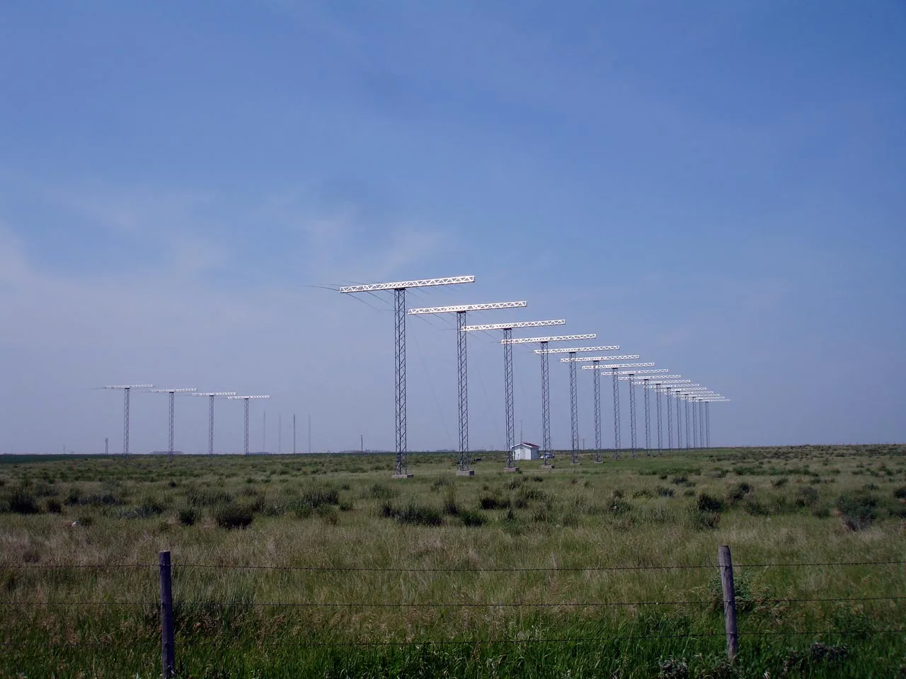
SuperDARN (Goose Bay) in Happy Valley-Goose Bay is a research institute (Virginia Polytechnic Institute and State University (United States)) 🌐. SuperDARN (Goose Bay) is also known as Super Dual Auroral Radar Network. SuperDARN (Goose Bay) is near North Star Drive. Ⓦ.
- Alternative Name
- Super Dual Auroral Radar Network
- Amenity
- research institute
- Land Use
- meadow
- Operator
- Virginia Polytechnic Institute and State University (United States)
- Website
- http://superdarn.org/
Image
Sports shops
Paint shops
ATMs
Outdoor shops
Electronics shops
Petrol stations
Motel
Chalet
Tourist information offices
Bank
Ferry terminals
Town hall
Social facility
Restaurants
Pharmacy
Parking
Roads nearby
Picton Lane2,8 km
North Star Drive2,9 km
Ottawa Avenue2,9 km
Senneterre Street3,0 km
Chatham Street3,0 km
Travis Street3,1 km
Loring Drive3,1 km
Marville Drive3,1 km
Dakota Drive3,1 km
Lahr Boulevard3,2 km
Zweibrucken Crescent3,2 km
Portage La Prairie Drive3,2 km
Baden Crescent3,2 km
Rivers Road3,2 km
Sabre Street3,2 km
Carswell Loop3,2 km
Westover Street3,3 km
Centrailia Road3,3 km
Alkali Drive3,3 km
Toronto Avenue3,3 km
Mets Lane3,3 km
Offutt Loop3,3 km
Edmonton Street3,4 km
Aylmer Street3,4 km
Angus Lane3,5 km
Vulcan Road3,5 km
Banshee Boulevard3,5 km
North West River RoadGoose Bay
3,5 km
Clinton Street3,6 km
Hamilton River RoadUltramar, Esso, Hometown Sports Excellence, D's Landing, The Source, Warr's Pharmacy, BMO, Benjamin Moore, Northern Lights Ltd
3,6 km
Nomad Street3,7 km
Tracker Street3,7 km
Whitman Circle3,7 km
Fort Churchill Circle3,7 km
Spitfire Place3,8 km
Attraction nearby
McDonnell CF-101F Voodoo3,3 km
Consolidated Canso A3,3 km
Avro Vulcan B.23,4 km
Buildings nearby
Irving Aviation2,8 km
5 Wing Military Gym3,1 km
Control Tower3,2 km
Terminal3,3 km
Woodward Aviation3,5 km
Hangars nearby
Canadian Helicopters3,2 km
Residential areas nearby
600's3,1 km
700's3,5 km
500's3,8 km
Streams nearby
Otter Creek3,3 km
Other nearby
Goose Bay Airport3,4 km
| Has part | Unwin Radar |
|---|
 Public transport map Happy Valley-Goose Bay Legend
| Railway | |
| Bus | |
| Tram |
 Cycling map Happy Valley-Goose Bay Legend
| Cycle path | |
| Cycle lane on road | |
| Cycling on bus lane | |
| Bicycle street | |
| Cyclists allowed | |
| Cyclists allowed, good surface | |
| No cycling | |
| Cobblestones |
| Long-distance cycle route | (depending on scale) | |
| Long-distance cycle route |
 Walking map Happy Valley-Goose Bay Legend
| Path |
| Long-distance hiking trail | (depending on scale) | |
| Long-distance hiking trail | ||
| No pedestrians |