
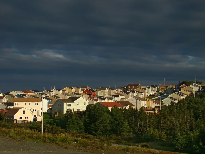
McNamara Drive in Paradise, Newfoundland and Labrador
McNamara Drive in Paradise is a two-lane, asphalted secondary road (40 km/h). The road has no sidewalks. There is no cycle path. It runs in a southeast-northwest direction and crosses Burnaby Street, Sarah Davis Way and Tipperary Street. It ends in a cul-de-sac.
- Bicycle
- yes
- Cycle Path
- no
- Road Type
- secondary road
- Lanes
- 2
- Speed Limit
- 40
- Route
- southeast-northwest
Image
Off-licences
Variety stores
Craft shops
Pharmacy
Hairdressers
Petrol stations
Fast food restaurants
Pet shops
Confectioneries
Patisseries
Beauty salons
Restaurants
Chalet
Convenience stores
DIY stores
Cafés
Gift shops
Roads nearby
Topsail RoadTopsail Post Office, Woodstock Colonial Inn, Topsail Breeze Restaurant, Little Caesars, Great Canadian Dollar Store, Continental Marble, Fabulous Gifts and Home Decor, Kozy Kitchen, Dairy Queen, Irving Paradise, Newfoundland Liquor Corporation
100 m
Burnaby StreetValley Ridge, Newfoundland Liquor Corporation
200 m
T’Railway Provincial ParkWoodstock, Coffee Matters Paradise, Domino's, Subway, Get Messy NL, The Candy Corner, The Medicine Shoppe, Cojones, Cakey Hand, Sunsations Tanning Salon, Salon1
250 m
Harcourt Road300 m
Panoramic Place300 m
Kinkora Street350 m
Clearview Heights350 m
Neil's Pond Trail350 m
Croydon Street350 m
Tiverton Street400 m
Octagon Pond Walk400 m
Devaughn Street400 m
Tilting Place400 m
Gosse's RoadNeeds Convenience, Pizza House
400 m
Sheppard Place400 m
Sarah Davis WayCanteen
450 m
Drover's Road450 m
Octagon Pond Walk (detour)450 m
Alma Avenue500 m
Tipperary Street500 m
Irving Drive500 m
Skeffington Place550 m
Dianne Whalen Drive600 m
Paddy Kay Drive600 m
Toslo Street650 m
Octagon Heights650 m
Ravenwood Crescent700 m
Hartland Avenue750 m
Heightview Drive750 m
Fred W Brown Drive800 m
Paradise Road900 m
Lancefield Street900 m
Barchester Street950 m
Grandview Avenue1000 m
Mallow Drive1000 m
Elmer Place1,0 km
Body of waters nearby
Octagon Pond400 m
Buildings nearby
Rovers Search and Rescue250 m
Capital Management Financial Advisors500 m
Cafés nearby
Starbucks100 m
Community centres nearby
Rotary Paradise Youth and Community Centre550 m
Fast food restaurants nearby
Burger King200 m
Pharmacies nearby
Shoppers Drug Mart50 m
Places of worship nearby
Spruce Hills Community Church950 m
Post offices nearby
Paradise Main Post Office250 m
Residential buildings nearby
Neil's Pond Condominiums800 m
Retail areas nearby
Paradise Plaza150 m
Supermarkets nearby
Sobeys100 m
Town halls nearby
Paradise Town Hall250 m
 Public transport map Paradise Legend
| Railway | |
| Bus | |
| Tram |
 Cycling map Paradise Legend
| Cycle path | |
| Cycle lane on road | |
| Cycling on bus lane | |
| Bicycle street | |
| Cyclists allowed | |
| Cyclists allowed, good surface | |
| No cycling | |
| Cobblestones |
| Long-distance cycle route | (depending on scale) | |
| Long-distance cycle route |
 Walking map Paradise Legend
| Path |
| Long-distance hiking trail | (depending on scale) | |
| Long-distance hiking trail | ||
| No pedestrians |