
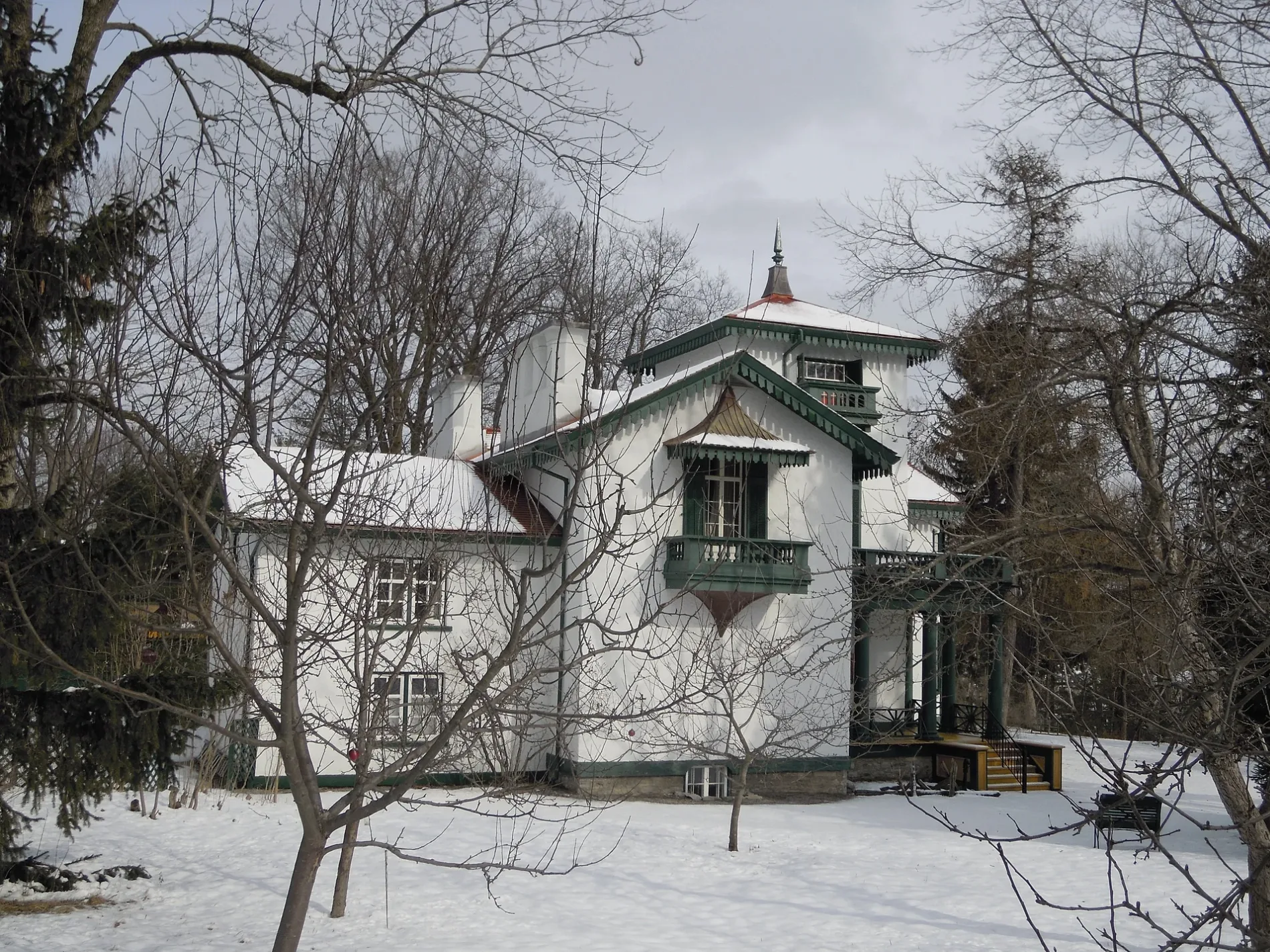
Bellevue House in Kingston, Ontario
Bellevue House in Kingston is a museum (Parks Canada, web), Centre Street 35. Bellevue House is also known as Bellevie House National Historic Site of Canada. Bellevue House is built in the Renaissance Revival architecture style. Ⓦ.
- House Number
- 35
- Street
- Centre Street
- Alternative Name
- Bellevie House National Historic Site of Canada
- Building Type
- building
- Operator
- Parks Canada
- Tourism
- museum
- Website
- https://parks.canada.ca/lhn-nhs/on/bellevue
Image
Roads nearby
Centre Street100 m
Edgehill Street150 m
Beverley Street250 m
Kensington Avenue250 m
King Street WestBeverly Street (north side of King), Albert Street (south side of King), Albert Street (north side of King), Beechgrove (south side of King), Super Monster Gamez, The Plant Shelf, Subway, Eunice Sushi, King Mart, The Village Spa & Hair Boutique, 710 Smoke Shop, Sky’s the Limit Custom Tattoo, Kai’s Delight, Mowat Avenue (south side of King), Portsmouth Avenue (south side of King), Portsmouth Avenue (north side of King), Sir John A. Macdonald Boulevard (north side), Lake Ontario Park (south side of King), Trailhead Place (south side of King), Waterfront Trail, PharmaChoice, Kingston - Portsmouth Harbour, Canada Post, Livingston Avenue (south side of King), The Isabel/Tett Centres ( side of King), Sir John A. Macdonald Boulevard (south side), Alwington Avenue (north side of King), Little Free Library, McDonald Avenue (north side of King), Lower University Avenue (south side of King), Time, Lower University Avenue (north side of King), Colonel Bradstreet, Murney Martello Tower, George Street (south side of King), George Street (north side of King)
250 m
Morton Way300 m
Collingwood Street300 m
Davidson Street350 m
Livingston Avenue400 m
Queen's CrescentLeonard Dining Hall
400 m
Ellerbeck Street400 m
Albert StreetTesla, Communauto
400 m
Traymoor Street450 m
Queen’s Crescent450 m
St. Lawrence Avenue500 m
Vandalay Crescent500 m
Hillcroft Drive500 m
Stirling / Chernoff Service Entrance550 m
Hill Street600 m
Bader LaneThe Lazy Scholar
600 m
Union StreetAlbert Street (north side of Union), Albert Street (south side of Union), Queen's Day Care Centre, Hedgewood House Dental, Queen's University, Queen's West Campus (north side of Union), Yonge Street (north side of Union), Mowat Avenue (north side of Union), Yonge Street (south side of Union), Queen's West Campus (south side of Union), The Library Cafe, Miller Museum of Geology, The Grad Club, Iron Man, Victoria Street (north side of Victoria), Beverley Street (south side of Victoria), Willingdon Avenue (north side of Union), Pembroke Street (north side of Union), Pembroke Street (south side of Union), Hillcroft Drive (south side of Union), Alfred Street (north side of Union), Alfred Street (south side of Union), Lederman Law Library, Goodes Cafe
600 m
MacDonnell StreetHotspot auto parts, Silhouette Hair Studio, Money Mart
700 m
Couper Street700 m
Arts centres nearby
J.K. Tett Centre300 m
Brownfields nearby
former Providence Care - St. Mary's of the Lake Site400 m
Buildings nearby
Kingston Water Treatment Plant200 m
Grant House350 m
Hedgewood House600 m
Convenience stores nearby
Bearance's Grocery450 m
Detached houses nearby
Geneva House700 m
Dormitories nearby
Brant House350 m
Morris Hall350 m
David C. Smith House400 m
Watts Hall400 m
Chown Hall600 m
Garages nearby
Physical Plant Services Shed550 m
Gardens nearby
Bellevue House Gardens100 m
Museum nearby
Bellevue House Visitors Centre50 m
Orchards nearby
Bellevue House Orchard50 m
Parks nearby
Breakwater Park400 m
Places of worship nearby
Beth Israel Congregation300 m
Sports pitches nearby
Tindall Field650 m
Theatres nearby
Isabel Bader Centre for Performing Arts400 m
University buildings nearby
Environmental Health & Safety Building450 m
Chernoff Hall500 m
Chernoff Auditorium500 m
Grey House600 m
Stirling Hall600 m
Watson Hall650 m
| Inception | 1840 |
|---|---|
| Architectural style | Renaissance Revival architecture |
| Heritage designation | national historic site of Canada, classified federal heritage building of Canada, designated heritage property (part IV) |
| Located in | Kingston |
| Country | Canada |
 Public transport map Kingston Legend
| Railway | |
| Bus | |
| Tram |
 Cycling map Kingston Legend
| Cycle path | |
| Cycle lane on road | |
| Cycling on bus lane | |
| Bicycle street | |
| Cyclists allowed | |
| Cyclists allowed, good surface | |
| No cycling | |
| Cobblestones |
| Long-distance cycle route | (depending on scale) | |
| Long-distance cycle route |
 Walking map Kingston Legend
| Path |
| Long-distance hiking trail | (depending on scale) | |
| Long-distance hiking trail | ||
| No pedestrians |