
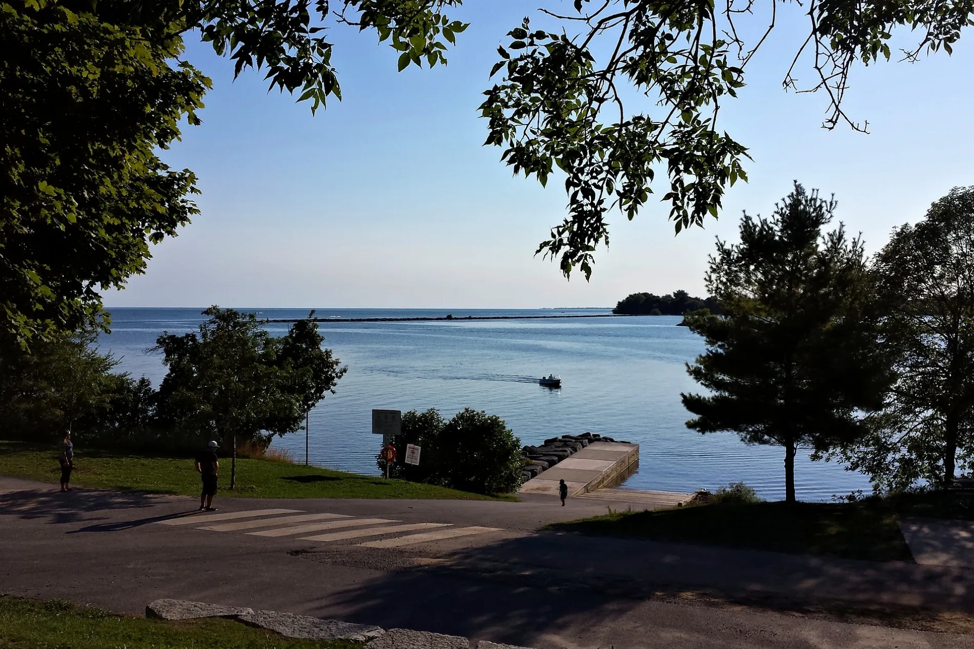
Lake Ontario Park in Kingston, Ontario
Lake Ontario Park in Kingston is a park, King Street West 920. Ⓦ.
- House Number
- 920
- Street
- King Street West
- Leisure
- park
Image
Roads nearby
Waterfront TrailTrailhead Place (north side of King), 1000 King Street West, Country Club Drive (north side of King), Portsmouth Avenue (north side of King), Township Tire, Bayside Inn, Bella Bistro
450 m
Country Club Drive650 m
Portsmouth AvenueElmwood Street (east side of Portsmouth), Fairview Road (east side of Portsmouth), Valleyview Avenue (east side of Portsmouth), Howard Crescent (east side of Portsmouth), Hillendale, Valleyview, Baiden Street (east side of Portsmouth), Baiden Street (west side of Portsmouth), Mowhawk Place (west side of Portsmouth), KFL&A Health Unit (east side of Portsmouth), Curtis Crescent (west side of Portsmouth), Shell, St. Lawrence College Transfer Point, Calderwood Drive (east side of Portsmouth), R.L. Fletcher Bicycles, Portsmouth Medical Clinic
650 m
Trailhead Place650 m
Hospital Lane700 m
Rideau TrailThe Rideau Trail
700 m
Leahurst Lane750 m
Collegeview Crescent750 m
Cartwright Street750 m
Churchill StreetCartwright Street (south side of Churchill), Francis Street (south side of Churchill), Cartwright Street (north side of Churchill), Francis Street (north side of Churchill)
800 m
Estate Lane800 m
Auld Street800 m
Gable Lane800 m
King Street WestBeechgrove (south side of King), Super Monster Gamez, The Plant Shelf, Subway, Eunice Sushi, King Mart, The Village Spa & Hair Boutique, 710 Smoke Shop, Sky’s the Limit Custom Tattoo, Kai’s Delight, Mowat Avenue (south side of King), Portsmouth Avenue (south side of King), Portsmouth Avenue (north side of King), Sir John A. Macdonald Boulevard (north side), Lake Ontario Park (south side of King), Trailhead Place (south side of King), Waterfront Trail, PharmaChoice, Kingston - Portsmouth Harbour, Canada Post, Livingston Avenue (south side of King), The Isabel/Tett Centres ( side of King), Sir John A. Macdonald Boulevard (south side), Alwington Avenue (north side of King), Little Free Library, McDonald Avenue (north side of King), Beverly Street (north side of King), Albert Street (south side of King), Albert Street (north side of King), Lower University Avenue (south side of King), Time, Lower University Avenue (north side of King), Colonel Bradstreet, Murney Martello Tower, George Street (south side of King), George Street (north side of King)
850 m
Heakes Lane850 m
Mary Street850 m
Curtis Crescent850 m
Baiden Street850 m
Front RoadInvista (north side of Front), Invista (south side of Front), Crystal Springs (north side of Front), Sunny Acres Road (north side of Front), Bishop Street (north side of Front), Sunny Acres Road (south side of Front), Bishop Street (south side of Front), Reddendale Pharmacy, Snip & Clip, Reddendale Plaza (north side of Front), Quik Chek, days on front Restaurant
850 m
McDonald AvenueAllTheDetails Professional Auto Detailing
900 m
Foster Street950 m
Woodstone Crescent950 m
Nickle Avenue1000 m
Old Oak RoadLittle Angels Child Care Centre
1000 m
Richfield Place1,0 km
Apartment buildings nearby
1000 King150 m
The Waterside250 m
Richardson Wharf300 m
The Brad Street Apartments850 m
Colleges nearby
Newcourt House300 m
Root Cellar350 m
Energy House500 m
St. Lawrence College500 m
Energy House 2.0550 m
Gardens nearby
Manidoo Ogitigan (Spirit Garden)200 m
Hospitals nearby
Beechgrove Cottage750 m
Leahurst800 m
Rockwood House800 m
Parks nearby
Elevator Bay Park250 m
Trailhead Park550 m
SLC Park650 m
Nickle Avenue Park850 m
Railway lines nearby
Cataraqui Spur800 m
Residential areas nearby
Commodore's Cove450 m
Portsmouth Court900 m
Sports centres nearby
YMCA550 m
Sports pitches nearby
South Field550 m
SLC outdoor volleyball court600 m
North Field900 m
| Inception | 1894 |
|---|---|
| Located in | Kingston |
| Country | Canada |
 Public transport map Kingston Legend
| Railway | |
| Bus | |
| Tram |
 Cycling map Kingston Legend
| Cycle path | |
| Cycle lane on road | |
| Cycling on bus lane | |
| Bicycle street | |
| Cyclists allowed | |
| Cyclists allowed, good surface | |
| No cycling | |
| Cobblestones |
| Long-distance cycle route | (depending on scale) | |
| Long-distance cycle route |
 Walking map Kingston Legend
| Path |
| Long-distance hiking trail | (depending on scale) | |
| Long-distance hiking trail | ||
| No pedestrians |