
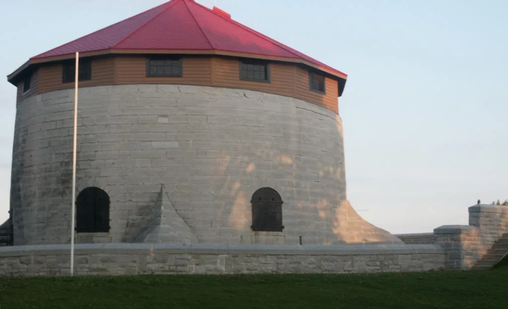
Murney Tower in Kingston, Ontario
Murney Tower in Kingston is a museum (opening hours: May 20 -Sep 04 10–17, free, web). Murney Tower is near O'Kill Street. Ⓦ.
- Building Type
- building
- Tourism
- museum
- Website
- https://www.murneytower.com/
- Wheelchair Access
- no
Image
Roads nearby
King Street EastSultan's Bazaar, Sir John's Public House, Tango Nouveau, Bubba's Pizzeria, Cambodian Village, Phnom-Penh Restaurant Cambodian & Thai Cuisine, HDR Mill & Ross Architects, Kingston Jewellery Repair, Red House, Silver Wok Restaurant, Kingston, Metalworks Contemporary Goldsmithing, The Shuroop, Cannon, Kingston Marriott, Taylor Studios, Laurier Optical, Dr. Don Anderson, Dr. Scott Anderson, Dr. Terry Devitt, Jack Astor's, Marc F. Raymond Optician, Morrison's Restaurant, The Keg, Kingston Coffee House, Marc F. Raymond Optician (under renovation), Maitland Street (south side of King), Maitland Street (north side of King)
100 m
Barrie StreetGenerations Barbershop, Frontenac Cycle and Sport, Untitled, Cannon, The Store Famous
100 m
O'Kill Street200 m
Emily StreetEmily Street - Flo
200 m
George StreetBracken Health Sciences Library, GIDRU
250 m
King Street WestBeechgrove (south side of King), Super Monster Gamez, The Plant Shelf, Subway, Eunice Sushi, King Mart, The Village Spa & Hair Boutique, 710 Smoke Shop, Sky’s the Limit Custom Tattoo, Kai’s Delight, Mowat Avenue (south side of King), Portsmouth Avenue (south side of King), Portsmouth Avenue (north side of King), Sir John A. Macdonald Boulevard (north side), Lake Ontario Park (south side of King), Trailhead Place (south side of King), Waterfront Trail, PharmaChoice, Kingston - Portsmouth Harbour, Canada Post, Livingston Avenue (south side of King), The Isabel/Tett Centres ( side of King), Sir John A. Macdonald Boulevard (south side), Alwington Avenue (north side of King), Little Free Library, McDonald Avenue (north side of King), Beverly Street (north side of King), Albert Street (south side of King), Albert Street (north side of King), Lower University Avenue (south side of King), Time, Lower University Avenue (north side of King), Colonel Bradstreet, Murney Martello Tower, George Street (south side of King), George Street (north side of King)
300 m
Maitland Street300 m
Stuart StreetWally's, George Street (north side of Stuart), Kingston General Hospital (north side of Stuart), Queen's University/Kingston General Hospital, George Street (south side of Stuart), Location 21
350 m
Deacon Walk450 m
Founder's RowConvocation Hall, Ground Outline
450 m
Bagot StreetWest Street (south side of Bagot), Johnson Street (west side of Bagot), Earl Street (west side of Bagot), West Street (north side of Bagot), Earl Street (east side of Bagot), Coin Laundry, CIBC, Downtown Transfer Point Platform 4, LifeLabs, Nexus, Saigon Delights Fine Vietnamese Cuisine, Stuff'd Urban Eats, Iviney & Associates Chartered Accountants, Downtown Transfer Point Platform 6, Downtown Transfer Point Platform 5, Young Drivers of Canada, The Hair Exhibition Room, Golden Viet Thai Restaurant, Nosh Kingston, Bay Street (west sideof Bagot), Kingston - Artillery Park Aquatic Center, Artillery Park (west side of Bagot), Ordinance Street (east side of Bagot)
450 m
Williams Walk500 m
Arch StreetTim Hortons
500 m
Medical Way500 m
Court Street600 m
Clinics nearby
Centre for Applied Urological Research250 m
Fast food restaurants nearby
FryWay350 m
Gardens nearby
Snodgrass Arboretum450 m
Medical Quadrangle500 m
Hospitals nearby
Burr Wing200 m
Victory Wing250 m
Emergency Department250 m
Dietary Wing250 m
Connell Wing300 m
Doran Building300 m
Empire Wing300 m
Douglas Wing300 m
Watkins Wing300 m
Angada Building350 m
Nickle Wing350 m
Marinas nearby
Kingston Yacht Club300 m
Museum nearby
Ann Baillie Building250 m
Parks nearby
MacDonald Park100 m
City Park100 m
Places of worship nearby
St. James' Anglican Church600 m
University buildings nearby
Macklem House100 m
Louise D. Acton Building200 m
Botterell Hall250 m
Cancer Research Institute300 m
Abrhamsky House350 m
Richardson Laboratory350 m
Queen's School of Medicine350 m
Cataraqui Building400 m
Abramsky Hall400 m
Summerhill450 m
Craine Building500 m
Earl Hall500 m
Humphrey Hall550 m
Kathleen Ryan Hall550 m
| Area | 0.2 ha |
|---|---|
| Heritage designation | national historic site of Canada, classified federal heritage building of Canada, part of UNESCO World Heritage Site |
| Located in | Kingston |
| Country | Canada |
| Described by source | martellotowers.co.uk |
| Part of | Kingston Fortifications, Rideau Canal World Heritage Site |
 Public transport map Kingston Legend
 | Railway | |
| Bus | |
| Tram |
 Cycling map Kingston Legend
 | Cycle path | |
| Cycle lane on road | |
| Cycling on bus lane | |
| Bicycle street | |
| Cyclists allowed | |
| Cyclists allowed, good surface | |
| No cycling | |
| Cobblestones |
| Long-distance cycle route | (depending on scale) | |
| Long-distance cycle route |
 Walking map Kingston Legend
 | Path |
| Long-distance hiking trail | (depending on scale) | |
| Long-distance hiking trail | ||
| No pedestrians |