
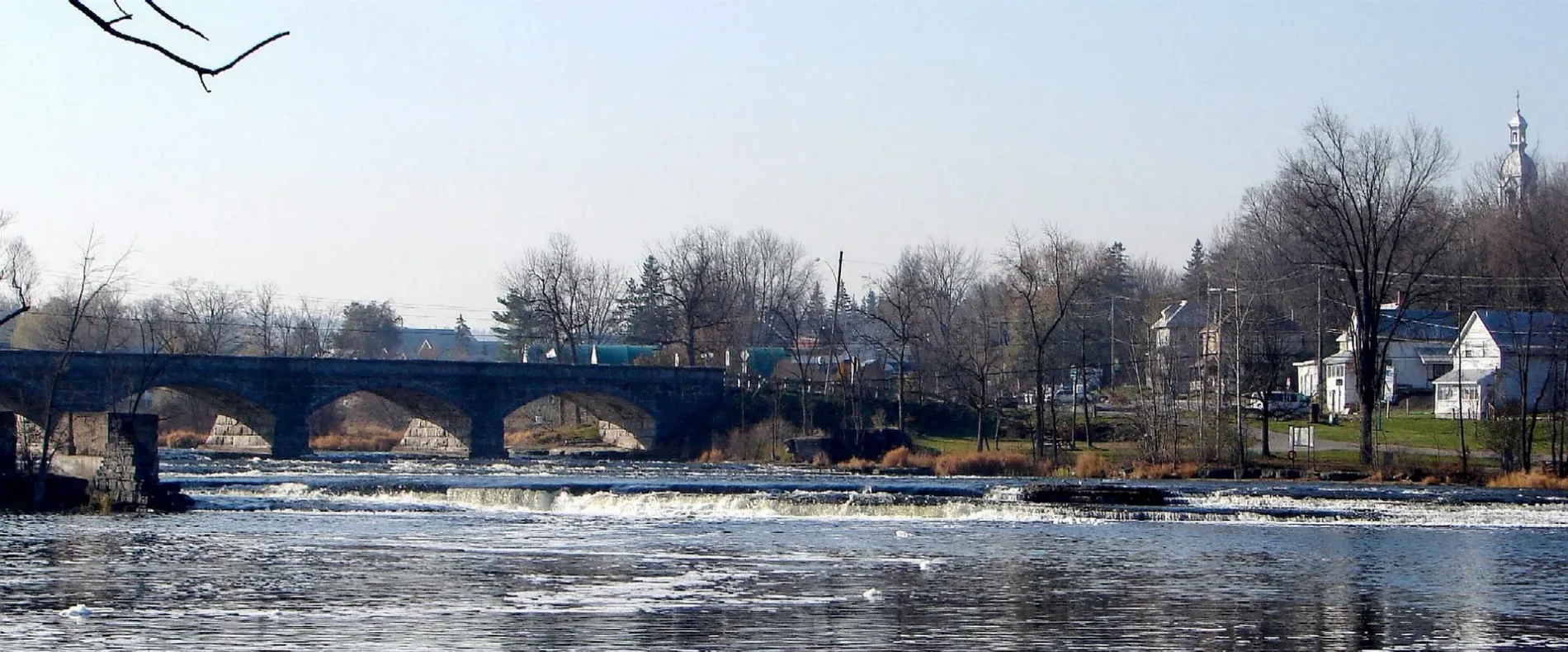
Mississippi River in Mississippi Mills, Ontario
Mississippi River in Mississippi Mills is a river. Mississippi River also exists in Tay Valley. Ⓦ.
- Waterway Type
- river
Image
Clothing shops
Attraction
Beauty salons
Cannabis shops
Tattoo studios
Ice cream parlours
Tourist information offices
Pet groomings
Dry cleaner's
Interior decorators
Restaurants
Museum
- The R. Tait McKenzie Memorial Museum (web) – approx. 2,3 km.
Artwork
Hairdressers
Outdoor shops
Pet shops
Shoe shops
Roads nearby
James Naismith Way500 m
McPhail Sideroad500 m
Mississippi Valley Trail - Naismith Section600 m
County Road 29 SouthTru Country Garden Centre
950 m
White Tail Drive1,2 km
Frank Fisher Crescent1,3 km
Antler Court1,5 km
Ottawa Valley Recreational TrailMorrow Gallery & Studio
1,5 km
Mississippi Valley Trail - Marchidon Section1,7 km
Connector path1,8 km
Ramsay Concession 11ACornerstone Community Church, Eurotek Motors
1,9 km
Middle footpath1,9 km
Lower footpath1,9 km
Spingbank trail1,9 km
Lower path2,0 km
Uppoer Footpath2,0 km
Mississippi Valley Trail - Bob's Run loop (Black)2,2 km
Mississippi Valley Trail - ART Section2,2 km
Martin Street North2,3 km
Forest Hike Trail2,4 km
Carss Street2,4 km
Trillium Trail2,4 km
Fitness TrailMill of Kintail Conservation Area, The R. Tait McKenzie Memorial Museum
2,4 km
Mississippi Valley Trail (Gnarly Trail)2,5 km
Rosebank Street2,5 km
Alexander Street2,5 km
Blakeney RoadBlankeny Ontario, Reciprocal Door, fall log slide
2,6 km
Ridge Road2,6 km
Brookdale Street2,6 km
Centre Street2,6 km
Adelaide Court2,6 km
David Street2,6 km
Union Street North2,7 km
Stephen Street2,7 km
Strathburn Street2,7 km
RiverwalkThe Founding of Almonte, Musical Chimes, Mississippi Valley Improvement Company, The Brockville to Ottawa Railroad
2,8 km
Norway StreetBlakeney
2,8 km
St Ives Street2,8 km
Malcolm Street2,8 km
Patrick Lane2,9 km
Dunn Street2,9 km
Car repair shops nearby
Munro's Service1000 m
Houses nearby
James Naismith House850 m
Pinehurst manor2,5 km
Industrial areas nearby
Lanark County works yard,1,2 km
Parks nearby
Landsdowne Natural Heritage Park1,7 km
Residential areas nearby
White Tail Ridge1,5 km
Blakeney2,6 km
Streams nearby
Wolf Grove Creek2,8 km
| Length | 169 |
|---|---|
| Elevation | 73 m |
| Located in | Ottawa, Lanark County, Frontenac County, Lennox and Addington County |
| Country | Canada |
| Origin | Mackavoy Lake |
| Mouth | Ottawa River |
| Tributary | Fall River, Indian River, Clyde River |
 Public transport map Mississippi Mills Legend
| Railway | |
| Bus | |
| Tram |
 Cycling map Mississippi Mills Legend
| Cycle path | |
| Cycle lane on road | |
| Cycling on bus lane | |
| Bicycle street | |
| Cyclists allowed | |
| Cyclists allowed, good surface | |
| No cycling | |
| Cobblestones |
| Long-distance cycle route | (depending on scale) | |
| Long-distance cycle route |
 Walking map Mississippi Mills Legend
| Path |
| Long-distance hiking trail | (depending on scale) | |
| Long-distance hiking trail | ||
| No pedestrians |