
Mississippi River in Tay Valley, Ontario
Mississippi River in Tay Valley is a river. Ⓦ.
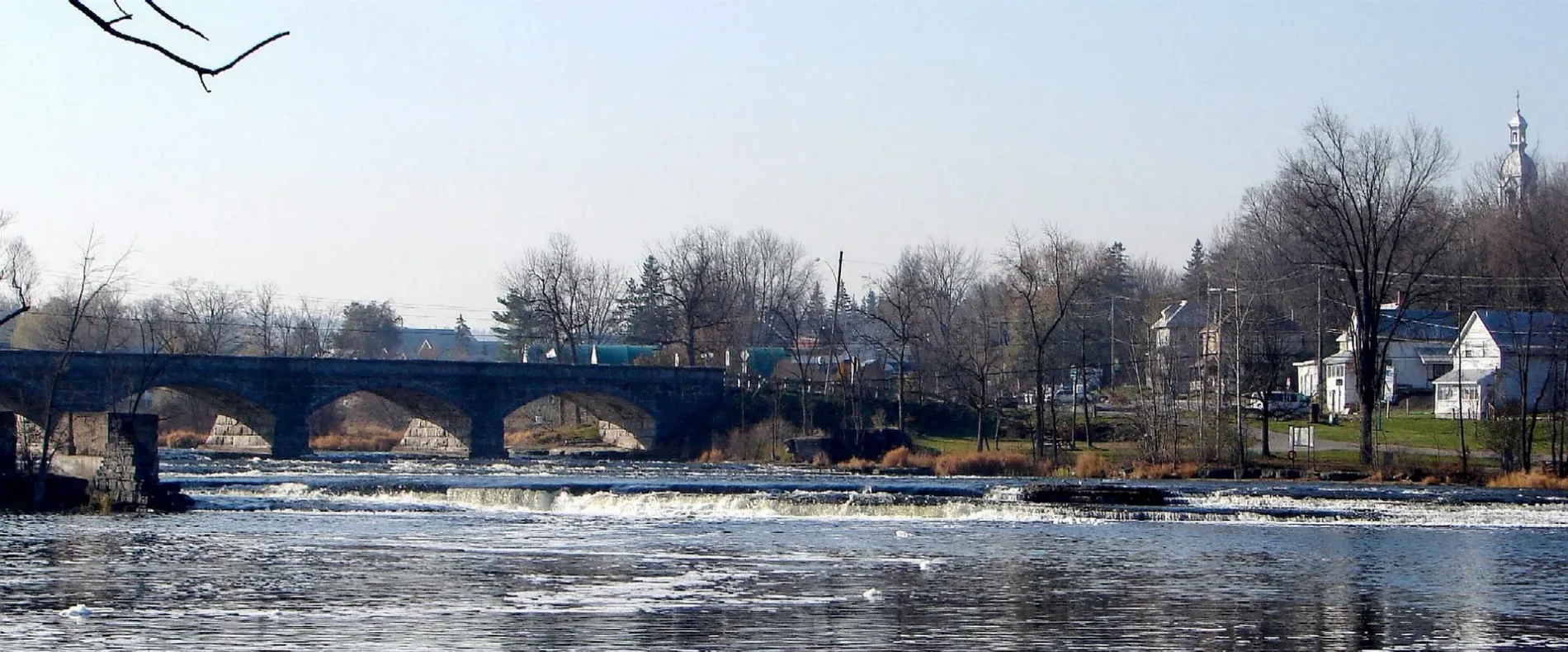
- Waterway Type
- river
Campsite
Attraction
Places of worship
Restaurants
Car repair shops
Post offices
Tourist information offices
Town hall
Farm supplies shops
Clothing shops
Convenience stores
Roads nearby
Hunter Sideroad1,4 km
Fallbrook RoadBalderson United Church
1,5 km
Iron Mine Road1,8 km
Ashby Road1,8 km
MacKay Line Road1,9 km
Bennett Lake Road2,0 km
Walter's Lane2,2 km
Anderson Side Road2,4 km
Fall Crescent2,4 km
McDonalds Corners RoadMcDonald's Corners, McDonald's Corners Post Office
2,5 km
White Water Lane3,6 km
Sheridan Rapids RoadSheridan Rapids
3,9 km
River Mist Lane4,1 km
River Drive4,1 km
Township Boundary Road4,6 km
2nd Concession Dalhousie4,6 km
Bathurst 9th Concession4,7 km
Ennis Road4,7 km
Markle Road4,8 km
1st Concession A Dalhousie5,2 km
Storie Road5,5 km
Forbes Road5,6 km
Mill Road5,6 km
Rothwell Street5,6 km
North Street5,6 km
Foster Drive5,7 km
Affleck Crescent5,7 km
Willis Street5,7 km
Argyle Street South5,7 km
Keays Road5,8 km
Argyle Street5,8 km
Hillier StreetFood Pantry Thrift Store
5,8 km
Old Morris Road5,8 km
Nature nearby
Stewart's Island3,3 km
Apartment buildings nearby
Pinehill Apartments5,7 km
Hillside Apartments5,8 km
Art galleries nearby
Studio Capitanio3,5 km
Body of waters nearby
Upper Mud Lake3,5 km
Clyde River5,5 km
Campsite nearby
Casawinati Campground550 m
Cemeteries nearby
Pinehurst Cemetery900 m
Funeral directors nearby
Blair & Son Funeral Directors5,8 km
Golf courses nearby
Blue Heron Golf Club900 m
Guest house nearby
Clyde Hall Historic Bed & Breakfast5,5 km
Quarries nearby
Crain's Construction Quarry3,7 km
Streams nearby
Bolton Creek2,1 km
North Creek2,4 km
Limekiln Creek2,7 km
Campbell's Creek3,6 km
| Length | 169 |
|---|---|
| Elevation | 73 m |
| Located in | Ottawa, Lanark County, Frontenac County, Lennox and Addington County |
| Country | Canada |
| Origin | Mackavoy Lake |
| Mouth | Ottawa River |
| Tributary | Fall River, Indian River, Clyde River |
 Public transport map Tay Valley Legend
| Railway | |
| Bus | |
| Tram |
 Cycling map Tay Valley Legend
| Cycle path | |
| Cycle lane on road | |
| Cycling on bus lane | |
| Bicycle street | |
| Cyclists allowed | |
| Cyclists allowed, good surface | |
| No cycling | |
| Cobblestones |
| Long-distance cycle route | (depending on scale) | |
| Long-distance cycle route |
 Walking map Tay Valley Legend
| Path |
| Long-distance hiking trail | (depending on scale) | |
| Long-distance hiking trail | ||
| No pedestrians |