
Edward Street in Manotick
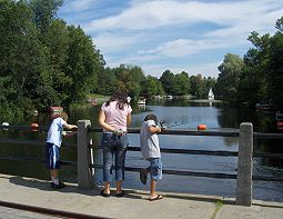
Edward Street in Ottawa, Manotick is a two-lane, asphalted residential street (40 km/h). No sidewalks. It runs in a northeast-southwest direction starting from Long Island Road and crosses North Drive and ends at West River Drive.
- Road Type
- residential street
- Speed Limit
- 40
- Lanes
- 2
- Route
- northeast-southwest
Image
Fast food restaurants
Cafés
Bookshops
Tourist information offices
Bus stops
Roads nearby
Elizabeth Avenue150 m
Sunrise Avenue200 m
North Riverside Drive250 m
Long Island RoadLong Island / Edward, Long Island / Rivreside, Long Island / Cindy Hill, Long Island / Driscoll, Long Island / Lena, Long Island / Riverside, Long Island / West, Long Island / Bridge, Long Island / Elizabeth
250 m
West River Drive250 m
North Drive300 m
Arthur CrescentMimi's In Manotick
350 m
Richard Street350 m
Hilltop Drive350 m
Dickinson Circle400 m
Dickinson StreetHomefront, Merchant Navy, The Clapp Family Barns, Army, Navy, Air Force, Peacekeeping, Family Life, A Square for All Time, Dickinson Square and Manotick, Carriage Shed
400 m
Riverside Crescent500 m
Watson MillThe Mill and Manotick
500 m
West Avenue500 m
Manotick Main StreetManotick Main / Island View, Manotick Main / Century, Manotick Main / Kelly Marie, Manotick, Morning Owl, Manotick Office Pro, Manotick Main / Eastman, Rebel Petal, Urban Design Co., Pizza All'Antica, Angelina, Manotick Main / Firefly, Ottawa Police - Manotick Community Police Centre, Manotick Main / Mahogany Harbour, Discount Tobacco and Grocery Shop, Green Spirit, Main / Mill, Manotick Main / Currier
500 m
Rideau Valley DriveRideau Valley / Prince Of Wales
500 m
Clapp LaneTerra Plants & Flowers, 6 Tigers Academy, Watson's Mill Used Book Store
550 m
Bankfield Road550 m
Maple AvenueMaple / Scharfield
550 m
Apartment buildings nearby
The Miller Seniors Apartments450 m
Banks nearby
RBC500 m
Beauty salons nearby
Spa Nails450 m
Cannabis shops nearby
High Ties450 m
Commercial buildings nearby
Mill Centre500 m
Manotick School of Music550 m
Royal LePage550 m
Convenience stores nearby
Circle K450 m
Dams nearby
Watson's Mill Dam500 m
Detached houses nearby
Builder Software Tools550 m
Tri-Natural Products550 m
Coldwell Banker550 m
Fast food restaurants nearby
Subway450 m
Hairdresser's nearby
First Choice Haircutters450 m
Museum nearby
Watson's Mill500 m
Parks nearby
Bracken Field100 m
West River Drive Park250 m
Hilltop Park300 m
White Horse Park350 m
A.Y. Jackson Park400 m
Manotick Remembrance Park450 m
Places of worship nearby
Ottawa Agape Chinese Alliance Church300 m
St. James' Anglican Church500 m
Restaurants nearby
Mano City Pizza450 m
CreekSide Bar & Grill500 m
Retail areas nearby
Manotick Mall500 m
Rivers nearby
Rideau River650 m
School buildings nearby
Manotick Public School200 m
Social facilities nearby
Manotick Place Retirement Community450 m
Sports pitches nearby
Ball Diamond150 m
Public transport map Manotick Legend
| Railway | |
| Bus | |
| Tram |
Cycling map Manotick Legend
| Cycle path | |
| Cycle lane on road | |
| Cycling on bus lane | |
| Bicycle street | |
| Cyclists allowed | |
| Cyclists allowed, good surface | |
| No cycling | |
| Cobblestones |
| Long-distance cycle route | (depending on scale) | |
| Long-distance cycle route |
Walking map Manotick Legend
| Path |
| Long-distance hiking trail | (depending on scale) | |
| Long-distance hiking trail | ||
| No pedestrians |