
Alexander Street in Brampton
Alexander Street in Brampton is a two-lane, asphalted residential street (50 km/h). It runs in a northeast-southwest direction starting from Union Street and ends at Main Street North. Alexander Street also exists in Durham Region, Niagara Region and Halton Region.
- Road Type
- residential street
- Lanes
- 2
- Speed Limit
- 50
- Route
- northeast-southwest
Image
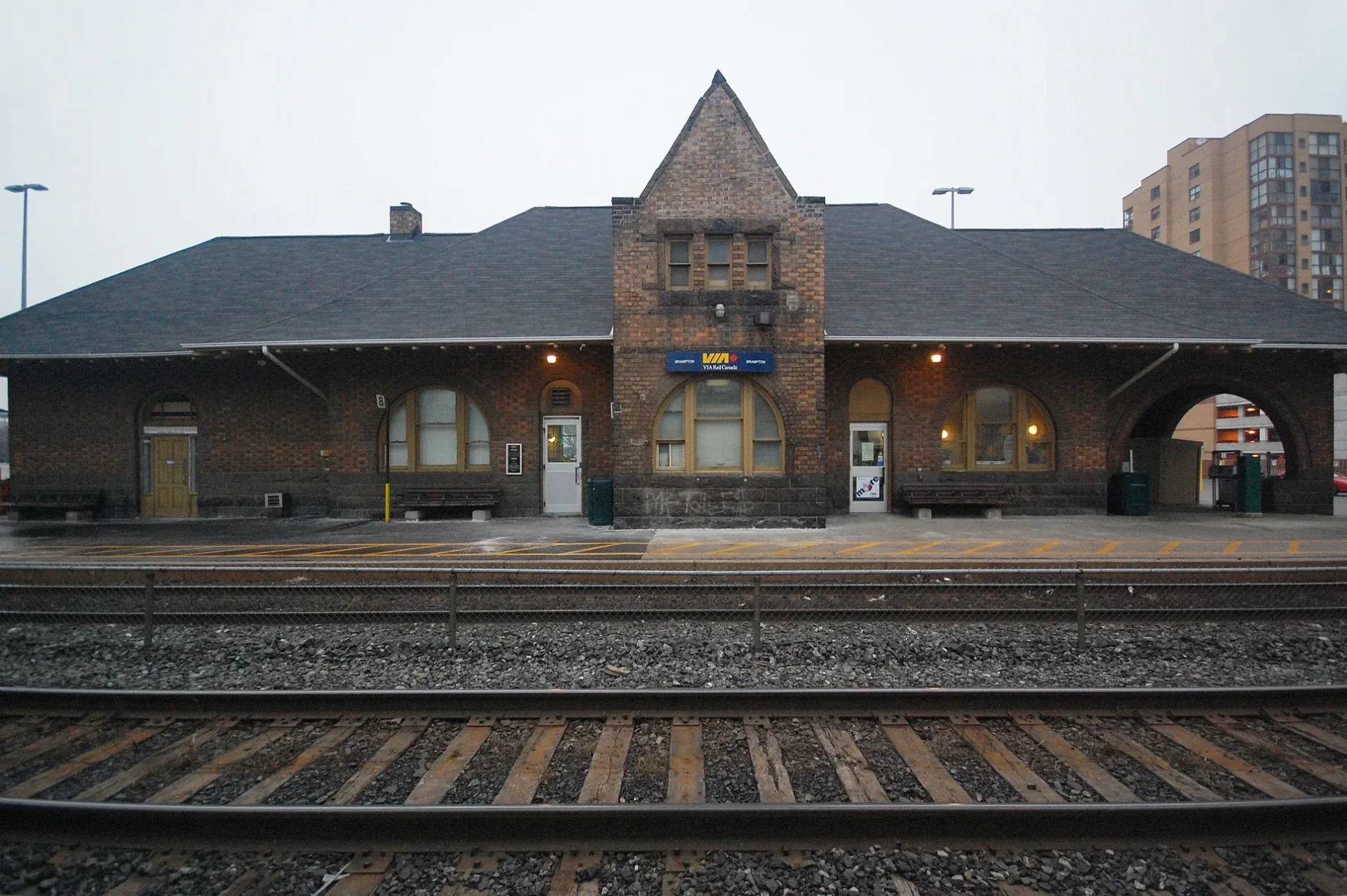
Convenience stores
Laundries
Platforms
Stations
Bus stops
Restaurants
Fast food restaurants
Doctor's office
Vending machines
Dentist
Roads nearby
Church Street WestSushi House
250 m
Ken Whillans Drive300 m
Etobicoke Creek TrailChargePoint, Rotary Centennial Garden
300 m
Downtown Brampton TerminalDowntown Terminal Route 1/1A/561 WB, Brampton Downtown Terminal GO Bus, Downtown Terminal Route 52 SB, Brampton Innovation District, Brampton Downtown Bus Terminal, Downtown Terminal Route 1/1A EB, Downtown Terminal Route, Downtown Terminal Route 501/501A EB
350 m
Nelson Street EastDry Cleaning and Laundry
350 m
Nelson Street WestRia, Dawson Dental
350 m
Main Street NorthDavid-Andrew Gentlemen Clothiers, Hooper's Pharmacy, Tadka King, Algoma University, Dental Office, Pawn Kings, Main St at Sproule Dr, A Healing Place Health Centre, Main St N at Rosedale Ave, Brampton East Medical Group/Queenwest Medical Associates, Main St. Pharmacy, Main St N at Brickyard Way, Main St s/of Bovaird Dr, National Bank, Pioneer, Sharmz, Main St N at Church St, Nelson Zum Main Station Southbound, Theatre Lane Zum Main Station Northbound, Cristina's Bakery & Grill, Spicy Island Jerk, Main St & Nelson St, Main Street North of Nelson Street, Bovaird, Main St. N. @ Bovaird Dr. W., Brampton City Hall - McArter Lane Entrance, Wellington ZUM - SB - Bike Rack, Main St N at Queen St W, Main St N n/of Queen St E, Garden Square, Main St & Williams Pkwy, Gino's Pizza, Crown & Anchor, Nails & Spa's Galaxy, I.D.A., Mane Attraction Hair Studio, Al-Ameen Elementary School, Golden Grains Bakery, Portas Do Mar Bar & Grill, Marca College, Once Upon a Child, Main St N btwn Brickyard Way & Quarry Edge Dr, Main St. N. @ Williams Pkwy., Beauty Supply Outlet, Main St N at English St, Sol de Ora Tanning & Sp, Vin Bon, Evolve Financial, Sonique Hair Design, Ladies' Facial & Spa, Dia Dentistry, Shawarma Point Wingz N Thingz, African Royal Foods, Thistle Pharmacy, Chennai Express, Golden Tattoo Parlour, Subway, Fat Bastard Burrito, Toshi Japanese Restaurant, Expedia CrusieShipCentres, Shawarma Queen, Dosa Den, Main St N at Gillingham Dr, Main St N at Quarry Edge Dr, Pay2Day, King's Point Plaza Canada Post, Main St s/of Brickyard Way, Main St. N. @ Vodden St. W., Main St. N. @ Vodden St. E., Money Mart, Punjabi Chaap Corner, Vodden Medical Pharmacy, Harvey's, EYES Childcare
350 m
Union Street400 m
Theatre LaneRose Theatre Parking Garage, BMO, Algoma University
400 m
Vivian Lane400 m
George Street North400 m
McKinney LaneThe Wee Smoke Shop
450 m
George StreetGeorge’s Corner Store, LCBO, Sushi Brampton, Fanzorelli's Restaurant & Lounge, Grillies, North American School
500 m
Diplock LaneNelson Square Parking Garage
500 m
McArter LaneLot 25, Subway
500 m
Scott Street500 m
Dalton LaneThe Palace Beauty Supplies Inc.
550 m
Carnegie Lane550 m
Queen Street WestRBC, Trish Juice, Mississauga Rd & Queen St, McMurchy - Zum Queen West Station Stop WB, Queen St W at Mercer Dr, Queen St W opp Mercer Dr, Eazy Auto Service, Avicenna Medical Arts Building, Castlemore Auto Sales, Queen St W at Park St, Mint Eyecare, Little Bloomers Childcare Centre, Knowledge Bookstore, Brampton’s Main Opticians, Mississauga Rd - Zum Queen West Station Stop WB, TD, Züm Chinguacousy, Lazeez Shawarma, Queen St W at Sobey's Entrance (WB), Sherwin-Williams, Freedom Mobile, Queen St W e/of Major William Sharpe, Chinguacousy - Zum Queen West Station Stop WB, Queen St W at Elizabeth St S, Sun Health Care, Dental Centre, Queen St W e/of Lockwood Rd, Creditview - Zum Queen West Station Stop WB, Creditview - Zum Queen West Station Stop EB, Queen St opp Elbern Markell Dr, Guardian, Queen St W at Mill St N, Blouds Dispensary, Pharmasave, Sarbat Foods Indian Cuisine, McLaughlin - Zum Queen West Station Stop WB, McLaughlin - Zum Queen West Station Stop EB, Queen St w/of Royal West Dr, Queen St opp Links Lane, Queen St W w/of Links Lane, Shawarma King, Eggsmart, Subway, #9 Auto Sales Ltd., Queen St W w/of Drinkwater Rd, Queen St W w/of Angelgate Rd
550 m
Main Street SouthBrampton, TD Canada Trust, Scotiabank, Dare Law, Brampton City Hall, Eastwood Psychologists, Main St & Nanwood Dr, Mr. Sub, Country Style, Gateway Terminal, Platform 10 at Brampton Gateway Terminal, 11, 12, 13, 14, Platform 15 at Brampton Gateway Terminal, Bell Canada, Petro-Canada, Swag Hair, Pho Viet Nam, Pita Pit, Benjamin Moore, Gypsy Queen, Blade Runner Barber Shop, Pizzanini, Money Hut, Nanwood Dental, Delhi Hub Restaurant, Ganjika House, Munchies, Bukhara Grill, Pizza Pizza, Clarence Street, Wellington
550 m
Maple Avenue550 m
Harmsworth Lane9 Queen Chinese
550 m
Chapel StreetHanh Heritage Spa, Christ Embassy
600 m
Daily Times Square600 m
John StreetJohn St Parking Garage, John Street Parking
600 m
Buffy LaneIce Cream Cafe
600 m
Buildings nearby
Heritage Theatre350 m
Apartment buildings nearby
Grace Court Seniors450 m
Arts centres nearby
The Rose Theatre Brampton450 m
Buildings nearby
Brampton Arts Council100 m
Car parks nearby
Nelson Square Parking Garage500 m
Car repair shops nearby
Barry’s Auto Repair & Service250 m
Civic buildings nearby
Carnegie Library550 m
Commercial buildings nearby
Goodison Building450 m
Fire stations nearby
Old Fire Hall550 m
Fountains nearby
Lorna Bissel Fountain450 m
Libraries nearby
Brampton Library - Four Corners Branch500 m
Military buildings nearby
Brampton Armoury600 m
Museum nearby
Lorne Scots Regimental Museum600 m
Office buildings nearby
I.T.F. Centre400 m
Parks nearby
Central Public School Recreation and Art Centre100 m
Scott Street Parkette350 m
Rosalea Park400 m
Erine Mitchell Park550 m
Places of worship nearby
Grace United Church150 m
Railway lines nearby
Halton Subdivision300 m
Sports centres nearby
YMCA350 m
Sports pitches nearby
Brampton Tennis Club300 m
Other nearby
Garden Square450 m
Public transport map Brampton Legend
| Railway | |
| Bus | |
| Tram |
Cycling map Brampton Legend
| Cycle path | |
| Cycle lane on road | |
| Cycling on bus lane | |
| Bicycle street | |
| Cyclists allowed | |
| Cyclists allowed, good surface | |
| No cycling | |
| Cobblestones |
| Long-distance cycle route | (depending on scale) | |
| Long-distance cycle route |
Walking map Brampton Legend
| Path |
| Long-distance hiking trail | (depending on scale) | |
| Long-distance hiking trail | ||
| No pedestrians |