Niagara Region

This page is the City map of Niagara Region, a regional municipality in Ontario, Canada, showing streets, roads, paths and places across the area. Located in the Golden Horseshoe between Lake Ontario and Lake Erie, the region covers approximately 1,854.2 square kilometres. About 447,888 people lived in Niagara Region in 2016, and the regional municipality was established in 1970. Niagara Region is divided into 12 municipalities, including the cities of St. Catharines, Niagara Falls, Welland, Thorold and Port Colborne.

City map Niagara Region
Jarek Tuszyński, CC BY-SA 3.0 – Wikimedia Commons
City map Welland
User:Qviri, Public domain – Wikimedia Commons

Welland

Welland is a city in Niagara Region with a population of 52,293 and an elevation of approximately 179 metres. The city was established in 1788 and lies on the Welland Canal, the major navigation route connecting Lake Ontario with Lake Erie.

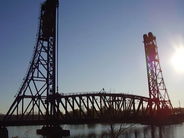
The Welland Canal crosses the Niagara Peninsula through a series of locks and has long influenced the city’s industrial and transport geography. Welland is located south of St. Catharines and north of Port Colborne within the central part of Niagara Region.

City map St. Catharines
Matt0401, Public domain – Wikimedia Commons

St. Catharines

St. Catharines is the largest city in Niagara Region, with a population of 136,803 and an area of approximately 97 square kilometres. The city was established in 1783 and has an elevation of about 98 metres near the southern shore of Lake Ontario.

St. Catharines is situated close to the Welland Canal and the Niagara Escarpment, which extends across southern Ontario. The city forms a major urban centre between Hamilton to the west and Niagara Falls to the east.

City map Lincoln
The original uploader was Chiaro at English Wikipedia ., CC BY-SA 3.0 – Wikimedia Commons

Lincoln

Lincoln is a town in Niagara Region with a population of 23,787, established in 1788. It occupies part of the Niagara Peninsula between the southern shore of Lake Ontario and the Niagara Escarpment.

The town includes communities such as Beamsville, Vineland and Jordan, and its landscape contains vineyards, orchards and agricultural land. Lincoln is connected with the Twenty Mile Creek watershed, which reaches Lake Ontario near Jordan Harbour.

City map Pelham
No machine-readable author provided. Terfili assumed (based on copyright claims)., Public domain – Wikimedia Commons

Pelham

Pelham is a town in central Niagara Region with a population of 17,110. The municipality lies south of St. Catharines and west of Welland, with settlements including Fonthill and Fenwick.

Pelham extends across the Niagara Escarpment, a limestone and dolostone landform that crosses the Niagara Peninsula. Fonthill is located on the Fonthill Kame, a distinctive glacial deposit that forms one of the higher local areas in Niagara Region.

City map Thorold
Gogerr, CC BY-SA 4.0 – Wikimedia Commons

Thorold

Thorold is a city in Niagara Region with a population of 23,816, an area of approximately 83 square kilometres and an elevation of about 162 metres. The city was established in 1850 and is located along the Welland Canal south of St. Catharines.

Thorold contains several locks of the Welland Canal, including the flight of locks that raises vessels through the Niagara Escarpment. The municipality also includes the historic downtown area and the former industrial corridor along the canal.

City map Niagara-on-the-Lake
Paste Let’s have a chat. / Paste at English Wikipedia, CC BY-SA 3.0 – Wikimedia Commons

Niagara-on-the-Lake

Niagara-on-the-Lake is a town at the mouth of the Niagara River, where the river flows into Lake Ontario. It has a population of 17,511, an area of approximately 132.83 square kilometres and an elevation of about 5 metres.

The town was established in 1781 and was known as Newark during part of the late 18th century. Its historic district contains buildings associated with the early settlement of Upper Canada, while Fort George preserves a major military site from the War of 1812.

City map Niagara Falls
Jason Pratt, CC BY 2.0 – Wikimedia Commons

Niagara Falls

Niagara Falls is a city in Ontario with a population of 88,071, an area of approximately 209.71 square kilometres and an elevation of about 173 metres. The city was incorporated in 1903 and lies on the Niagara River beside the international border with the United States.

The Niagara Falls consist of Horseshoe Falls, American Falls and Bridal Veil Falls, where the Niagara River drops between Lake Erie and Lake Ontario. Niagara Falls State Park in New York and Queen Victoria Park in Ontario are located on opposite sides of this internationally known natural landmark.

City map Fort Erie
Óðinn, CC BY-SA 3.0 – Wikimedia Commons

Fort Erie

Fort Erie is a town on the Niagara River at the eastern end of Lake Erie, with a population of 30,710. The municipality lies directly across the river from Buffalo, New York, and forms part of the southern boundary of Niagara Region.

Old Fort Erie is a reconstructed military fortification associated with the War of 1812, including the 1814 siege and battle. The Peace Bridge connects Fort Erie with Buffalo and carries road traffic across the Niagara River between Canada and the United States.

City map Grimsby
Óðinn, CC BY-SA 2.5 ca – Wikimedia Commons

Grimsby

Grimsby is a town on the western edge of Niagara Region with a population of 28,883 and an area of approximately 68.71 square kilometres. It lies on the southern shore of Lake Ontario, between Hamilton and Lincoln.

The Niagara Escarpment rises south of the town, while Forty Mile Creek flows through Grimsby to Lake Ontario. The town’s location between the lake and the escarpment places it within the narrow urban and agricultural corridor of the western Niagara Peninsula.

City map Port Colborne
Mhsheikholeslami, CC BY-SA 4.0 – Wikimedia Commons

Port Colborne

Port Colborne is a city on the northern shore of Lake Erie with a population of 18,306 and an elevation of approximately 175.3 metres. The city occupies the southern terminus of the Welland Canal, where the waterway meets Lake Erie.

Port Colborne developed around canal shipping, harbour facilities and industrial activity connected with the Great Lakes. The municipality extends east and west along Lake Erie and is located south of Welland and Wainfleet.

City map Wainfleet
JFVoll, CC BY-SA 4.0 – Wikimedia Commons

Wainfleet

Wainfleet is a rural township municipality in Niagara Region with a population of 6,372 and an elevation of about 177 metres. It extends along the north shore of Lake Erie between Port Colborne and the eastern boundary of Niagara Region.

The township includes agricultural areas, woodland and wetlands associated with the Lake Erie shoreline. Wainfleet is also connected with the Wainfleet Bog, one of the remaining wetland landscapes on the Niagara Peninsula.

City map West Lincoln Township
Magnolia677, CC BY 4.0 – Wikimedia Commons

West Lincoln Township

West Lincoln Township is a township municipality in western Niagara Region with a population of 14,500 and an elevation of approximately 181 metres. It borders Lincoln to the east and extends northward toward Lake Ontario.

The municipality includes rural communities such as Smithville and lies within the agricultural landscape between the Niagara Escarpment and Lake Ontario. Twenty Mile Creek passes through West Lincoln before continuing toward Lincoln and Lake Ontario.

Data sources: OpenStreetMap (ODbL), Wikidata (CC0) · Image: Wikimedia Commons

Niagara Region – Facts

Inhabitants 447888
Area 1854.2 km²
Subregions 12
Inception 1970
Located in Ontario
Country Canada
Native label Niagara Region
Website http://www.niagararegion.ca/

Data source: Wikidata (CC0)

Important and frequently searched streets
Perma Court Wallace Street Devon Street