
Skálatrøð in Tórshavn
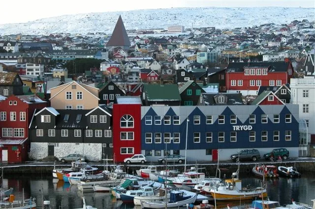
Skálatrøð in Streymoyar sýsla is an asphalted residential street. No sidewalks. There is no cycle path. It runs in a northeast-southwest direction starting from Sigmundargøta and ends at Vágsbotnur. In the vicinity, you can find among other things a clothing shop, a DIY store, a charging station and a restaurant. The nearest bus stop in the vicinity is Tróndargøta (approx. 450 m away).
- Bicycle
- yes
- Road Type
- residential street
- Route
- northeast-southwest
Image
Clothing shops
Charging stations
Artwork
Roads nearby
VágsbotnurNólsoyar Páll, Iktys
200 m
BøgøtaGlitnir, Skóhornið, Optikbúðin, Súkkluverkstaðið hjá Gunnari
200 m
Vestara BryggjaMEST - Søla og Eykalutir, Green Travel, Náttúruvísindadeildin, Fróðskaparsetur Føroya
200 m
Trappugøta300 m
Gríms Kambans gøtaNumber 1 Pizza, The Irish Pub
300 m
Undir BryggjubakkaKaffihúsið
300 m
Magnus Heinasonargøta300 m
BryggjubakkiReyði Krossur, Kafe Umami, The Tarv
350 m
TróndargøtaTróndargøta, CityChurch, Salong Annika
350 m
Kirkjuvegur350 m
SverrisgøtaTórshøll, Bassalt, Basecamp, Tógvhúsið, Aroy, Landskrona, RentABike, Koba, Marcopolo, Tutl
350 m
Magnus Heinasonar gøta350 m
Við BojsensgardGamli Bókahandil
350 m
HúsabrúgvCafe Paname
400 m
MylnugøtaHvonn Brasserie
400 m
VagliðTinghúsgarður, Tórshavn
400 m
Niels Finsens gøtaMadar og Kona, Bitin, Hotel Bólid, Býarbókasavnið, Mylnan, Visit Tórshavn, Suppugarðurin, Guðrun & Guðrun, Einstakt, Take Away, Auto taxi, Suðuroyar Sparikassi, Sjónleikarhúsið
400 m
Shops nearby
Polar50 m
Maria Poulsen Búnýti400 m
Banks nearby
Betri Banki450 m
Buildings nearby
Skeiva pakkhús50 m
á Hallarkletti50 m
Gamla Hospitalið100 m
Müllers pakkhús100 m
Sjóvinnuhúsið300 m
Advokatur Kristina Samuelsen300 m
Miðlahúsið300 m
Strúkijarnið300 m
Perlan300 m
Hjá Klett350 m
Reinsaríið350 m
Arnes Minde350 m
Margarinfabrikin350 m
Handilskjarnin450 m
Ebenezer450 m
Cemeteries nearby
á Svínaryggi250 m
Clothing shops nearby
Hjá Kissa400 m
Fast food restaurants nearby
Sentrum400 m
Gallery nearby
Smiðjan í Lítluvík200 m
Listagluggin300 m
Hotels nearby
62°N Hotel City Center300 m
Hotel Tórshavn350 m
Kiosks nearby
Kioskin hjá Astu400 m
Places of worship nearby
Havnar Kirkja350 m
Public buildings nearby
Snarskivan400 m
Supermarkets nearby
Føroya Keypssamtøka350 m
Theatres nearby
Tjóðpallur Føroya350 m
Town halls nearby
Tórshavnar Býráð350 m
Village greens nearby
Tinghús vøllur400 m
Public transport map Tórshavn Legend
| Railway | |
| Bus | |
| Tram |
Cycling map Tórshavn Legend
| Cycle path | |
| Cycle lane on road | |
| Cycling on bus lane | |
| Bicycle street | |
| Cyclists allowed | |
| Cyclists allowed, good surface | |
| No cycling | |
| Cobblestones |
| Long-distance cycle route | (depending on scale) | |
| Long-distance cycle route |
Walking map Tórshavn Legend
| Path |
| Long-distance hiking trail | (depending on scale) | |
| Long-distance hiking trail | ||
| No pedestrians |