
Vestara Bryggja in Tórshavn
Vestara Bryggja in Streymoyar sýsla is a service road and it crosses Rundingur. In the vicinity, you can find a hardware shop, a car hire and a university. The nearest stop in the vicinity is Hornabøur (approx. 100 m away).
- Road Type
- service road
Image
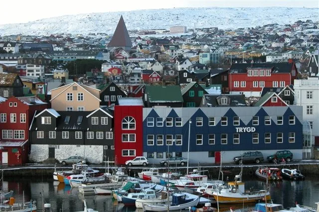
Hardware shops
University
Roads nearby
Skiparagøta100 m
J.C. Svabos gøtaJ.C. Svabos gøta, Hornabøur, Landsbókasavnið, Landssjúkrahúsið
100 m
Hornagøta200 m
Jákups Dahls gøta200 m
SigmundargøtaStudio Bloch, Penthouse Tórshavn
200 m
SkálatrøðØstrøm, Valdemar Lützen, Skálatrøð, Skeiva Pakkhús, Fiskakonan
200 m
NóatúnOvastova, Fróðskaparsetur Føroya
250 m
Rasmusargøta250 m
RundingurJust Drive Car Rental
250 m
Háskúlaveguraurora hair
300 m
Sandagerðsvegur300 m
Símunargøta300 m
Á Frælsinum Cycle PathEirargarður, Frælsið
300 m
VágsbotnurNólsoyar Páll, Iktys
350 m
TinganesTInganes, Reini, Tinganes
400 m
Sandagerðisvegur550 m
Shops nearby
Polar250 m
Attraction nearby
Aquarium750 m
Beaches nearby
Sandagerð700 m
Boathouses nearby
Müllers neyst100 m
Hornaneystið100 m
Boatyards nearby
MEST150 m
Buildings nearby
Sjóvinnuhúsið150 m
Gamla Hospitalið150 m
Müllers pakkhús150 m
Skeiva pakkhús200 m
Magn200 m
á Hallarkletti200 m
Ovastova250 m
Vónin300 m
Háskúlin300 m
Munkastovan350 m
Leigubúðin350 m
Fútahúsini400 m
Bakkapakkhúsið400 m
Sjó- og Vektarbúðin400 m
Portugálið400 m
Reynagarður400 m
Hospitals nearby
Landssjúkrahúsið400 m
Dronning Alexandrines Hospital450 m
Houses nearby
Hornahúsið250 m
Kiosks nearby
Active250 m
Libraries nearby
Landsbókasavnið250 m
Office buildings nearby
Havstovan250 m
School buildings nearby
Vinnuháskúlin200 m
Social facilities nearby
Ellisheimið350 m
University buildings nearby
Náttúruvísindadeildin250 m
Setursskrivstovan300 m
Other nearby
Faroe Islands National Hospital Helipad500 m
Public transport map Tórshavn Legend
| Railway | |
| Bus | |
| Tram |
Cycling map Tórshavn Legend
| Cycle path | |
| Cycle lane on road | |
| Cycling on bus lane | |
| Bicycle street | |
| Cyclists allowed | |
| Cyclists allowed, good surface | |
| No cycling | |
| Cobblestones |
| Long-distance cycle route | (depending on scale) | |
| Long-distance cycle route |
Walking map Tórshavn Legend
| Path |
| Long-distance hiking trail | (depending on scale) | |
| Long-distance hiking trail | ||
| No pedestrians |