
Ayer Rajah Expressway in Greater Southern Waterfront
Ayer Rajah Expressway in Bukit Merah is a two-lane, asphalted, lit motorway (80 km/h) and it crosses a bridge. It runs in an east-west direction and crosses Central Expressway. It connects Telok Blangah Rise, Depot Road, Greater Southern Waterfront and Telok Blangah Way. Ayer Rajah Expressway is also known as Keppel Viaduct. This road is part of the long-distance road "AYE". Ayer Rajah Expressway also exists in Everton Park, Alexandra Hill and Bukit Merah. Ⓦ.
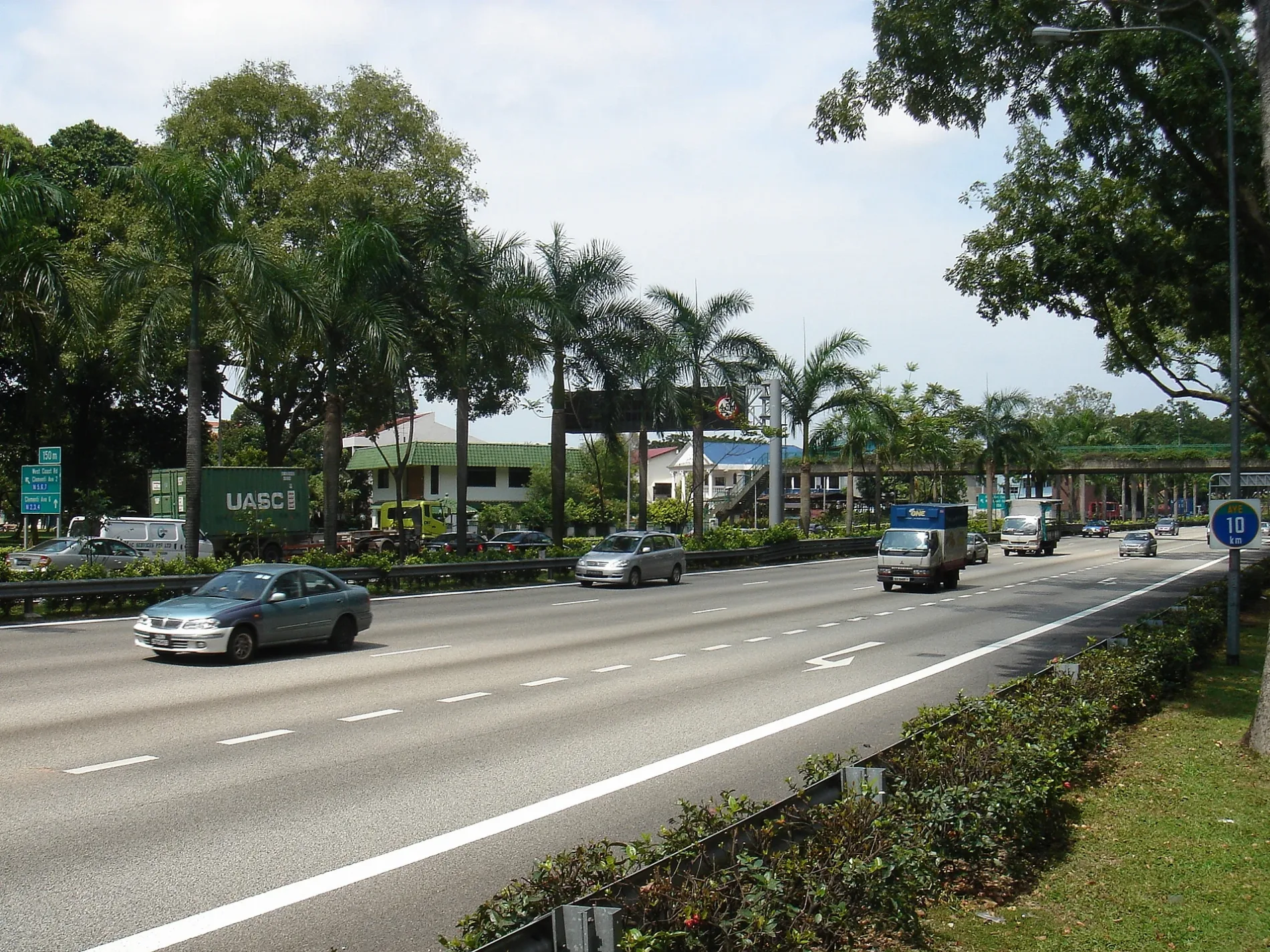
- Road Type
- motorway
- Speed Limit
- 80
- Lanes
- 2
- Route
- east-west
Bus stops
- bus lines 502, 647, 649, 651, 653, 657, 667, 674, 684
Restaurants
Museum
- SAM at Tanjong Pagar Distripark (Singapore Art Museum, opening hours: Mon–Sun 10–19, fee required, web) at Keppel Road 39 – approx. 850 m.
Convenience stores
Roads nearby
Rail CorridorCantonment
100 m
Bukit Teresa Road150 m
Kampong Bahru RoadMelati Blk 2, Opposite Melati Blk 2
200 m
Silat Avenue250 m
Spooner RoadRailway corridor entry point
350 m
Silat RoadTanjong Pagar Neighbourhood Police Post
400 m
Kampong Bahru Bus TerminalKampong Bahru Terminal, NTWU canteen
400 m
College Road450 m
Bukit Purmei AvenueBlk 109, Radin Mas, Opposite Blk 109, Telok Blangah Rise
450 m
Jalan Bukit MerahOpposite Blk 140, Opposite Blk 149
450 m
Macalister RoadMulti Storey Car Park H, Open Car Park H
450 m
Central Expressway450 m
Raeburn Park550 m
Bukit Teresa Close550 m
Hospital BoulevardOutram Community Hospital, West Entrance, Koufu, Fairprice Xpress
550 m
Ayer Rajah ExpresswayKeppel
550 m
Keppel Terminal AvenueSIP at SAM
600 m
Bukit Purmei Road650 m
Sentosa Gateway Tunnel650 m
West Coast HighwayKeppel Distripark Blk 517, Keppel Station Exit 2, Keppel (CCL)
650 m
Lower Delta RoadThe Pearl @ Mount Faber
700 m
Mount Faber RoadPoland's Bells of Happiness (Dar Pomorza), Bell of Happiness, Faber Peak, Cable car tickets, Arbora
700 m
Telok Blangah RiseTelok Blangah Rise Food Centre, Blk 36 Market/Food Centre, Blk 28, Blk 41
700 m
Keppel Drive 5Greater Southern Waterfront
800 m
Keppel RoadKeppel (CCL), Opposite Cantonment Station Exit 4, Keppel, SAM at Tanjong Pagar Distripark, Prestige Gallery, Opposite Keppel Distripark Blk 517, Cantonment (CCL), New Art Museum Singapore, Keppel Workshop, After Cantonment Road, Ya Hua Bak Kut Teh, Lok Fu, Keppel Station Exit 3
850 m
Keppel Drive 6900 m
Artwork nearby
Saint Theresa250 m
Buildings nearby
Transit Point @ 3 Spooner250 m
Peace I Bequeath To You...250 m
Kampong Bahru Substation500 m
Churches nearby
St. Teresa's Centre300 m
Commercial areas nearby
Keppel Distripark100 m
LHN Space500 m
Garageses nearby
Kampong Bahru Bus Termiinal400 m
Hotels nearby
Harbour Ville Hotel350 m
Industrial areas nearby
Keppel Terminal500 m
Parks nearby
Silat Avenue Park250 m
Places of worship nearby
Church of St. Teresa200 m
Tang Gah Beo Temple250 m
Tai Yeong Kong Temple400 m
Silat Road Sikh Temple450 m
Religious buildings nearby
Carmelite Monastery450 m
Residential areas nearby
Bukit Purmei Ville250 m
Avenue South Residence300 m
Harbour Suites350 m
Retail buildings nearby
Black & Walnut550 m
Stations nearby
Keppel500 m
Cantonment750 m
Subway lines nearby
North East Line400 m
Circle Line (CC)450 m
| Inception | 1983 |
|---|---|
| Country | Singapore |
Public transport map Greater Southern Waterfront Legend
| Railway | |
| Bus | |
| Tram |
Cycling map Greater Southern Waterfront Legend
| Cycle path | |
| Cycle lane on road | |
| Cycling on bus lane | |
| Bicycle street | |
| Cyclists allowed | |
| Cyclists allowed, good surface | |
| No cycling | |
| Cobblestones |
| Long-distance cycle route | (depending on scale) | |
| Long-distance cycle route |
Walking map Greater Southern Waterfront Legend
| Path |
| Long-distance hiking trail | (depending on scale) | |
| Long-distance hiking trail | ||
| No pedestrians |