
Ayer Rajah Expressway in Kampong Tiong Bahru
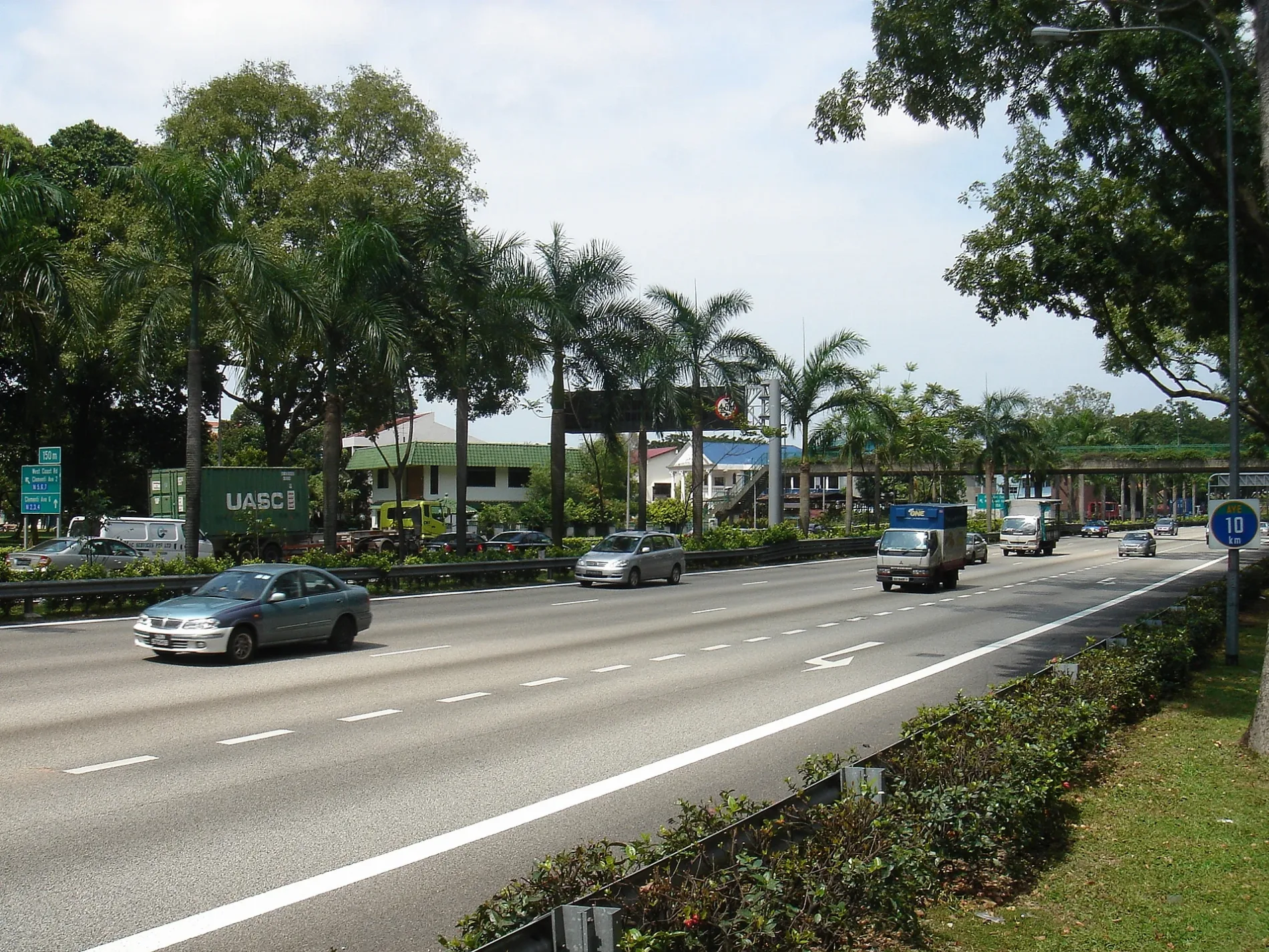
Ayer Rajah Expressway in Bukit Merah is a two-lane, asphalted motorway (80 km/h) and crosses a bridge. It runs in an east-west direction starting from Central Expressway and connects Bukit Merah, Kampong Tiong Bahru and Alexandra Hill. Ayer Rajah Expressway is also known as Keppel Viaduct. This road is part of the long-distance road "AYE". The nearest bus stop in the vicinity is Keppel Workshop (approx. 50 m away). Ayer Rajah Expressway also exists in City Terminals, Telok Blangah Rise, Telok Blangah Way and Depot Road. Ⓦ.
- Alternative Name
- Keppel Viaduct
- Road Type
- motorway
- Lanes
- 2
- Speed Limit
- 80
- Route
- east-west
Bus stops
- bus lines 651, 653, 657, 667, 674, 868, 982E
Attraction
Clothing shops
Cafés
Subway stops
Museum
- SAM at Tanjong Pagar Distripark (Singapore Art Museum, opening hours: Mon–Sun 10–19, fee required, web) at Keppel Road 39 – approx. 300 m.
Fast food restaurants
Convenience stores
Roads nearby
Raeburn Park100 m
Spottiswoode Park RoadCantonment, Everton Park
300 m
Keppel Terminal AvenueSIP at SAM
350 m
Kampong Bahru Bus TerminalKampong Bahru Terminal, Ntwu canteen
400 m
Keppel RoadOpposite Former Railway Station, Keppel, SAM at Tanjong Pagar Distripark, Opposite Keppel Distripark Blk 517, New Art Museum Singapore, Keppel Workshop, After Cantonment Road, Ya Hua Bak Kut Teh, Lok Fu, Tanjong Pagar Distripark Blk F5
450 m
Rail Corridor500 m
Kampong Bahru RoadStrangers' Reunion Waffles, Cheers, Costumes 'n' Parties, DDD Club, Red Dot Pub, 万歌舞酒廊, Highlander Coffee, Old Boys Gallery, Art of Drinking, Cellarbration, Nine, Siam Secret, The Attic by SG Montessori #02-03, Dolç Patisserie, Dolc Patisserie, Before Kampong Bahru Terminal, Canadian Pizza, EAT.DRINK.MAN.WOMAN, 经典, Highball, 缤纷年代
500 m
Spooner RoadRailway corridor entry point
500 m
Jalan Bukit MerahBlk 140, Good Chance Pohpiah, Mao Medical Center & Surgery, ACE Marketplace, Golden Hostel, Round Boy Roasters, Rain Forest 149 Hostel, GHK Food House, Blk 149, Blk 111
500 m
West Coast HighwayKeppel Distripark Blk 517, Opposite Tanjong Pagar Distripark Blk F5
550 m
Keppel Drive 5City Terminals
550 m
Blair RoadYa-Mahyuddin Al-Jailani Restaurant
550 m
Everton RoadEverton Park, Cantonment Towers
600 m
Hospital BoulevardWest Entrance, Koufu, Fairprice Xpress, Outram Community Hospital
600 m
Silat Avenue650 m
Hospital CrescentNational Cancer Centre Singapore, The Coffee Bean & Tea Leaf, Noel Gift, 7-Eleven, Mr Bean, Triplets, Kaffe & Toast, SGH Block 4 Entrance, Singapore General Hospital, Singapore General Hospital Block 3, SG Hawker, National Cancer Centre Singapore Entrance
650 m
Neil RoadThe Audacious Cakery, Central Narcotics Bureau, Walnut Tree, EssentialPlus, Miz Japanese Restaurant, Chef Icon, Ar-Rahman, Home Ground Pub, Kevin's, Orio, Dollhouse Pets, Wang Tian Kitchen, 7-Eleven, Double Shot Coffee Kampong Bahru, Blk 3, Aroy Mookata
650 m
College Road650 m
Hospital DriveKaffe & Toast, National Heart Centre Singapore, Starbucks
650 m
Cantonment LinkBlk 16
700 m
Eu Tong Sen StreetAfter Hospital Drive, Outram Park Station Exit 6/SGH
700 m
New Bridge RoadOutram Park, Criminal Investigation Department, Commercial Affairs Department, Before Neil Road
700 m
Apartment buildings nearby
Kemuning550 m
Melati600 m
Buildings nearby
New Hope Community Services500 m
Gel600 m
Car parks nearby
Cantonment Towers650 m
Commercial areas nearby
Keppel Distripark600 m
Constructions nearby
Circle Line Stage 6 Station worksite650 m
Garageses nearby
Kampong Bahru Bus Termiinal450 m
Hospitals nearby
Singapore General Hospital Emergency Building600 m
Outram Community Hospital650 m
Blk 1 (A&E)650 m
Industrial areas nearby
Keppel Terminal200 m
Museum nearby
Baba House650 m
Office buildings nearby
SingHealth Tower650 m
Parks nearby
Silat Avenue Park600 m
Places of worship nearby
Silat Road Sikh Temple550 m
Railway stations nearby
Former Tanjong Pagar Railway Station550 m
Railways under construction nearby
Circle Line (CC)600 m
Residential areas nearby
Spottiswoode Park Estate350 m
Spottiswoode Residences500 m
Spottiswoode 18550 m
Spottiswoode Suites600 m
Sky Everton650 m
Retail buildings nearby
Black & Walnut150 m
Stations nearby
Cantonment200 m
Keppel400 m
Subway lines nearby
North East Line250 m
| Inception | 1983 |
|---|---|
| Length | 27 |
| Country | Singapore |
Public transport map Kampong Tiong Bahru Legend
| Railway | |
| Bus | |
| Tram |
Cycling map Kampong Tiong Bahru Legend
| Cycle path | |
| Cycle lane on road | |
| Cycling on bus lane | |
| Bicycle street | |
| Cyclists allowed | |
| Cyclists allowed, good surface | |
| No cycling | |
| Cobblestones |
| Long-distance cycle route | (depending on scale) | |
| Long-distance cycle route |
Walking map Kampong Tiong Bahru Legend
| Path |
| Long-distance hiking trail | (depending on scale) | |
| Long-distance hiking trail | ||
| No pedestrians |