
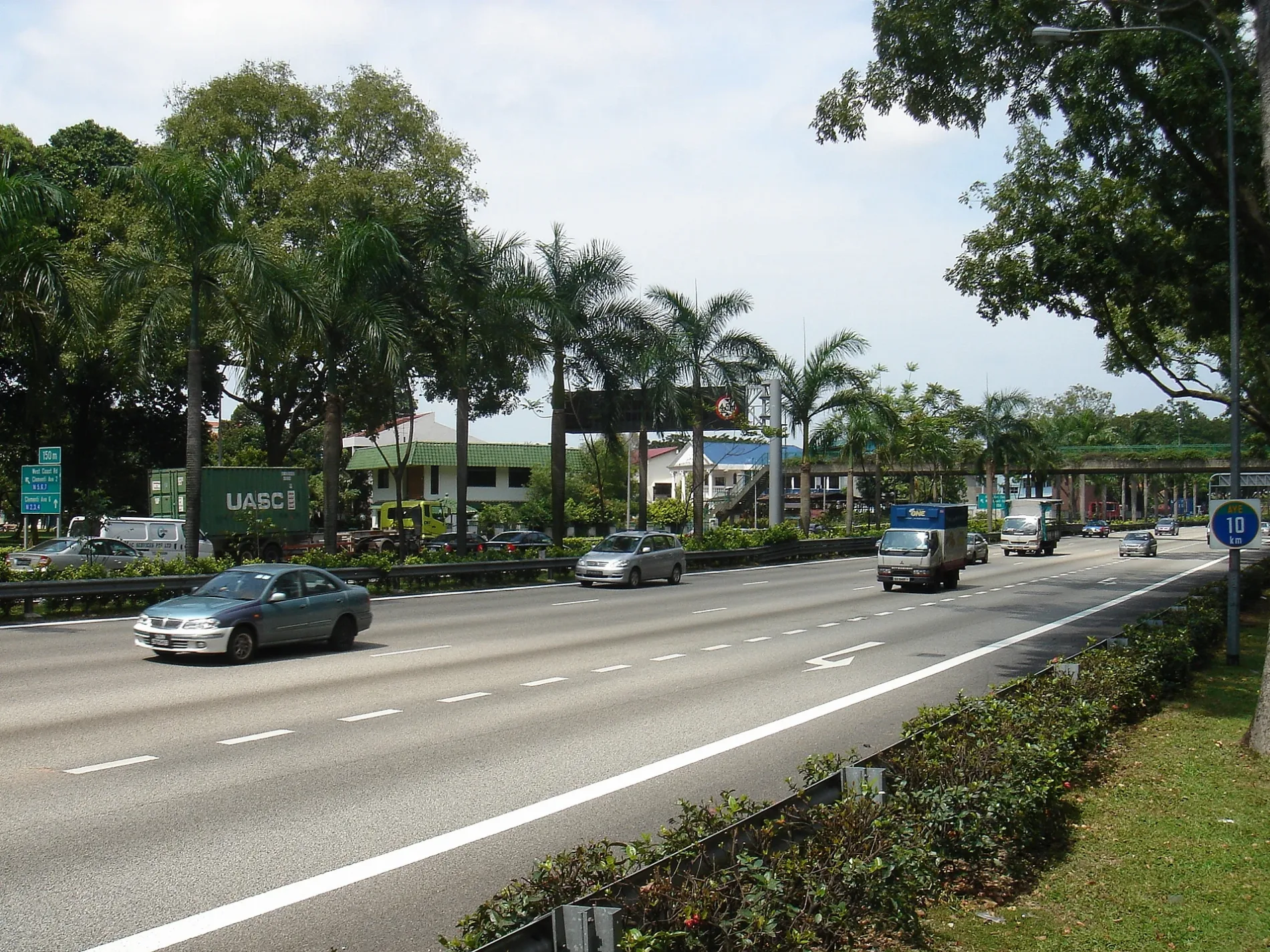
Clementi Road in National University of Singapore
Clementi Road in Queenstown is a three-lane, asphalted main road (60 km/h) and it crosses a bridge. It runs in a north-south direction and crosses Commonwealth Avenue West, Dover Road, Kent Ridge Crescent, Kent Ridge Terminal, Pasir Panjang Road, West Coast Road, West Coast Ferry Road and Clementi Avenue 2. It connects National University of Singapore, Singapore Polytechnic, Dover, Pasir Panjang 1 and Port. This road is part of the long-distance road "AH2". The nearest stops are Before Kent Ridge Terminal, The Japanese Primary School, SDE3 and Coll of Design & Engrg. The bus lines 33, 33A, 95, 96, 96A, 151, 183, 188, 188e, 196, A1, A2, E and K serve this stop.
- Road Type
- main road
- Lanes
- 4
- Speed Limit
- 60
- Route
- north-south
Image
Bus stops
- bus lines 33, 33A, 95, 96, 96A, 151, 183, 188, 188e, 196, A1, A2, E, K
Roads nearby
The Verandahdrop off zone, Housing Office
250 m
Ayer Rajah ExpresswayOpp NUS Sports Ctr, College Clinic, College Clinic Pickup/Dropoff, Kurt Hahn House (UWCSEA Dover Campus)
250 m
College LinkUniversity Town
350 m
Engineering Drive 1Spinelli
350 m
College Avenue WestYale-NUS Black Box Theatre, Lecture Theatre 1, Yale-NUS Performance Hall, Tan Chin Tuan Lecture Theatre, Saga College, A, UTown Auditorium 2, chicken rice, Korean, Noodles, Cendana College, Cendana Dining Hall, Bismillah Biryani, Dance Studio
350 m
College Link Walkway350 m
Conservatory DriveYSTCM Concert Hall, Carpark 3, Music Library
350 m
College Avenue EastScooter Station
400 m
Sandwich Road450 m
Create WayMaya Angelou House (UWCSEA Dover Campus), The Royals Bistro, Mala, Indian, Chinese mixed veg, UTown Auditorium 1, Udon Don Bar, Cheers, Chop Chop
500 m
Apartment buildings nearby
Blk I200 m
Blk H250 m
Blk G300 m
Artwork nearby
NUS THE BEST CAMPUS LIFE350 m
Buildings nearby
Education Resource Centre300 m
Ngee Ann Kongsi Auditorium300 m
University Cultural Centre350 m
Tembusu West Learn Lobe400 m
Acacia South Learn Lobe400 m
Tembusu Multi-Purpose Hall400 m
Dining Hall400 m
Tembusu Tower400 m
University Scholars Programme (USP) Office400 m
Acacia Tower400 m
Block 5450 m
Lee Kong Chian Natural History Museum450 m
Chua Thian Poh Hall450 m
Alice & Peter Tan Multi-Purpose Hall500 m
Boarding House500 m
Hockey Pitch & Bus Bay500 m
Fast food restaurants nearby
Canteen300 m
Hostel nearby
NUS High Boarding School350 m
Industrial areas nearby
UTown District Cooling Facility400 m
Libraries nearby
Node300 m
Music schools nearby
Yong Siew Toh Conservatory of Music300 m
Parks nearby
Town Green300 m
Residential areas nearby
Kent Vale200 m
Tembusu College350 m
Acacia College350 m
UTown Residence350 m
Sands nearby
Berlin Wall fragments450 m
Swimming pools nearby
SRC Swimming Pool200 m
UTown Pool200 m
swimming pool400 m
University buildings nearby
Tropical Technologies Laboratory200 m
Stephen Riady Centre200 m
Create Tower350 m
Create350 m
Other nearby
NUS Sport Climbing Wall200 m
Public transport map National University of Singapore Legend
| Railway | |
| Bus | |
| Tram |
Cycling map National University of Singapore Legend
| Cycle path | |
| Cycle lane on road | |
| Cycling on bus lane | |
| Bicycle street | |
| Cyclists allowed | |
| Cyclists allowed, good surface | |
| No cycling | |
| Cobblestones |
| Long-distance cycle route | (depending on scale) | |
| Long-distance cycle route |
Walking map National University of Singapore Legend
| Path |
| Long-distance hiking trail | (depending on scale) | |
| Long-distance hiking trail | ||
| No pedestrians |