
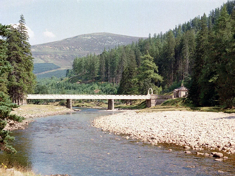
Victoria Bridge in Aberdeenshire
Victoria Bridge in Aberdeenshire is a service road (customers only). It runs in a north-south direction and ends in a cul-de-sac. Victoria Bridge is also known as Mar Lodge, Victoria Bridge. Victoria Bridge also exists in Argyll and Bute, Moray, Glasgow City, Scottish Borders and East Lothian. Ⓦ.
- Road Type
- service road
- Route
- north-south
Image
Roads nearby
Path avoiding flood damaged track2,9 km
Chapel Braetaste.., Auchendryne
4,6 km
Broombank TerraceThe Duke of Rothesay Highland Games Pavilion
4,8 km
Linn of Dee Place4,8 km
Linn of Dee Road4,9 km
Buildings nearby
South Lodge50 m
Stuffer's Hall700 m
Mealdarroch750 m
Stag Ballroom800 m
Craigview1,1 km
Bourtree1,2 km
Hawthorn Cottage1,2 km
Old Schoolhouse1,3 km
Albany1,4 km
Mains1,4 km
Bellaneye1,9 km
Elrig1,9 km
Carn-na-Moine2,0 km
Pansy Cottage2,1 km
Woodside2,1 km
Queen Victoria's Picnic Lodge2,2 km
Quoich Cottage2,3 km
Blackburn Cottage2,4 km
Muir Cottage2,5 km
Allanaquoich2,6 km
Mar Forest2,8 km
Carr Cottage2,8 km
Mill of Coull3,9 km
Dalvorar House4,7 km
Braemar Curling Club4,9 km
Chapels nearby
St Ninian's Chapel750 m
Detached houses nearby
Allanaquoich Farmhouse2,6 km
Ford Cottage3,8 km
Holiday apartment nearby
Mar Lodge800 m
Houses nearby
Cragan1000 m
Pinewood2,0 km
Wood Hill4,2 km
Grampian Cottage4,4 km
Moorfield House4,7 km
Industrial buildings nearby
Morrone Radio Relay Hut3,1 km
Nature reserves nearby
Morrone Birkwood Site of Special Scientific Interest2,6 km
Recreation grounds nearby
Princess Royal & Duke of Fife Memorial Park4,6 km
Rivers nearby
River Dee1,5 km
Ey Burn1,7 km
Quoich Water3,0 km
Lui Water3,8 km
Streams nearby
Allt Connie2,9 km
Allt Clais Fhearnaig4,8 km
Woodlands nearby
ex-ROC bunker4,4 km
| Named after | Victoria |
|---|---|
| Heritage designation | category B listed building |
| Protected area | Cairngorms National Park |
| Located in | Aberdeenshire, Crathie and Braemar |
| Country | United Kingdom |
| Crosses | River Dee |
| Carries thoroughfare | unclassified road |
 Public transport map Aberdeenshire Legend
| Railway | |
| Bus | |
| Tram |
 Cycling map Aberdeenshire Legend
| Cycle path | |
| Cycle lane on road | |
| Cycling on bus lane | |
| Bicycle street | |
| Cyclists allowed | |
| Cyclists allowed, good surface | |
| No cycling | |
| Cobblestones |
| Long-distance cycle route | (depending on scale) | |
| Long-distance cycle route |
 Walking map Aberdeenshire Legend
| Path |
| Long-distance hiking trail | (depending on scale) | |
| Long-distance hiking trail | ||
| No pedestrians |