
Victoria Bridge in Argyll and Bute
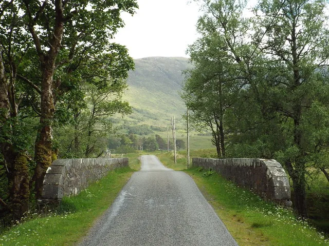
Victoria Bridge in Argyll and Bute is a single-lane, unlit tertiary road. It runs in a north-south direction and ends in a cul-de-sac. Victoria Bridge is also known as Blackmount, Victoria Bridge. This road is part of the mountain bike route "Highland Trail 550" and the hiking trail "West Highland Way (Inveroran to Kingshouse)". Victoria Bridge also exists in Moray, Aberdeenshire, Glasgow City, Scottish Borders and East Lothian.
- Road Type
- tertiary road
- Lanes
- 1
- Speed Limit
- 60 mph
- Route
- north-south
Image
Roads nearby
Bridge of Orchy3,6 km
Clashgour Bridge3,8 km
West Highland WayBridge of Orchy
3,9 km
Station BraeBridge of Orchy, Bridge of Orchy Hotel
3,9 km
Allt Chonoglais Bridge4,6 km
Loch Tulla ViewpointLoch Tulla Viewpoint Info Plaque
4,8 km
Ba Bridge6,3 km
West Highland Way - Slighe Taobh an Iar na GàidhealtachdKinlochleven Wild Camping Area, White Corries, Kingshouse, The Way Inn, Altnafeadh, Mam Mor
6,8 km
Body of waters nearby
Coirein Lochain5,2 km
Lochan Mhic Pheadair Ruaidh5,3 km
Buildings nearby
Dorran Cottage1,2 km
Four Winds Cottage5,4 km
Achallader Castle (ruins)5,5 km
Cabins nearby
Clashgour Hut1,5 km
Community centres nearby
Bridge of Orchy Community Hall3,7 km
Detached houses nearby
Taransay Cottage3,8 km
Hotels nearby
Inveroran850 m
Bridge of Orchy Hotel3,7 km
Houses nearby
Tulla Cottage5,0 km
Places of worship nearby
Strathfillan Parish Church3,7 km
Railway lines nearby
West Highland Line4,0 km
Residential areas nearby
Upper Dorran5,3 km
Residential buildings nearby
Black Mount1,3 km
Rivers nearby
Allt Tolaghan1,3 km
Abhainn Shira2,7 km
River Orchy4,0 km
Allt Bhreacnais4,2 km
Allt Kinglass6,7 km
Ba7,0 km
School buildings nearby
60 Mile Inn3,8 km
Streams nearby
Allt a'Chlair550 m
Allt Chaorach700 m
Allt Orain750 m
Easan Dubh2,2 km
Allt Doire nan Taghan3,0 km
Allt Caolain Duibh3,1 km
Allt Toaig3,1 km
Allt Coire na Muic3,4 km
Allt Ghabhar4,0 km
Allt Coire an Dothaidh4,1 km
Allt Coire Dheardhedh5,2 km
Allt an Tairbh5,5 km
River Ba6,0 km
Water of Tulla6,0 km
Allt an Laoigh6,0 km
Allt Coire Bhiocair6,5 km
Allt Coire an Easain6,6 km
Other nearby
Eilean na h-Ainnis950 m
Eilean an Stalcair2,0 km
| Heritage designation | category B listed building |
|---|---|
| Located in | Argyll and Bute, Glenorchy and Inishail |
| Country | United Kingdom |
| Crosses | Abhainn Shira |
| Carries thoroughfare | unclassified road |
 Public transport map Argyll and Bute Legend
| Railway | |
| Bus | |
| Tram |
 Cycling map Argyll and Bute Legend
| Cycle path | |
| Cycle lane on road | |
| Cycling on bus lane | |
| Bicycle street | |
| Cyclists allowed | |
| Cyclists allowed, good surface | |
| No cycling | |
| Cobblestones |
| Long-distance cycle route | (depending on scale) | |
| Long-distance cycle route |
 Walking map Argyll and Bute Legend
| Path |
| Long-distance hiking trail | (depending on scale) | |
| Long-distance hiking trail | ||
| No pedestrians |