
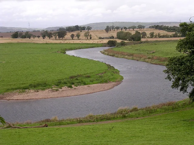
River Isla in Angus, Scotland
- Waterway Type
- river
Image
Roads nearby
Bridge of RuthvenRuthven
700 m
Bridge of Dillavaird2,2 km
Bridge of Dean2,6 km
Bridge of Crathies3,3 km
Alyth Road3,6 km
Forfar Road3,6 km
Steading Place3,7 km
Smithy Lane3,7 km
Tree Back3,7 km
The SquarePlaice in the Square, Aberfeldy, Draft & Flow Community Cycle Workshop, Blair Atholl, Highlands Jewelry, Indigo Charlie, Atholl Arms Hotel, Bothy Bar
3,7 km
Strathmore Place3,8 km
Kinloch Place3,9 km
Ardler RoadBroomend
3,9 km
Dundee RoadMeigle, Meigle Post Office, Fairmount Road, Manse Road, Branklyn Gardens, Branklyn Gardens Tearoom, Markethill, Commercial Street
3,9 km
Kirkhill Road4,0 km
Drumkilbo Road4,0 km
Belmont Place4,0 km
Abandoned railways nearby
Alyth Branch2,2 km
Buildings nearby
Nether Balloch2,8 km
Airlie Castle3,8 km
Meigle Telephone Exchange3,9 km
Cafés nearby
Flour3,7 km
The Joinery3,7 km
Chalet nearby
Square Cottage3,7 km
Convenience stores nearby
Spar3,7 km
Detached houses nearby
Ruthven House1,1 km
Farmyards nearby
Milton of Ruthven350 m
Bridgend of Ruthven600 m
Islabank1,0 km
Haughend1,5 km
Simprin Farm1,8 km
Wester Cardean Farm2,1 km
Barns of Airlie3,7 km
Drumkilbo Farm3,7 km
Forests nearby
Redmire Wood1,1 km
Selvie Wood1,9 km
Boat Wood1,9 km
Crow Wood2,3 km
Golf courses nearby
Alyth Golf Course2,4 km
Hotel nearby
Kinloch Arms Hotel3,8 km
Houses nearby
Drumkilbo3,6 km
Museum nearby
Meigle Sculptured Stone Musuem3,9 km
Places of worship nearby
Ruthven Parish Church950 m
Meigle Parish Church3,8 km
Police stations nearby
Meigle Police Station3,6 km
Streams nearby
Burn of Quiech2,2 km
Meigle Burn3,7 km
Burn of Auchrannie3,7 km
Other nearby
Alyth Substation1,3 km
| Length | 74 |
|---|---|
| Located in | Angus, Perth and Kinross |
| Country | United Kingdom |
| Mouth | River Tay |
| Tributary | River Ericht |
 Public transport map Angus Legend
 | Railway | |
| Bus | |
| Tram |
 Cycling map Angus Legend
 | Cycle path | |
| Cycle lane on road | |
| Cycling on bus lane | |
| Bicycle street | |
| Cyclists allowed | |
| Cyclists allowed, good surface | |
| No cycling | |
| Cobblestones |
| Long-distance cycle route | (depending on scale) | |
| Long-distance cycle route |
 Walking map Angus Legend
 | Path |
| Long-distance hiking trail | (depending on scale) | |
| Long-distance hiking trail | ||
| No pedestrians |