
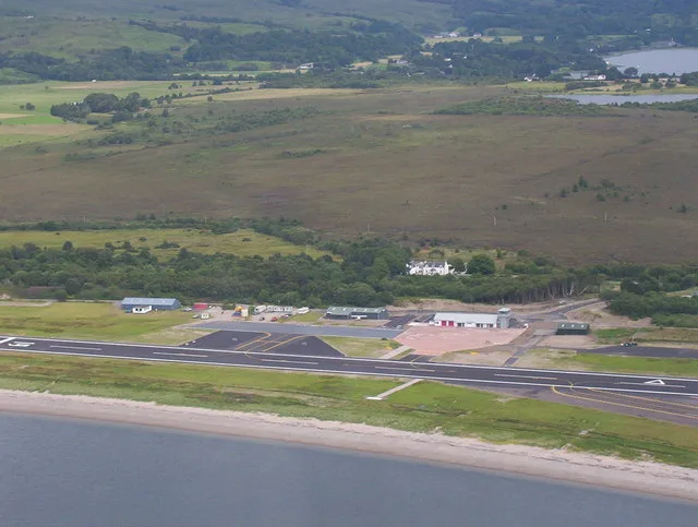
Oban Airport in Argyll and Bute
Oban Airport in Argyll and Bute is an airfield (IATA: OBN, ICAO: EGEO, regional airport) (PA37 1SW). Oban Airport is also known as North Connel Airport. Ⓦ.
- Postal Code
- PA37 1SW
- Website
- http://www.obanandtheislesairports.com/
- Operator
- Argyll and Bute council
Image
Roads nearby
Benmore View650 m
Croft View750 m
Lora ViewLochnell Arms
850 m
Observer Corps Post RoadEtive Park
850 m
Etive Park900 m
Connel Bridge1,3 km
Deirdre1,4 km
Ferryfield Drive1,5 km
Bonawe RoadNorth Connel, Black Crofts
1,5 km
Ferryfield Road1,5 km
Powell Place1,6 km
St Oran's Place1,6 km
Connel Village Loop RoadConnel, Post Office
1,6 km
Grosvenor Crescent1,6 km
Old Shore Road1,7 km
Falls Crescent1,9 km
Achaleven Road1,9 km
Glen Park1,9 km
Nature nearby
Eilean Beag1,7 km
Eilean Mòr2,0 km
Antique shops nearby
Funky Junk & The Tin Bin1,8 km
Baies nearby
Ardmucknish Bay700 m
Body of waters nearby
Loch Eck1,3 km
Lochan nan Rath1,6 km
Lochan a`Chuirn2,0 km
Buildings nearby
Former ROC Group HQ300 m
Connel Telephone Exchange1,7 km
Lora Villa1,8 km
Caravan site nearby
North Ledaig Caravan Site1,3 km
Chalet nearby
Cnocaruan1,4 km
Loch View1,5 km
Community centres nearby
Connel Village Hall1,7 km
Doctor's practice nearby
Taynuilt Medical Practice1,4 km
Guest house nearby
Ronebhal Guest House1,4 km
Mactalla1,5 km
Grove House1,8 km
Hotels nearby
Falls of Lora Hotel1,8 km
Industrial areas nearby
Oilfast Limited500 m
Gleaner1,8 km
Places of worship nearby
St Oran's Church1,6 km
St Oran's Church - Church Hall1,7 km
Railway lines nearby
West Highland Line1,9 km
Razed railways nearby
Connell Ferry to Ballachulish Line1,6 km
Residential areas nearby
Ledaig600 m
Other nearby
H1200 m
H2250 m
H4650 m
H3700 m
A' Bhratag1,8 km
| Named after | Oban |
|---|---|
| Opening | 1938 |
| Elevation | 24 |
| Located in | Argyll and Bute |
| Country | United Kingdom |
| Location | North Connel |
 Public transport map Argyll and Bute Legend
| Railway | |
| Bus | |
| Tram |
 Cycling map Argyll and Bute Legend
| Cycle path | |
| Cycle lane on road | |
| Cycling on bus lane | |
| Bicycle street | |
| Cyclists allowed | |
| Cyclists allowed, good surface | |
| No cycling | |
| Cobblestones |
| Long-distance cycle route | (depending on scale) | |
| Long-distance cycle route |
 Walking map Argyll and Bute Legend
| Path |
| Long-distance hiking trail | (depending on scale) | |
| Long-distance hiking trail | ||
| No pedestrians |