
Collinswell Drive in Burntisland
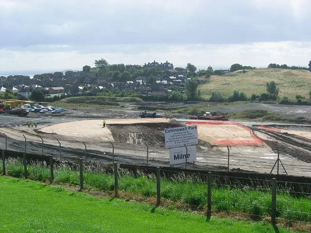
Collinswell Drive in Alba / Scotland, Burntisland is a two-lane, asphalted, lit residential street. The road has sidewalks. It runs in a northeast-southwest direction starting from Aberdour Road and crosses Inchgarvie Avenue. It ends in a cul-de-sac.
- Road Type
- residential street
- Speed Limit
- 20 mph
- Lanes
- 2
- Route
- northeast-southwest
Image
Dentist
Public bookcases
Bus stops
Roads nearby
Little Craigs View100 m
Seamill Gardens100 m
Burnside Gardens150 m
Colinswell RoadDunearn Bank, Silverbarton Terrace, Stenhouse Drive
150 m
Geds Mill Close150 m
Dunearn Bank200 m
Kirkton Gardens200 m
Silverbarton Terrace250 m
Grange RoadThe Book Exchange
250 m
Braehead250 m
Church StreetKirkton Churchyard
250 m
Kirkton Drive300 m
Aberdour RoadJubilee Tavern, Righteous Rides, Cromwell Road, Grange Garage, Adam's Autocare, RDB Car Sales, Martin's Lodge, Church Street, SM Autos
300 m
Meldrum Crescent300 m
Fairfax Court350 m
Church Grove350 m
Kirkton RoadHaugh Road, Kirkton Road
350 m
Dollar Grove350 m
Dollar RoadMeadowfield
400 m
Broomhill400 m
Kerr Court450 m
Glebe Place450 m
Craig Court500 m
West Broomhill Road500 m
Lothian StreetBurntisland House Hotel
500 m
Binn Avenue500 m
MeadowfieldFleming Way
550 m
Broomhill AvenueBurntisland Foodbank
550 m
Neilson Grove550 m
Dick Crescent550 m
Lonsdale Crescent550 m
Aytoun Crescent600 m
Meadow Court600 m
Landale Place650 m
Landale Gardens650 m
Orrock Drive650 m
Buildings nearby
Pavilion350 m
Burntisland Telephone Exchange350 m
Cemeteries nearby
Kirkton Churchyard350 m
Convenience stores nearby
Co-op Food250 m
Grasslands nearby
Duncan’s Field350 m
Industrial areas nearby
Meadowfield Industrial Estate650 m
Places of worship nearby
The Salvation Army450 m
Playgrounds nearby
Haugh Road250 m
Piper CrescentPiper Crescent
500 m
Railway lines nearby
Fife Circle Line250 m
Recreation grounds nearby
Recreation Park350 m
Sports pitches nearby
Burntisland Shipyard F.C.350 m
Streams nearby
Kirkton Burn300 m
Public transport map Burntisland Legend
| Railway | |
| Bus | |
| Tram |
Cycling map Burntisland Legend
| Cycle path | |
| Cycle lane on road | |
| Cycling on bus lane | |
| Bicycle street | |
| Cyclists allowed | |
| Cyclists allowed, good surface | |
| No cycling | |
| Cobblestones |
| Long-distance cycle route | (depending on scale) | |
| Long-distance cycle route |
Walking map Burntisland Legend
| Path |
| Long-distance hiking trail | (depending on scale) | |
| Long-distance hiking trail | ||
| No pedestrians |