
Maby's Way in Edinburgh
Maby's Way in City of Edinburgh is a service road (private). It runs in a northeast-southwest direction and ends in a cul-de-sac. In the vicinity, there is a viewpoint. The nearest bus stop in the vicinity is Royal Highland Centre (approx. 350 m away).
- Road Type
- service road
- Route
- northeast-southwest
Image
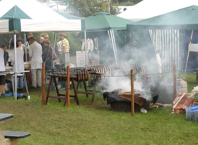
Viewpoint
Roads nearby
Hallyards RoadHallyards, Royal Highland Centre
300 m
Lilybank Road600 m
Lilybank Wynd650 m
Hillwood Gardens750 m
Glasgow RoadIngliston Road, Ingliston Showground, Middle Norton, Gogar Roundabout, Airport Junction, Airport Roundabout, Gogarstone Road, Maybury Road (Maybury), Lochend Road, Arnold Clark Accident Repair Centre, Gogar, Gogarburn A8, Gogarburn, North Gyle Road, Craigs Avenue, Craigs Gardens, Bar B Que, Lucky Chen, Smile Plus, Dance Podiatry/Chiropody, Slumdog, St Thomas' Church, Domino's, Cast Iron Grill, Dechmont Road, Clark Commercials, Automak, City Valet, SRS Alloys, Dechmont House, Craigievar Guest House, Station Road
800 m
Hillwood Terrace800 m
Hillwood RoadRatho Station
800 m
Ratho Park850 m
Hillwood Crescent900 m
Hillwood Rise950 m
Queen Anne DriveEasirent, Drivalia, Now Where Campers Limited
1000 m
Almond RoadEdinburgh Supercharger
1000 m
Harvest DriveStation Road, Harvest Drive
1,0 km
Station RoadDalmeny Station, The Toll, Almondside, Robert Bennie & Sons, Dalmeny, ScotRail, Railway Station, Millennium Milepost Dalmeny, The Gift Tree, Enterprise Car Club, Hillwood Road, Kassy's Café, Project 24, Queen Margaret Drive, Ashburnham Road, Dalmeny Deli
1,0 km
Almond Drive1,1 km
Harvest WyndNorton House Hotel
1,1 km
Harvest RoadScotmid Co-op Electric Vehicle Charger, MacGregor and MacDuff, RDM, Forth Coffee Roasters, Edinburgh Jam Group, CryoPDP
1,1 km
Ingliston RoadIngliston Cattery and Kennels, Royal Highland Showground, Gate 5S, Gate 5N
1,1 km
Almond Avenue1,2 km
Boathouse Bridge1,2 km
Amenities nearby
Little Flyers Nursery1,3 km
Buildings nearby
Secure Airparks - Airport Parking Edinburgh800 m
Lowland Hall800 m
Leonard Hudson850 m
TCR UK EDI850 m
Streamline950 m
Kirkliston Telephone Exchange950 m
Commsworld1,0 km
The Gathering1,1 km
Garden Suite Health Club1,2 km
Capital House1,2 km
Car hires nearby
EasiRent800 m
Constructions nearby
Lauder Grove800 m
Convenience stores nearby
Scotmid800 m
M&S Simply Food1,3 km
Farmhouses nearby
Norton Mains Farm1,4 km
Hotels nearby
Travelodge850 m
Norton House Hotel1,2 km
Hampton by Hilton Edinburgh Airport1,2 km
Moxy Edinburgh Airport1,3 km
Industrial areas nearby
Harrowden Turf950 m
Industrial buildings nearby
Batt Cables1,0 km
Spring1,1 km
Parks nearby
Ratho Station Flyover Park700 m
Railway lines nearby
Edinburgh and Glasgow Main Line1,0 km
Razed railways nearby
Queensferry and Dalmeny South (Kirkliston) Branch1,1 km
Residential buildings nearby
Ingliston House Lodge And Gatepiers1,2 km
Roof structures nearby
Parking Pay Point1,3 km
Transport buildings nearby
Edinburgh Airport1,3 km
 Public transport map City of Edinburgh Legend
| Railway | |
| Bus | |
| Tram |
 Cycling map City of Edinburgh Legend
| Cycle path | |
| Cycle lane on road | |
| Cycling on bus lane | |
| Bicycle street | |
| Cyclists allowed | |
| Cyclists allowed, good surface | |
| No cycling | |
| Cobblestones |
| Long-distance cycle route | (depending on scale) | |
| Long-distance cycle route |
 Walking map City of Edinburgh Legend
| Path |
| Long-distance hiking trail | (depending on scale) | |
| Long-distance hiking trail | ||
| No pedestrians |