
Stair House in East Ayrshire
Stair House in East Ayrshire is a building (listed building). Stair House is near Mansefield Road. Ⓦ.
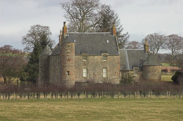
- Building Type
- building
Bus stops
Pubs
Newsagent's
Post offices
Hairdressers
Fast food restaurants
Restaurants
Car repair shops
Doctor's office
Guest house
Ice cream parlours
Convenience stores
Garden centres
Bakeries
Pharmacy
Benches
Carpet shops
Roads nearby
Gadgirth Bridge2,9 km
Limekiln Wynd3,0 km
McLeod Court3,2 km
James StreetBlack Bull Hotel, Sampy's
3,2 km
Hodge Court3,2 km
Mansefield Road3,2 km
School Avenue3,2 km
Montgomerie StreetPlough Inn, Tarbolton Clinic, James Street, Girvan, McConnell Square, Girvan, Montgomerie Street
3,2 km
Craigie View3,3 km
Langlands Drive3,3 km
Alton Avenue3,3 km
Fail Avenue3,3 km
Park RoadSpar
3,3 km
Princes StreetPrinces Street, Princess Cafe
3,3 km
Beechwood Road3,4 km
Back Street3,4 km
Gallowhill Avenue3,4 km
Margaret Sloan Place3,4 km
Well Street3,4 km
Smithfield Crescent3,5 km
Sandgate StreetTarbolton, Tarbolton Pharmacy, Bachelor's Club
3,5 km
Burns Street3,5 km
Cunningham StreetThe Village Tea Room
3,6 km
Kirkport3,6 km
Buildings nearby
The Stair Inn400 m
Dalmore House800 m
Tarbolton Telephone Exchange3,4 km
Tarbolton Pharmacy3,5 km
Cemeteries nearby
Tarbolton Cemetery3,5 km
Chalet nearby
The Pines3,1 km
Farm supplies shops nearby
Hamilton Brothers3,1 km
Farmyards nearby
Keyshill1,6 km
Roadend3,0 km
Bridgend3,3 km
Forests nearby
Loachhartshill Plantation3,3 km
Hotels nearby
The Failford Inn3,0 km
Industrial areas nearby
Old Pit Bing1,7 km
Libraries nearby
The Lorimer Library3,4 km
Museum nearby
Batchelor's Club3,5 km
Places of worship nearby
Stair Parish Church250 m
Tarbolton Gospel Hall3,4 km
Tarbolton Parish Church3,5 km
Railway lines nearby
Mauchline Branch1,5 km
Residential areas nearby
Cherrybank3,0 km
Rivers nearby
River Ayr350 m
Water of Coyle3,5 km
Ruins nearby
Trabboch Castle2,5 km
Streams nearby
Trabboch Burn3,7 km
Woodlands nearby
Ayr Gorge Woodlands Reserve1,5 km
| Located in | East Ayrshire, Stair |
|---|---|
| Country | United Kingdom |
 Public transport map East Ayrshire Legend
| Railway | |
| Bus | |
| Tram |
 Cycling map East Ayrshire Legend
| Cycle path | |
| Cycle lane on road | |
| Cycling on bus lane | |
| Bicycle street | |
| Cyclists allowed | |
| Cyclists allowed, good surface | |
| No cycling | |
| Cobblestones |
| Long-distance cycle route | (depending on scale) | |
| Long-distance cycle route |
 Walking map East Ayrshire Legend
| Path |
| Long-distance hiking trail | (depending on scale) | |
| Long-distance hiking trail | ||
| No pedestrians |