
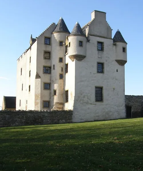
Fa'side Castle in East Lothian
Fa'side Castle in East Lothian is a castle. Fa'side Castle is also known as Faside Castle. Fa'side Castle is near Colliers Row. Ⓦ.
- Alternative Name
- Faside Castle
- Building Type
- building
- Website
- https://faside-estate.com/
Image
Pharmacy
Bus stops
Roads nearby
Laing Loan850 m
Laing Park850 m
Bath Crescent900 m
Colliers Row900 m
Masons WayWallyford Primary School, Laing Loan, Davidson Way, Osmond Drive, Auburn Locks, Wallyford Learning Campus
950 m
Windlass Gardens950 m
Colliers Park950 m
Davidson Way1,0 km
Davidson Court1,0 km
Windlass Drive1,1 km
Davidson Crescent1,1 km
Sweethope Crescent1,1 km
Chute Crescent1,1 km
Fa'side Terrace1,1 km
Ormond Drive1,1 km
Blair Walk1,1 km
Bourhill Court1,1 km
Hester Lane1,2 km
Fa'side Avenue North1,2 km
Fa'side Gardens1,2 km
Krause Walk1,2 km
Ormond Avenue1,2 km
Howe Mire1,2 km
Futures Way1,2 km
Wallyford Industial Estate1,2 km
Moffat Lane1,2 km
Fa'side Avenue South1,3 km
Fa'side Avenue Court1,3 km
Futures Court1,3 km
St Clements Terrace1,3 km
Blair Way1,3 km
St Clements CrescentTerminus
1,3 km
St Clements Gardens North1,3 km
Albert PlaceWallyford Pharmacy, Lifestye Express
1,3 km
Harvey Avenue1,4 km
Innes Neuk1,4 km
Castle Rise1,4 km
Oliphant Gardens1,4 km
Inchview Crescent1,4 km
Old Row1,5 km
Harvester Road1,5 km
Baler Crescent1,6 km
Farmyards nearby
Myles Farm1,4 km
Industrial areas nearby
Wallyford Industrial Estate1,3 km
Razed railways nearby
Wallyford Colliery1,3 km
Residential areas nearby
Elphinstone Tower Farm Cottages1,5 km
Schools nearby
Rosehill High School1,4 km
Wallyford Learning Campus1,4 km
Streams nearby
Harry's Burn1,2 km
| Heritage designation | category B listed building |
|---|---|
| Located in | East Lothian, Tranent |
| Country | United Kingdom |
 Public transport map East Lothian Legend
| Railway | |
| Bus | |
| Tram |
 Cycling map East Lothian Legend
| Cycle path | |
| Cycle lane on road | |
| Cycling on bus lane | |
| Bicycle street | |
| Cyclists allowed | |
| Cyclists allowed, good surface | |
| No cycling | |
| Cobblestones |
| Long-distance cycle route | (depending on scale) | |
| Long-distance cycle route |
 Walking map East Lothian Legend
| Path |
| Long-distance hiking trail | (depending on scale) | |
| Long-distance hiking trail | ||
| No pedestrians |