
Petley Street in Highland
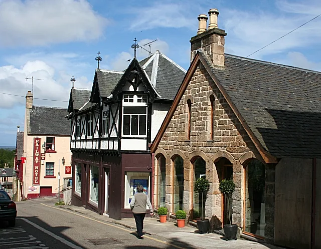
Petley Street in Highland is a two-lane residential street. The road has a width of 5.7 m. It runs in a northeast-southwest direction starting from Shandwick Street and crosses Stafford Street and Sutherland Street and ends at Petley Place.
- Road Type
- residential street
- Lanes
- 2
- Route
- northeast-southwest
Image
Roads nearby
Sutherland Street50 m
Hartfield Street100 m
Petley Place100 m
Gower StreetBrora, Brora Level Crossing, The Thrift Shop, Fair deal fashion
100 m
Stafford StreetShell Garage, Petrol Station, Bannockburn Inn, Belgrave Hotel
100 m
Shandwick Street100 m
Duke Street100 m
Knockbreck Street100 m
Cromartie Gardens150 m
Gower Place150 m
Upper King Street150 m
Fountain RoadCoffee Bothy, Countess of Sutherland Memorial Fountain
200 m
Library House Lane200 m
Knockbreck Court200 m
Ross StreetBalintore
200 m
Burgage Drive200 m
Cadboll Place250 m
Geanies Street250 m
Ankerville Street250 m
Sutherland Crescent300 m
King StreetLunar, Tain Tanning Beauty & Nail, Highland Hospice, Invergordon, 9. Pipes and Drams, Bonnie Bhaji, D Gilmour, A Cut Above The Rest, Kingussie Picture Framers & Art Gallery, John Ross Funeral Services, Bottom of Brae
300 m
Lamington StreetPost Office
300 m
Seaforth Court300 m
Crickety Steps300 m
Cunarder Lane350 m
Crammond BraeGlasstorm
350 m
Bank StreetBank Street Lodge, The Royal Hotel, Tianavaig, RBS, Post Office, Carmina Gadelica, Taste of India
350 m
Kirksheaf Road350 m
Knockbreck RoadAsda, Tain
400 m
Burgage Court400 m
Antique shops nearby
Cheeky Highlander250 m
Buildings nearby
Audacia Accounting Solutions250 m
Rose House300 m
Butcher's nearby
John M. Munro250 m
Cafés nearby
Pipers Coffee House250 m
Commercial buildings nearby
Alternatives300 m
Glasstorm400 m
Fast food restaurants nearby
The Wee Grill Takeaway200 m
Top Tain Fish and Chicken250 m
SilverTide Fish & Chips300 m
Fire stations nearby
Tain Community Fire Station150 m
Hairdresser's nearby
Twenty One Barber150 m
CC's Hair300 m
Libraries nearby
Tain Library150 m
Parks nearby
Rose Garden350 m
Places of worship nearby
Associated Presbyterian Church200 m
Post offices nearby
Tain300 m
Restaurants nearby
Curry Club300 m
Weapons shops nearby
R. Macleod & Sons250 m
 Public transport map Highland Legend
| Railway | |
| Bus | |
| Tram |
 Cycling map Highland Legend
| Cycle path | |
| Cycle lane on road | |
| Cycling on bus lane | |
| Bicycle street | |
| Cyclists allowed | |
| Cyclists allowed, good surface | |
| No cycling | |
| Cobblestones |
| Long-distance cycle route | (depending on scale) | |
| Long-distance cycle route |
 Walking map Highland Legend
| Path |
| Long-distance hiking trail | (depending on scale) | |
| Long-distance hiking trail | ||
| No pedestrians |