
Stafford Street in Highland
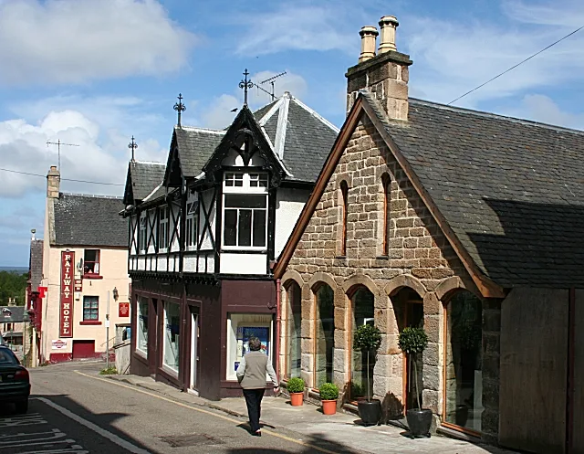
Stafford Street in Highland is a two-lane expressway. The road has sidewalks. It runs in a southeast-northwest direction starting from Cadboll Place and crosses Library House Lane, Geanies Street, Hartfield Street, Petley Street, Shandwick Street, Duke Street, Knockbreck Street and Gower Street and ends at Knockbreck Road. This road is part of the long-distance roads E 15, Gritting Priority 1 roads, A9 and North Coast 500 and the hiking trail "John O'Groats Trail (Brora to Helmsdale)". In the vicinity, there is among other things a pub. The nearest stops are Shell Garage, Petrol Station and Belgrave Hotel. Stafford Street also exists in Argyll and Bute, Glasgow City and North Lanarkshire.
- Road Type
- tertiary road
- Route
- southeast-northwest
Image
Pubs
Roads nearby
Shandwick Street100 m
Library House Lane100 m
Ross StreetBalintore
100 m
Hartfield Street100 m
Duke Street100 m
Knockbreck Street100 m
Geanies Street100 m
Upper King Street150 m
Petley Street150 m
Cadboll Place150 m
Sutherland Street150 m
Ankerville Street150 m
Lamington StreetPost Office
200 m
King StreetLunar, Tain Tanning Beauty & Nail, Highland Hospice, Invergordon, 9. Pipes and Drams, Bonnie Bhaji, D Gilmour, A Cut Above The Rest, Kingussie Picture Framers & Art Gallery, John Ross Funeral Services, Bottom of Brae
200 m
Gower StreetBrora, Brora Level Crossing, The Thrift Shop, Fair deal fashion
200 m
Petley Place200 m
Cunarder Lane200 m
Gower Place250 m
Cromartie Gardens250 m
Crickety Steps250 m
Crammond BraeGlasstorm
250 m
Kirksheaf Road250 m
Bank StreetBank Street Lodge, The Royal Hotel, Tianavaig, RBS, Post Office, Carmina Gadelica, Taste of India
250 m
Knockbreck Court250 m
Fountain RoadCoffee Bothy, Countess of Sutherland Memorial Fountain
300 m
Burgage Drive300 m
Sutherland Crescent350 m
Seaforth Court400 m
Knockbreck RoadAsda, Tain
450 m
Burgage Court500 m
Antique shops nearby
Cheeky Highlander150 m
Buildings nearby
Audacia Accounting Solutions150 m
Rose House200 m
Butcher's nearby
John M. Munro200 m
Cafés nearby
Pipers Coffee House150 m
Commercial buildings nearby
Alternatives200 m
Glasstorm300 m
Fast food restaurants nearby
The Wee Grill Takeaway100 m
SilverTide Fish & Chips150 m
Top Tain Fish and Chicken150 m
Fire stations nearby
Tain Community Fire Station250 m
Hairdresser's nearby
Twenty One Barber50 m
CC's Hair200 m
Libraries nearby
Tain Library50 m
Parks nearby
Rose Garden250 m
Places of worship nearby
Associated Presbyterian Church150 m
Post offices nearby
Tain150 m
Restaurants nearby
Curry Club150 m
Weapons shops nearby
R. Macleod & Sons150 m
 Public transport map Highland Legend
| Railway | |
| Bus | |
| Tram |
 Cycling map Highland Legend
| Cycle path | |
| Cycle lane on road | |
| Cycling on bus lane | |
| Bicycle street | |
| Cyclists allowed | |
| Cyclists allowed, good surface | |
| No cycling | |
| Cobblestones |
| Long-distance cycle route | (depending on scale) | |
| Long-distance cycle route |
 Walking map Highland Legend
| Path |
| Long-distance hiking trail | (depending on scale) | |
| Long-distance hiking trail | ||
| No pedestrians |