
Glenfarg South Tunnel in Perth and Kinross
Glenfarg South Tunnel in Perth and Kinross is a compacted track (semi-solid). The surface is fair.
- Road Type
- track
- Route
- northeast-southwest
Image
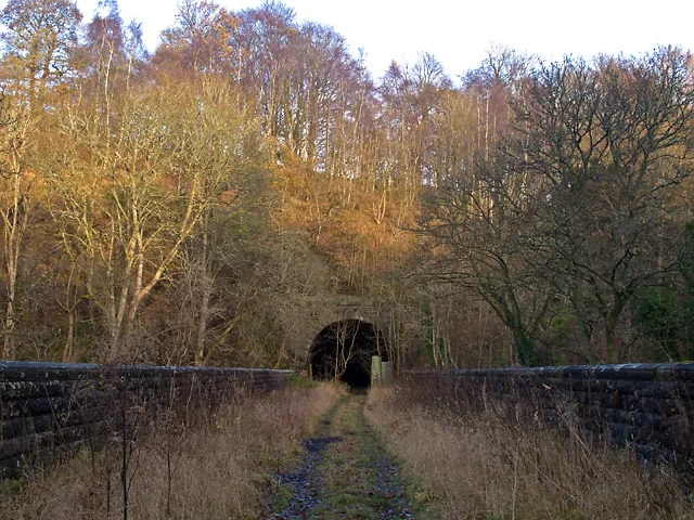
Cemetery
Cafés
Car repair shops
Museum
- Museum of Abernethy (web) at School Wynd (PH2 9JJ) – approx. 4,5 km.
Bus stops
Convenience stores
Tourist information offices
Pubs
Car dealerships
Guest house
Roads nearby
Glenfarg Viaduct400 m
Letham Bridge1,2 km
Glenfarg North Tunnel1,4 km
Kilknockie Viaduct1,7 km
Letham RoadForesterseat, Letham Road
1,7 km
North Binn Hill1,9 km
Millden RoadBalvaird
1,9 km
Bealach Nan Landfill2,0 km
Farm road2,0 km
Quad bike track2,2 km
Drumcairn hill top road2,2 km
Baiglie Road2,4 km
Croupie Craig Track2,4 km
Ridge Path2,5 km
A9122,5 km
Nethermill Cottages2,6 km
Nethermill Place2,7 km
Paris Bridge2,7 km
A913Aberargie, Front Row, Nethermill, Glenfoot Road, Maryland
2,8 km
Buildings nearby
Blairstruie1,8 km
Beautyfield House2,0 km
Balvaird Castle2,2 km
Ayton2,3 km
Scarrhill Cottages2,3 km
Brampton House2,3 km
Balmanno Castle2,6 km
Farmyards nearby
Meikle Fieldie950 m
Easter Fordel1,7 km
Kilknockiebank1,8 km
Catochil Farm2,0 km
Drumcairn2,3 km
Ayton Farm2,4 km
Balmanno2,4 km
Conland2,5 km
East Dron3,0 km
Houses nearby
Easter Fordel Cottage1,6 km
Blairstruie Cottage1,6 km
Industrial areas nearby
Aberargie Distillery2,8 km
Pubs nearby
Bein Inn450 m
The Baiglie Inn2,4 km
Razed railways nearby
Cowdenbeath Junction to Bridge of Earn Line1,9 km
Residential areas nearby
Clochridgestane1,1 km
Streams nearby
Fildie Burn1,2 km
Baiglie Burn1,7 km
Binn Burn2,4 km
River Farg2,7 km
Dron Burn2,8 km
Wood Burn3,0 km
Woodlands nearby
Kennel Wood2,6 km
| Located in | Perth and Kinross |
|---|---|
| Country | United Kingdom |
 Public transport map Perth and Kinross Legend
| Railway | |
| Bus | |
| Tram |
 Cycling map Perth and Kinross Legend
| Cycle path | |
| Cycle lane on road | |
| Cycling on bus lane | |
| Bicycle street | |
| Cyclists allowed | |
| Cyclists allowed, good surface | |
| No cycling | |
| Cobblestones |
| Long-distance cycle route | (depending on scale) | |
| Long-distance cycle route |
 Walking map Perth and Kinross Legend
| Path |
| Long-distance hiking trail | (depending on scale) | |
| Long-distance hiking trail | ||
| No pedestrians |