
Mar Hall Hotel in Renfrewshire
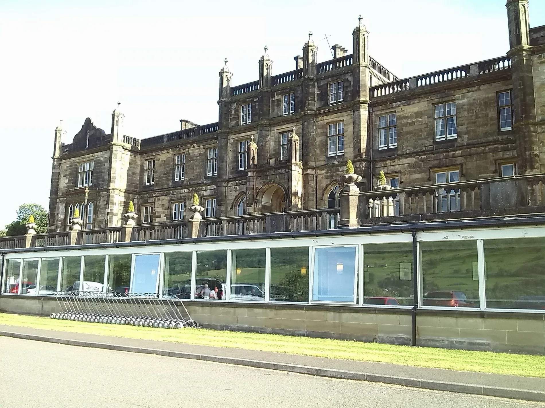
Mar Hall Hotel in Renfrewshire is a hotel (PA7 5NW). Mar Hall Hotel is also known as The Princess Louise Scottish Hospital for Limbless Sailors and Soldiers at Erskine House. Mar Hall Hotel is near Mar Hall Avenue. Mar Hall Hotel is built in the Gothic architecture style. Ⓦ.
- Postal Code
- PA7 5NW
- Building Type
- hotel
- Tourism
- hotel
- Website
- https://www.marhall.com/
Image
Places of worship
Pharmacy
Stations
Dentist
Bus stops
ATMs
Fast food restaurants
Post offices
Cafés
Convenience stores
Hairdressers
Pubs
Roads nearby
Mar Hall Avenue300 m
McCallum Way450 m
Veteranes Cottages550 m
Princes Park650 m
Nursery Avenue750 m
Shilton Lane800 m
Portpatrick Road850 m
Toll Plaza InterchangeToll Plaza Interchange
900 m
Roman Crescent1,0 km
Gavinburn Gardens1,0 km
Forth and Clyde Canal TowpathBankie's Bike, Forth & Clyde and Union Canals, McMonagles Fish & Chips, Clydebank
1,0 km
Gavinburn Street1,0 km
Dumbarton RoadNisa Local, Old Kilpatrick Post Office, The Village Barbers, Ashtree Court, BP, Travelodge, Masala Twist, Clydebank Central Junction, JET, Terminus Store, Esso, Amazon Hub Locker, Hardgate, at Cochno Road, Duntocher, opposite Roman Road, Duntocher, at Beeches Road, Hardgate, opposite Cochno Road, Duntocher Sports Centre (opp), Henry's, Dalmuir Barber Shop, Day-Today Express, The Mountblow, Villa Bakery, Old Kilpatrick, Gavinburn Street, Old Kilpatrick Church, Erskine View, Gavinburn Gardens, Kirk Crescent, Glenarbuck Lodge, Bowling, Bowling Shop & Snack, Creative Cutz, Bowling Railway Station, Beardmore Sculpture, Duntocher, Roman Crescent
1,1 km
Mansefield Crescent1,1 km
Gavinburn Place1,1 km
BowlineMagic Cycles, Lodestone Works, Paton's Place, Clyde and Loch Lomond Cycleway
1,1 km
Kirk Crescent1,2 km
Ferry Road1,2 km
Drumcross Road1,2 km
Great Western RoadDalnottar Interchange, Allerdyce Road, Shell, Drumry, Great Western Road/ B & Q Warehouse, Drumry, Great Western Road/ Drumry road
1,3 km
Manse Road1,3 km
Darroch Drive1,3 km
Baird Drive1,3 km
Douglas Crescent1,4 km
Blantyre Court1,4 km
Barwood Road1,4 km
Hamilton Drive1,4 km
Maxwell Drive1,4 km
Abandoned railways nearby
Lanarkshire and Dumbartonshire Branch1000 m
Beaches nearby
Bodden Boo900 m
Body of waters nearby
Bowling Basin1,0 km
Buildings nearby
Hewlett Packard Enterprise600 m
Ferry Lodge1,0 km
Canals nearby
Forth and Clyde Canal1,0 km
Cemeteries nearby
Old Kilpatrick Cemetery1,3 km
Farmyards nearby
Gavinburn Farm1,1 km
Golf courses nearby
Earl of Mar Golf Course800 m
Erskine Golf Club900 m
Industrial buildings nearby
Scotland's Bravest Manufacturing Company250 m
Nature reserves nearby
The Saltings850 m
Pigsties nearby
Erskine House piggery250 m
Places of worship nearby
Bishopton Parish Church800 m
St John Boscos Church1,3 km
Pubs nearby
The Bay Inn1,2 km
Retail areas nearby
Caulders Garden Centre800 m
School buildings nearby
Happitots Nursery150 m
Service buildings nearby
Reid Macewan Activity Centre200 m
Social facilities nearby
David Boyle Court200 m
Woodlands nearby
Big Wood650 m
| Inception | 1845 |
|---|---|
| Architectural style | Gothic architecture |
| Floors above ground | 3 |
| Heritage designation | category A listed building |
| Located in | Renfrewshire, Erskine |
| Country | United Kingdom |
| Location | Bishopton, Erskine |
 Public transport map Renfrewshire Legend
| Railway | |
| Bus | |
| Tram |
 Cycling map Renfrewshire Legend
| Cycle path | |
| Cycle lane on road | |
| Cycling on bus lane | |
| Bicycle street | |
| Cyclists allowed | |
| Cyclists allowed, good surface | |
| No cycling | |
| Cobblestones |
| Long-distance cycle route | (depending on scale) | |
| Long-distance cycle route |
 Walking map Renfrewshire Legend
| Path |
| Long-distance hiking trail | (depending on scale) | |
| Long-distance hiking trail | ||
| No pedestrians |