
Waengron in Nantyglo and Blaina
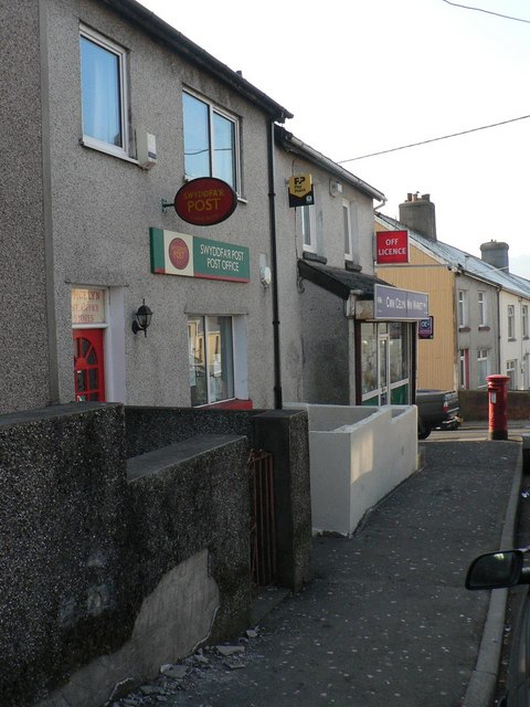
Waengron in Blaenau Gwent, Nantyglo and Blaina is a residential street and it runs in a northeast-southwest direction and ends at Brynheulog, while the other end is a cul-de-sac.
- Road Type
- residential street
- Route
- northeast-southwest
Image
Hotels
Cafés
Gift shops
Post offices
Pubs
Convenience stores
Frozen food shops
Pet shops
Variety stores
Library
Places of worship
Car parts shops
Roads nearby
South Lands150 m
Brynheulog150 m
Queen StreetBethel Chapel
250 m
Heol Arthur Fear250 m
Southlands300 m
Forge Lane300 m
Gwent Terrace350 m
Gwalia Terrace350 m
High StreetBlaina Post Office, Blaina, Bush Inn, Blaina Library
350 m
Club Row350 m
Hope Street350 m
Bryncelyn350 m
Cross Street400 m
Cae'r-Odyn400 m
Church Street400 m
New Gladstone Street400 m
Caddick's Row400 m
Mostyn Thomas Close400 m
East Pentwyn Road400 m
River Row400 m
Edmunds Close450 m
Dol-Y-Garn Terrace450 m
Zephaniah Way450 m
Bennett Street450 m
Cwm-Celyn Road450 m
Surgery Road450 m
Beech Tree Crescent500 m
Quarry RoadCwmcelyn
500 m
Mill Street550 m
Hawthorn Glade550 m
Station Road550 m
Woodland Walk550 m
Glyn Milwr550 m
Gladstone Street550 m
East Pen-Twyn550 m
Tanglewood Drive600 m
Oak Road650 m
Attlee Road850 m
Body of waters nearby
Cwmcelyn Pond400 m
Buildings nearby
Waungoch Cottages200 m
Llys-y-Coed350 m
The Cwtch350 m
Riverside350 m
Community centres nearby
The Institute600 m
Fire stations nearby
Blaina Fire Station600 m
Places of worship nearby
Salem Chapel400 m
St Peter's Church500 m
Streams nearby
Nant Ystruth650 m
Supermarkets nearby
Co-op Food250 m
Public transport map Nantyglo and Blaina Legend
| Railway | |
| Bus | |
| Tram |
Cycling map Nantyglo and Blaina Legend
| Cycle path | |
| Cycle lane on road | |
| Cycling on bus lane | |
| Bicycle street | |
| Cyclists allowed | |
| Cyclists allowed, good surface | |
| No cycling | |
| Cobblestones |
| Long-distance cycle route | (depending on scale) | |
| Long-distance cycle route |
Walking map Nantyglo and Blaina Legend
| Path |
| Long-distance hiking trail | (depending on scale) | |
| Long-distance hiking trail | ||
| No pedestrians |