
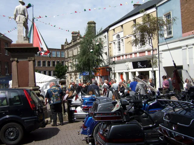
Guildhall Square in Carmarthen
Guildhall Square in Sir Gaerfyrddin / Carmarthenshire, Carmarthen is a paved pedestrian zone. It runs in a southeast-northwest direction and crosses Red Street, Hall Street and Saint Mary's Street. In the vicinity, you can find 3 cafés, 2 bank, a bookshop and a restaurant. The nearest bus stop in the vicinity is Carmarthen Bus Station (approx. 100 m away).
- Road Type
- pedestrian zone
- Route
- southeast-northwest
Image
Restaurants
Cafés
Roads nearby
Bull LaneBarnardo's, Bowen & Weaving, Country Max, Cowpots, La'torias Hair Salon
50 m
Blue StreetCarmarthen Nails, Carmarthen Bus Station, The Flower Studio, Bethan Jones, Bethaney & Co, Alexander Jones Barber, U.S.A. Pizza, Haydn Dental, Carmarthen Bus Station (Stop 2), Ebenezer Gospel Hall
100 m
Red StreetClarks, Boots Opticians, Ramsdens, Pavers Shoes, Three., Fone Cafe, Warren James
100 m
Albion ArcadeCloud 9, At The Barbers
100 m
Chapel StreetThe Optic Shop, Catch
100 m
Mill StreetCarmarthen Bus Station
100 m
Dark GateCash Generator, Caffè Nero, Jenkins Bakery, CeX, Ryman, Santander
100 m
Merlin's Walk150 m
Little Bridge Street150 m
Shaw's LaneThe New Stag's Head, Greggs, Ladbrokes, Trespass
150 m
Quay Street150 m
Coracle Way150 m
Church forecourtTony's Emporium, Cegin Hedyn entrance
150 m
The QuayThe Carmarthen Dragon
200 m
Lammas StreetCitizens' Advice Bureau, Carmarthen Booze, Shoe Zone, Flowers at No 11, John Francis, Rainbow, Walter Lloyd, West Wales Properties, HSBC UK, Boars Head Hotel, Halifax, Sally Anne's Coffee Shop, The Salvation Army, Last Harpoon Tattoos, Gerald R. Vaughan, The Salvation Army - Carmarthen, Coinwash Laundrette Carmarthen, The Golden Lion, Drovers Arms, Salon Eleri
200 m
Heol ManselBurgess Jewellers, The Mansel Arms, The Warren
250 m
Heol Morley250 m
Friars Park300 m
Heol y GŵyddauSmith's Barbershop, Merlin Veterinary Group, Carmarthen Supercharger
350 m
Garth Tomos400 m
Prospect Place400 m
Llys Y Gors400 m
Shops nearby
The Bee House50 m
Carmarthen Camera Centre300 m
Banks nearby
Barclays100 m
Buildings nearby
Carmarthen House100 m
Ashmole & Co.200 m
Ungoed-Thomas and King200 m
The Quay Centre350 m
Car dealerships nearby
Toyota500 m
Charity shops nearby
RSPCA50 m
YMCA200 m
Clothing shops nearby
Weird Fish150 m
Convenience stores nearby
Spar250 m
Fast food restaurants nearby
Subway150 m
Gift shops nearby
925 Treats150 m
Card Factory150 m
Grass nearby
The Bulwarks400 m
Health food shops nearby
Holland & Barrett150 m
Hotels nearby
Rose and Crown200 m
Jeweller's nearby
F.Hinds150 m
Places of worship nearby
English Baptist Church150 m
Eglwys Annibynnol Heol Awst300 m
Capel Heol Dŵr350 m
Restaurants nearby
Dexters200 m
Cinnamon250 m
Retail areas nearby
FRF Toyota Carmarthen450 m
Shopping malls nearby
New Market Hall (2009)250 m
Supermarkets nearby
Lidl400 m
Variety stores nearby
Poundland150 m
Public transport map Carmarthen Legend
| Railway | |
| Bus | |
| Tram |
Cycling map Carmarthen Legend
| Cycle path | |
| Cycle lane on road | |
| Cycling on bus lane | |
| Bicycle street | |
| Cyclists allowed | |
| Cyclists allowed, good surface | |
| No cycling | |
| Cobblestones |
| Long-distance cycle route | (depending on scale) | |
| Long-distance cycle route |
Walking map Carmarthen Legend
| Path |
| Long-distance hiking trail | (depending on scale) | |
| Long-distance hiking trail | ||
| No pedestrians |