
The Parade in Carmarthen
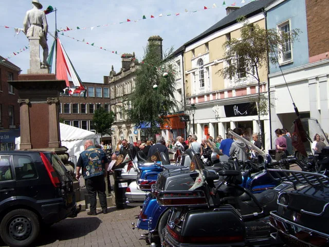
The Parade in Sir Gaerfyrddin / Carmarthenshire, Carmarthen is a residential street. It runs in a northeast-southwest direction and crosses Ger y Llan, Rhodfar Gogledd and The Avenue and ends at The Esplanade, while the other end is a cul-de-sac. This road is part of the bicycle route "National Cycle Network Route 47". The Parade also exists in Pembrokeshire, Vale of Glamorgan, Gwynedd, Monmouthshire and Cardiff.
- Road Type
- residential street
- Speed Limit
- 20 mph
- Route
- northeast-southwest
Image
Bar
Hotels
Furniture shops
Clothing shops
Herbalists
Pubs
Fast food restaurants
Gallery
Supermarkets
Tobacconist's
Hairdressers
Restaurants
Bus stops
Guest house
Bank
Cafés
Craft shops
Bookshops
Roads nearby
Under Parade Road100 m
Ger y Llan100 m
Rhodfar Gogledd200 m
Church Street200 m
Old Station Road200 m
Parade Road250 m
St. Peter's Court250 m
Heol San Pedr250 m
Clos y Deri250 m
Church Lane300 m
Conduit Lane300 m
Spilman StreetIvy Bush Royal Hotel
300 m
Dan-y-Banc300 m
Heol Dŵr FachCwrw
300 m
Wood's Row350 m
Bank Lane400 m
King StreetYr Hen Dderwen, Lloyds Bank, Oriel King Street Gallery, Donuts & Dragons, Co-op Food
400 m
Orchard Street400 m
Heol Fach y DŵrCarmarthen Pine Centre
400 m
Richmond Close400 m
Cwrt y Berllan400 m
Furnace Road400 m
Richmond Terrace400 m
St. Andrews Road400 m
Little Water Street450 m
Francis Terrace500 m
Parc Myrddin500 m
Myrddin Crescent550 m
Long Acre Road550 m
Capel Evan Road600 m
Llys y Nant650 m
Lluest-yr-Bryn650 m
Apartment buildings nearby
Plas-Y-Milwr150 m
Buildings nearby
Ty Myrddin300 m
Carmarthen Town AFC Clubhouse300 m
University of Wales - yr atom350 m
Community Education Centre350 m
John Farr-Davies & Co. Solicitors400 m
Charity shops nearby
British Red Cross450 m
Hotels nearby
Hotel Spilman350 m
Libraries nearby
Carmarthen Library300 m
Places of worship nearby
Carmarthen Evangelical Church150 m
Bethania Welsh Calvinistic Methodist Chapel200 m
St. Peter's200 m
St. Johns200 m
Pubs nearby
Stag and Pheasant350 m
Sports pitches nearby
Carmarthen Bowling Club350 m
Carmarthen Town AFC350 m
Theatres nearby
Lyric Theatre400 m
Public transport map Carmarthen Legend
| Railway | |
| Bus | |
| Tram |
Cycling map Carmarthen Legend
| Cycle path | |
| Cycle lane on road | |
| Cycling on bus lane | |
| Bicycle street | |
| Cyclists allowed | |
| Cyclists allowed, good surface | |
| No cycling | |
| Cobblestones |
| Long-distance cycle route | (depending on scale) | |
| Long-distance cycle route |
Walking map Carmarthen Legend
| Path |
| Long-distance hiking trail | (depending on scale) | |
| Long-distance hiking trail | ||
| No pedestrians |