
Cambrian Way in Carmarthen
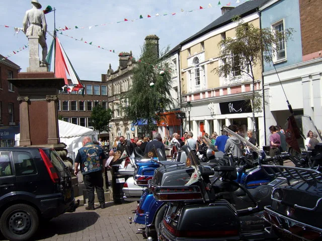
Cambrian Way in Sir Gaerfyrddin, Carmarthen is a pedestrian zone and runs in a northeast-southwest direction starting from John Street and ends at Saint Catherine's Walk. In the vicinity, you can find among other things 2 clothing shops, an ice cream parlour, a mobile phone shop and a travel agency. The nearest bus stop in the vicinity is Hanover Court (approx. 700 m away). Cambrian Way also exists in Ceredigion, Powys, Flintshire, Conwy and Newport.
- Road Type
- pedestrian zone
- Route
- northeast-southwest
Image
Game shops
Hearing aid centres
Clothing shops
Travel agencies
Bookmakers
Delicatessens
Roads nearby
John Street50 m
Saint Catherine's WalkVodafone, EE, Yours Clothing, Superdrug, Fashion Outlet, Eric Davies & Son, The Lighthouse, Coffee#1, Lush, Vision Express, Clogau, Hays Travel, Timpson, Xcel Furniture, Costa, Sied Goffi
50 m
St Catherine's WalkAmi, Taste of Thailand, Siop y Pentan, Sugar Mouse, Carmarthen Deli, Rone's Jewellers, Bubble Talk, PizzaExpress, The Entertainer, Towy Community Church, SERO, The Drover, Toby Carvery, Harvester, Flying Tiger Copenhagen
50 m
Merlin's LaneBoots, Marks & Spencer
100 m
Red StreetClarks, Boots Opticians, Ramsdens, Pavers Shoes, Three., Fone Cafe, Warren James
100 m
Barn RoadSuper Photography, Tracey's Hair Fashions
100 m
Saint Catherine StreetNext, Xcel Furniture Showroom
100 m
Shaw's LaneThe New Stag's Head, Greggs, Ladbrokes, Trespass
100 m
Market Way150 m
Heol Morley150 m
Barnsfield Terrace200 m
Heol ManselBurgess Jewellers, The Mansel Arms, The Warren
200 m
Church forecourtKarizma Barbers, Tony's Emporium, Cegin Hedyn entrance
200 m
Waterloo Terrace200 m
Lammas StreetCitizens' Advice Bureau, Carmarthen Booze, Shoe Zone, Flowers at No 11, Aardvark Alternatives, John Francis, Rainbow, Walter Lloyd, West Wales Properties, HSBC UK, Boars Head Hotel, Halifax, Sally Anne's Coffee Shop, The Salvation Army, Last Harpoon Tattoos, Gerald R. Vaughan, The Salvation Army - Carmarthen, Coinwash Laundrette Carmarthen, The Golden Lion, Drovers Arms, Salon Eleri
250 m
Water StreetThe Raj, Dog & Piano, Kwong Yick, The Western Mail
250 m
Merlin Street300 m
Pond Street300 m
Clos MorganCarmarthen
300 m
Heol Pentrefelin350 m
Llys Y Gors350 m
Tabernacle Terrace350 m
Morgan Street350 m
Cardifor Street350 m
Brynhaul Street400 m
Fountain Hall Terrace400 m
Brewery RoadHanover Court
450 m
Heol Spurrell450 m
Ferrar StreetThe New Daries
450 m
Parc Bagnall450 m
Greenhill Close450 m
Heol Disgwylfa550 m
Bro Hedydd600 m
Cae Celyn600 m
Russell TerraceRussell Terrace
600 m
Shops nearby
Carmarthen Camera Centre200 m
Charity shops nearby
YMCA250 m
Cinemas nearby
Vue200 m
Clothing shops nearby
New Look250 m
Convenience stores nearby
Spar250 m
Hotels nearby
Rose and Crown250 m
Places of worship nearby
English Baptist Church200 m
Capel y Tabernacl250 m
Capel Heol Dŵr300 m
Restaurants nearby
Cinnamon200 m
The Welsh House200 m
School buildings nearby
Sunday School250 m
Shopping malls nearby
New Market Hall (2009)100 m
Other nearby
Fairlane Switching Station300 m
Public transport map Carmarthen Legend
| Railway | |
| Bus | |
| Tram |
Cycling map Carmarthen Legend
| Cycle path | |
| Cycle lane on road | |
| Cycling on bus lane | |
| Bicycle street | |
| Cyclists allowed | |
| Cyclists allowed, good surface | |
| No cycling | |
| Cobblestones |
| Long-distance cycle route | (depending on scale) | |
| Long-distance cycle route |
Walking map Carmarthen Legend
| Path |
| Long-distance hiking trail | (depending on scale) | |
| Long-distance hiking trail | ||
| No pedestrians |