
St. Peter's Court in Carmarthen
St. Peter's Court in Sir Gaerfyrddin, Carmarthen is a residential street. It runs in a northeast-southwest direction starting from Parade Road and ends in a cul-de-sac.
- Road Type
- residential street
- Speed Limit
- 20 mph
- Route
- northeast-southwest
Image
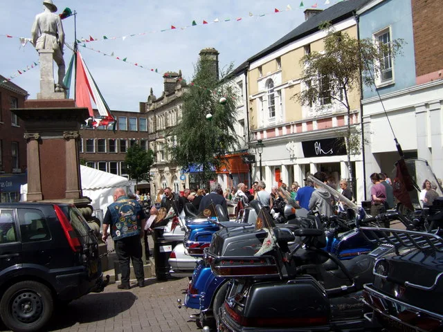
Hairdressers
Art galleries
Hardware shops
Community centre
Variety stores
Charity shops
Gallery
Opticians
Restaurants
Hotels
Bank
Gift shops
Pubs
Antique shops
Convenience stores
Tattoo studios
Beauty salons
Butcher's
Supermarkets
Roads nearby
Parade Road50 m
Church Lane50 m
Conduit Lane50 m
Spilman StreetIvy Bush Royal Hotel
100 m
Church Street100 m
Old Station Road100 m
Little Water Street100 m
St Peter's StreetR. & M. Hardware, Carmarthen Express, The Painted Saints, Oriel Myrddin
150 m
Dan-y-Banc150 m
Ger y Llan150 m
Heol Dŵr Fach150 m
King StreetYr Hen Dderwen, Lloyds Bank, Oriel King Street Gallery, Donuts & Dragons, Cwrw, Co-op Food, Norma Davies, Reflections of Carmarthen, King's Barbers, Origin, M.L. Dark, Love Your Body, Old Curiosity Antique Centre, Yr Atom, Ginger, Criwdem Celf, Hugh Evans Family Butcher, Mooch, Oxfam, Celtic Opticians, Climate Shop, King Vape, British Red Cross, Morgan Edward, Steps 2.0, Blasus Delicatessen, The Spread Eagle
150 m
Bank Lane150 m
Wood's Row150 m
Under Parade Road200 m
Orchard Street200 m
Cwrt y Berllan200 m
Heol Fach y DŵrCarmarthen Pine Centre
250 m
Rhodfar Gogledd250 m
Furnace Road300 m
St. Andrews Road300 m
Richmond Close350 m
Francis Terrace350 m
Clos y Deri350 m
Penuel StreetBBC
400 m
Myrddin Crescent400 m
Priory StreetOld Priory Guest House, New King George, Oriental Garden, Lidl, Fortune House, Castle Hotel, Priory Street
450 m
Parc Myrddin450 m
Richmond TerraceBay Coffee Roasters
500 m
Long Acre Road550 m
Llys y Nant600 m
Capel Evan Road650 m
Lluest-yr-Bryn700 m
Apartment buildings nearby
Plas-Y-Milwr250 m
Buildings nearby
Towyside200 m
John Farr-Davies & Co. Solicitors200 m
Clee Tompkinson Francis200 m
Community Education Centre200 m
Carmarthen Town AFC Clubhouse350 m
Hotels nearby
Hotel Spilman150 m
Libraries nearby
Carmarthen Library150 m
Places of worship nearby
St. Peter's100 m
Carmarthen Evangelical Church150 m
Bethania Welsh Calvinistic Methodist Chapel300 m
St. Johns350 m
Pubs nearby
Stag and Pheasant150 m
Sports pitches nearby
Carmarthen Bowling Club300 m
Carmarthen Town AFC400 m
Theatres nearby
Lyric Theatre200 m
Public transport map Carmarthen Legend
| Railway | |
| Bus | |
| Tram |
Cycling map Carmarthen Legend
| Cycle path | |
| Cycle lane on road | |
| Cycling on bus lane | |
| Bicycle street | |
| Cyclists allowed | |
| Cyclists allowed, good surface | |
| No cycling | |
| Cobblestones |
| Long-distance cycle route | (depending on scale) | |
| Long-distance cycle route |
Walking map Carmarthen Legend
| Path |
| Long-distance hiking trail | (depending on scale) | |
| Long-distance hiking trail | ||
| No pedestrians |